Colorado State Highway 74 facts for kids
Quick facts for kids
State Highway 74 |
||||
|---|---|---|---|---|
Central Colorado with SH 74 marked in red
|
||||
| Route information | ||||
| Maintained by CDOT | ||||
| Length | 18.110 mi (29.145 km) | |||
| Existed | 1923–present | |||
| Major junctions | ||||
| West end | ||||
| East end | ||||
| Location | ||||
| Counties: | Jefferson | |||
| Highway system | ||||
Colorado State Highways
|
||||
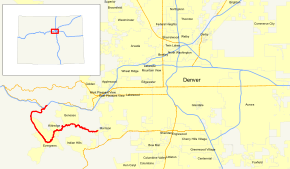
State Highway 74 (SH 74) is a special road in Colorado. It's about 18 miles long. This highway connects I-70 in El Rancho to SH 8 in Morrison. It follows a path that looks a bit like a hook.
Part of SH 74 is called Evergreen Parkway. This section, near Evergreen, has four to six lanes. The other part is known as the Bear Creek Canyon Scenic Mountain Drive. This section mostly follows Bear Creek. It goes through small towns like Kittredge and Idledale.
SH 74 is close to Denver. It passes through several of Denver's mountain parks. These include Bergen, Dedisse, and Red Rocks.
This road has a long history. It started as a path for miners and loggers in the late 1800s. Floods often damaged the road along Bear Creek. So, people built things to protect it. Parts of the road, like the Bear Creek Canyon Scenic Mountain Drive, are now listed on the National Register of Historic Places. This means they are important historical sites.
Contents
Exploring State Highway 74's Path
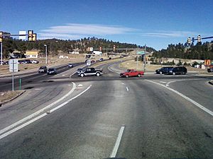
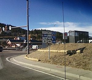
SH 74 begins at a major highway exit with I-70 in El Rancho. If you are coming from I-70, you can easily get onto SH 74. From I-70, the road goes southwest through El Rancho. It meets US 40 (Swede Gulch Road).
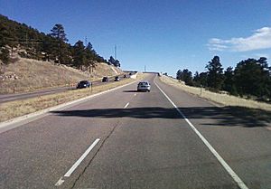
The highway then turns west and southwest. It goes through a forest with tall evergreen trees. This part is a four-lane road. It passes Fillius Park in Hidden Valley. The area here has many mountains. SH 74 then turns south after meeting Bergen Parkway. This parkway leads to Bergen Park.
The road crosses Troublesome Creek. It then travels along Buchanan Park. SH 74 also follows Elk Meadow Open Space Park. Here, you can see open grasslands with some trees. The road becomes two lanes and goes uphill at milepost five. It passes Wah Keeney Park. Then, it turns southeast towards Hiwan.
SH 74 enters the town of Evergreen. It goes by Evergreen Lake, which is part of Dedisse Park. Here, the road meets County Road 74. This road goes west along the Upper Bear Creek.
Bear Creek Road: A Scenic Journey
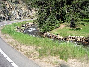
After Evergreen, SH 74 becomes Bear Creek Road. It curves east and north as it leaves town. This part of the road is two lanes wide. It follows Bear Creek closely. The road curves northeast toward Kittredge. Pence Park is on the east side.
In Kittredge, the road meets County Road 120. This road goes southeast toward Indian Hills. SH 74 then winds east on the north side of Bear Creek. It passes Idledale. This is north of Lair O the Bear Park.
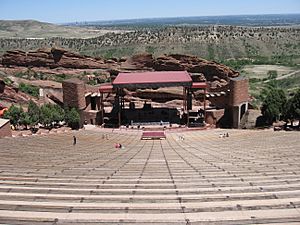
East of Idledale, SH 74 goes into Bear Creek Canyon Park. Here, the road curves along the creek. The area becomes more rocky and dramatic. SH 74 also passes through Red Rocks Park. This park is famous for its large red rock formations.
After leaving Red Rocks Park, SH 74 enters Morrison. Bear Creek Road meets SH 8 here. From this point, SH 8 continues toward Denver.
How Roads Are Maintained
The Colorado Department of Transportation (CDOT) takes care of SH 74. CDOT builds and maintains all the highways in Colorado. They also check how many cars use the roads. This is called "average annual daily traffic" (AADT). It tells them how busy a road is each day.
In 2009, CDOT found that about 3,200 cars used SH 74 daily near Idledale. But near I-70 and in Evergreen, as many as 23,000 cars used the road every day. This information helps CDOT decide where to make improvements.
The History of State Highway 74
|
Bear Creek Canyon Scenic Mountain Drive
|
|
| Lua error in Module:Location_map at line 420: attempt to index field 'wikibase' (a nil value). | |
| Nearest city | Morrison, Colorado |
|---|---|
| Area | 688 acres (278 ha) |
| Built | 1914 |
| Architect | Olmsted Bros.; Civilian Conservation Corps |
| MPS | Denver Mountain Parks MPS |
| NRHP reference No. | 90001706 |
| Added to NRHP | November 15, 1990 |
In 1873, John Evans, a former governor of Colorado, built a toll road. This road went from Evergreen to Morrison. It followed Bear Creek canyon. People used this road to get to mining and logging areas. The road had over twenty wooden bridges over Bear Creek.
By the late 1870s, toll roads were less common. So, Jefferson County took over maintaining the road.
Mountain Parks and the CCC
SH 74 goes through many of Denver's mountain parks. These include Bergen Park and Dedisse Park. Colorado governor Robert W. Speer started this park system in 1909. It was the first city-owned park system in the world!
The road, then called SH 27, passed by the Denver Motor Club in Idledale. It also went through newly bought parks. In the 1910s, Denver could set rules for these parks. They set a speed limit of 20 miles per hour uphill and 15 miles per hour downhill.
In Red Rocks Park, near Morrison, a special camp was set up in 1935. This was a CCC camp. The CCC was a program during the Great Depression. Young men in the CCC built a huge outdoor theater in Red Rocks Park. This camp, called SP-13-C, is the only CCC camp left in Colorado. Both the camp and the Bear Creek Canyon Scenic Mountain Drive are listed on the National Register of Historic Places.
Battling Floods and Road Improvements
Bear Creek often flooded. In 1896, Morrison was almost destroyed by a flood. In 1925, cars on the road were even swept into the river! To stop floods and keep the road safe, a dam was built near Evergreen. This dam, finished in 1928, created Evergreen Lake.
After a big flood in 1938, workers built walls along the creek. These walls were up to 34 feet high. This work was part of a federal program called the Works Progress Administration (WPA). They built over 4,500 feet of stone walls from Morrison to Idledale. This helped protect the road from future floods.
From 1923 to the early 1930s, SH 74 went further west. It started at Echo Lake. Then it followed Squaw Pass Road to Bergen Park. From there, it followed its current path to Morrison. In 1928, the road from Morrison to Evergreen was paved. This helped prevent erosion during floods.
By 1938, the section west of Bergen Park became SH 68. SH 74 was changed to go north to US 40. Later, in the 1940s, the road was extended east into Denver. But this part was removed later.
In 1956, the Colorado State Highway Department changed parts of SH 74. They moved it away from Bear Creek in some places. The section between Evergreen and Kittredge was also improved. It was resurfaced and made wider. By 1972, I-70 was completed. This included an exit at El Rancho for SH 74.
In the 1990s, CDOT decided to upgrade SH 74 even more. They wanted to make the section from I-70 to Evergreen into a faster road. Work started in 1993. They improved the interchange with I-70 and widened the road. This project cost $8 million.
Major Road Connections
Here are the main intersections along State Highway 74:
The entire route is in Jefferson County.
| Location | mi | km | Destinations | Notes |
|---|---|---|---|---|
| El Rancho | 0.000 | 0.000 | This is where SH 74 begins; it's exit 252 on I-70. | |
| 0.374 | 0.602 | |||
| Morrison | 18.110 | 29.145 | This is where SH 74 ends. | |
| 1.000 mi = 1.609 km; 1.000 km = 0.621 mi | ||||


