Kittredge, Colorado facts for kids
Quick facts for kids
Kittredge, Colorado
|
|
|---|---|

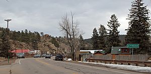
Kittredge in 2014
|
|

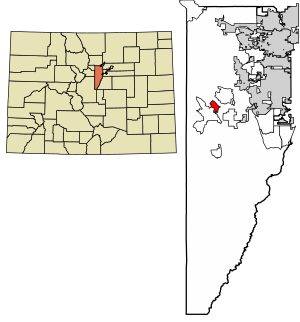
Location of the Kittredge CDP in Jefferson County, Colorado.
|
|
| Country | |
| State | |
| County | Jefferson County |
| Government | |
| • Type | unincorporated town |
| Area | |
| • Total | 1.885 sq mi (4.881 km2) |
| • Land | 1.884 sq mi (4.880 km2) |
| • Water | 0.0005 sq mi (0.0012 km2) |
| Elevation | 7,073 ft (2,156 m) |
| Population
(2020)
|
|
| • Total | 1,308 |
| • Density | 694.1/sq mi (267.98/km2) |
| Time zone | UTC-7 (MST) |
| • Summer (DST) | UTC-6 (MDT) |
| ZIP Code |
80457
|
| Area codes | 303 & 720 |
| GNIS feature | Kittredge CDP |
Kittredge is a small community in Colorado, United States. It's known as an unincorporated town, which means it doesn't have its own city government. Instead, it's managed by Jefferson County. Kittredge is also a census-designated place (CDP), which is a special area defined by the United States Census Bureau for gathering population data.
This charming place is part of the larger Denver–Aurora–Lakewood, CO Metropolitan Statistical Area. If you ever send mail to Kittredge, you'd use the ZIP code 80457. In 2020, about 1,308 people called Kittredge home.
Contents
A Look Back: Kittredge's History
The history of Kittredge is quite interesting! The town's post office, where people send and receive mail, first opened its doors in 1923.
The community was named after an important person from its early days. C. M. Kittredge was an early postmaster, and the town was named in his honor.
Exploring Kittredge's Location
Kittredge is nestled in a beautiful valley. This valley was carved out by Bear Creek, a lovely waterway that flows through the area.
Colorado State Highway 74 is a main road that runs through Kittredge. If you travel east on this highway, you'll go about 8 miles (13 km) down Bear Creek Canyon to reach Morrison. If you head southwest, going upstream along the creek, you'll find Evergreen about 2 miles (3 km) away.
The Kittredge CDP covers an area of about 1.88 square miles (4.881 square kilometers). A very small part of this area, about 0.00046 square miles (0.0012 square kilometers), is water.
Who Lives in Kittredge?
The United States Census Bureau helps us understand how many people live in different places. They first counted Kittredge as a CDP for the United States Census 2000.
The population of Kittredge has changed over the years:
| Kittredge CDP, Colorado | ||
|---|---|---|
| Year | Pop. | ±% |
| 2000 | 954 | — |
| 2010 | 1,304 | +36.7% |
| 2020 | 1,308 | +0.3% |
| Source: United States Census Bureau | ||
Learning in Kittredge
Students in Kittredge attend schools that are part of the Jefferson County Public Schools system. This school district provides education for many communities in Jefferson County.
Well-Known Residents of Kittredge
Kittredge has been home to some notable people. One famous resident was Gary Hart. He was a former U.S. Senator, which means he was elected to represent Colorado in the United States government. He also ran for U.S. President, hoping to lead the entire country.
See also
 In Spanish: Kittredge para niños


