Comet, Queensland facts for kids
Quick facts for kids CometQueensland |
|||||||||||||||
|---|---|---|---|---|---|---|---|---|---|---|---|---|---|---|---|

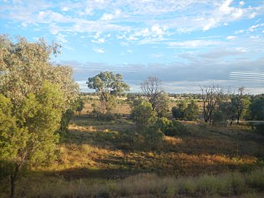
Grazing land west of the town of Comet, 2013
|
|||||||||||||||
| Population | 360 (2021 census) | ||||||||||||||
| • Density | 0.2049/km2 (0.531/sq mi) | ||||||||||||||
| Postcode(s) | 4702 | ||||||||||||||
| Area | 1,756.8 km2 (678.3 sq mi) | ||||||||||||||
| Time zone | AEST (UTC+10:00) | ||||||||||||||
| Location |
|
||||||||||||||
| LGA(s) | Central Highlands Region | ||||||||||||||
| State electorate(s) | Gregory | ||||||||||||||
| Federal Division(s) | Flynn | ||||||||||||||
|
|||||||||||||||
Comet is a small town in the Central Highlands Region of Queensland, Australia. It's a place with a lot of history! In 2021, about 360 people lived in Comet.
Contents
Where is Comet Located?
Comet is the oldest town near Emerald. It was built where the Comet River and Nogoa River meet. The town is about 859 kilometers (534 miles) northwest of Brisbane, Queensland's capital city. You can find it right on the Capricorn Highway.
How Trains Connect Comet
The main railway line, called the Central Western railway line, runs through Comet. It comes from the east and goes towards Emerald in the west. While trains use this line, there are no passenger services that stop in Comet anymore. Most of the old train stations are not used, except for one.
- Yamala railway station (23°34′49″S 148°22′19″E / 23.5804°S 148.3719°E)
- Comet railway station (23°36′20″S 148°32′51″E / 23.6055°S 148.5475°E)
- Tolmies railway station (23°35′32″S 148°44′43″E / 23.5921°S 148.7452°E)
- Burngrove railway station (23°35′27″S 148°45′19″E / 23.5907°S 148.7552°E)
There's also Ensham railway station (23°27′59″S 148°31′42″E / 23.4664°S 148.5282°E) to the north. This station helps transport coal from the Ensham coal mines.
Local Areas and Farming
Comet has a few smaller areas within it:
- Yamala (23°33′00″S 148°22′00″E / 23.55°S 148.3666°E)
- Leichhardt Tree (23°34′00″S 148°32′00″E / 23.5666°S 148.5333°E)
- Junction (23°36′S 148°45′E / 23.6°S 148.75°E)
There's also a mountain called Mount Crocker (23°35′17″S 148°38′21″E / 23.5880°S 148.6391°E). It rises to 248 meters (814 feet) above sea level.
The land around Comet is used for farming. Farmers grow cotton and grains. They also raise cattle, both in open fields and in special feeding areas called feedlots.
Comet's Past: A Look at History
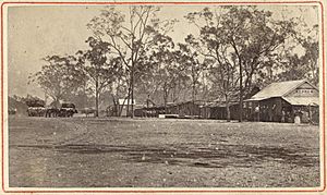
Comet was first called Cometville. It got its name from the Comet River. An explorer named Ludwig Leichhardt named the river. He saw a comet in the sky on December 29, 1844, while he was exploring this area.
The Comet Post Office opened its doors on September 5, 1877. Just a little later, on October 23, 1877, Cometville State School welcomed its first students. In 1912, the school's name was changed to Comet State School. Finally, on March 19, 1931, the town's name officially changed from Cometville to Comet.
Education in Comet
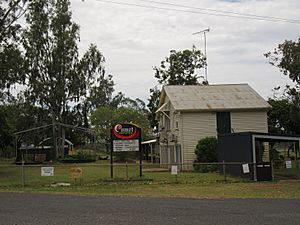
Comet State School is a primary school for students from Prep to Year 6. It's located just off the Capricorn Highway (23°36′22″S 148°32′42″E / 23.6061°S 148.5451°E). In 2017, the school had 28 students. In 2018, there were 25 students.
There isn't a high school in Comet itself. Students who want to go to secondary school usually travel to Emerald State High School. Emerald is about 41 kilometers (25 miles) west of Comet.
Fun Things to See in Comet
One of the most famous spots in Comet is the Leichhardt Tree. This special tree is known as a "dig tree." Explorer Ludwig Leichhardt marked it to show where he had buried food and his journals for others to find.
If you visit Comet, you can also follow a walking trail. This trail takes you to different places around the town that have historical importance.
 | Aaron Henry |
 | T. R. M. Howard |
 | Jesse Jackson |


