Commerce, Missouri facts for kids
Quick facts for kids
Commerce, Missouri
|
|
|---|---|
|
Village
|
|

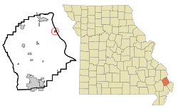
Location of Commerce, Missouri
|
|
| Country | United States |
| State | Missouri |
| County | Scott |
| Area | |
| • Total | 0.35 sq mi (0.90 km2) |
| • Land | 0.35 sq mi (0.90 km2) |
| • Water | 0.00 sq mi (0.00 km2) |
| Elevation | 348 ft (106 m) |
| Population
(2020)
|
|
| • Total | 45 |
| • Density | 130.06/sq mi (50.22/km2) |
| Time zone | UTC-6 (Central (CST)) |
| • Summer (DST) | UTC-5 (CDT) |
| ZIP code |
63742
|
| Area code(s) | 573 |
| FIPS code | 29-15760 |
| GNIS feature ID | 2398607 |
Commerce is a small village located in Scott County, Missouri, United States. It sits right by the Mississippi River. In 2020, about 45 people lived there. It's a quiet place with a long history.
Contents
History of Commerce, Missouri
Commerce has a very interesting past, especially because it's one of the oldest settlements in Missouri.
Early Beginnings in Commerce
In 1788, French settlers were the first to live where Commerce is today. This makes Commerce one of the oldest places in Missouri. Only St Louis and St. Charles are older. A trading post was set up in 1803. This post was a busy center for trade in the area. That's how the village got its name, "Commerce." In 1823, a court decided to create official lots for the village.
Commerce During the Civil War
During the American Civil War, Commerce was special. It was one of the few places in Scott County that kept getting mail. Other areas were too dangerous for mail carriers. Commerce and a German settlement called New Hamburg supported the Union. This was different from most of Scott County.
In November 1861, Colonel Oglesby arrived in Commerce. He had about 3,000 soldiers with him. These soldiers soon had small fights with M. Jeff Thompson's group. Thompson's group also raided Commerce in December 1861. Later, in February 1862, General Pope landed here. He started with 140 troops. A week later, his force had grown to over 26,000 men. An island near Commerce, once called Cat Island, is now part of Powers Island.
Changes to the County Seat
During the Civil War, important county records were moved. They went to a military post in Cape Girardeau. Around August 1863, Commerce became the unofficial county seat. This means it was the main town for county government. On January 26, 1864, this change became official. A brick building was built in Commerce for the county court.
However, in 1878, the county seat moved back to Benton. The old courthouse building in Commerce then became a school. Around 1875, a saloon building from 1867 was changed into a Masonic hall. Commerce was originally a Methodist town. Its church group started as early as 1825. A Baptist church didn't open until 1906.
Geography of Commerce
Commerce is a small village. It covers about 0.35 square miles (0.90 square kilometers). All of this area is land. There are no large bodies of water within the village limits.
Population and People
The number of people living in Commerce has changed over the years. Here's a look at the population counts from different years:
| Historical population | |||
|---|---|---|---|
| Census | Pop. | %± | |
| 1880 | 440 | — | |
| 1900 | 588 | — | |
| 1910 | 544 | −7.5% | |
| 1920 | 593 | 9.0% | |
| 1930 | 351 | −40.8% | |
| 1940 | 413 | 17.7% | |
| 1950 | 360 | −12.8% | |
| 1960 | 247 | −31.4% | |
| 1970 | 234 | −5.3% | |
| 1980 | 199 | −15.0% | |
| 1990 | 173 | −13.1% | |
| 2000 | 110 | −36.4% | |
| 2010 | 67 | −39.1% | |
| 2020 | 45 | −32.8% | |
| source: | |||
Population in 2010
In 2010, there were 67 people living in Commerce. These people lived in 30 different homes. About 18 of these were families. The village had about 191 people per square mile. Most residents were White (92.54%). A smaller number were Black or African American (7.46%).
About 23% of homes had children under 18. Many homes (56.7%) were married couples. Some homes (36.7%) had just one person living there. About 26.7% of homes had someone 65 or older living alone. The average age in the village was 46.5 years.
See also
 In Spanish: Commerce (Misuri) para niños
 | Aaron Henry |
 | T. R. M. Howard |
 | Jesse Jackson |

