
Conasauga shale facts for kids
The Conasauga Shale Field is a very old rock layer from the Cambrian Period. It's found deep underground in parts of Alabama, Georgia, and Tennessee.
This underground area is made of shale and other rocks called carbonates. It can be more than 15,000 feet (4,600 meters) thick in some places. Early drilling tests showed that it might hold one of the largest amounts of natural gas ever found in the U.S.
Contents
Where is the Conasauga Shale Field?
The Conasauga Shale is located beneath other rock layers. It sits on top of the Rome Formation and below the Knox Formation. You can find it as far south as Talladega County, Alabama. It also stretches north into several other counties in Alabama, including Calhoun and Cherokee. It also reaches into Northwest Georgia.
This shale layer is one of the thickest in the world. It contains a small amount of organic material, which is important for forming natural gas. Experts have calculated that a lot of gas could be stored in this area. Geologists describe the unique underground structure here as a "mushwad." This means it has a special way that the ground has sunk and pushed together over millions of years.
What is Natural Gas and How is it Found Here?
The Conasauga Shale is a type of shale gas reservoir. This means it holds natural gas trapped within the shale rock. It's similar to the Barnett Shale in Texas, which is another big gas field.
For a long time, it was too expensive to get the gas out of the Conasauga Shale. This was because the shale is very hard. But new technologies, like those used in the Barnett Shale, have made it possible.
One challenge with the Conasauga Shale is that it absorbs water and swells. This can slow down the flow of gas. So, successful drilling here uses special methods that keep water use low. They also try to prevent water from flowing into the open parts of the drill hole. Usually, a pipe called a casing is used only at the top. Then, the rest of the hole is left open. This allows gas from many different layers to flow into the borehole.
When was the Conasauga Field Discovered?
- Discovery: The field was first found in the 1980s.
- Start of Production: Gas started to be produced from this field in 2005.
Early Drilling and Discoveries
One of the first important wells was the J.J. Young 34-2 #1 well in St. Clair County, Alabama. It was drilled in 1984 by two companies, Amoco and ARCO. When they drilled, they found a lot of gas. Engineers thought this well could produce over one million cubic feet of gas per day. However, the well was later closed in 1985. It turned out that Amoco didn't own the mineral rights to some of the land around the well.
Later, in the late 1980s, Michigan Oil Co. bought a lot of land in this area. But before they could drill, another company, Pan-Oak Corp, bought them in 1991. In 1993, Pan-Oak drilled the Young #2 well, very close to the first one. They drilled deep and reported finding good signs of gas.
Dominion's Involvement
In 2002, a company called Red Hills Resources started buying leases in the Young #1 area. After getting a lot of land, they partnered with Dominion Black Warrior Basin Inc. in late 2004.
Dominion then took over the drilling. In March 2005, they started drilling the Dawson 34-3 No. 1 well. They found gas at different depths. At one point, a large amount of gas was found, causing a big flare (a controlled burn of gas). The well continued to produce a lot of gas, even when it rained. Another large gas discovery happened in March 2005, which was seen by many people nearby.
Energen's Work in the Field
In January 2006, Energen drilled the Williams 29-12 #1 well. It was about 10 miles (16 kilometers) southwest of Dominion's Dawson #1 well. After this, Energen and Dominion began competing to lease more land in the area.
In April 2006, Dominion drilled the Andrews 27-14 #3 well. They hit a gas zone, and the well produced a lot of gas. The equipment used to control the well had trouble handling the pressure. Experts were called in to help control the gas flow. Even though they didn't measure the gas with a meter, it was estimated that the well was producing a very large amount of gas per day.
Another well, the Oakes E23-11 #26, was drilled in 2007. It found an excellent area filled with gas at about 7,600 feet (2,300 meters) deep. This well is now connected and selling gas. It was producing a lot of gas with high pressure, and the surface equipment was covered in ice, showing that some CO2 (carbon dioxide) was still in the gas.
The Burgess E28-11 #58 well also showed a lot of gas while drilling in April 2007. The gas flow was so strong that they had to light a flare stack (a tall pipe that burns off excess gas). Local residents described a large, roaring flare. Another big gas release happened a few days later, creating a large fireball that shook windows over a mile away. Drilling continued, and they reached the full depth of the well.
Energen Resources, from Birmingham, Alabama, also started buying leases in St. Clair and Etowah Counties in June 2005. They drilled two more wells in 2006. One of them, the GAA 23-12 #1 well, had drilling problems and was later closed.
Other Companies Involved
Chesapeake and Energen have teamed up in a joint project. They share a large area of land for gas exploration. They also have an agreement to share any new land they acquire.
Loews Corporation, a company owned by the Tisch family, became a major player in the Conasauga Shale in 2007. They bought natural gas assets from Dominion, including all of Dominion's Conasauga Shale properties. Loews then assigned these operations to a company called Highmount Exploration.
How the Northeast Alabama Gas District Helps
The Northeast Alabama Gas District covers parts of Talladega, Calhoun, and Cleburne Counties. This public organization has given a special right to another group, called a "Special District," to drill for, produce, and transport natural gas in its area.
Landowners who have mineral rights in this area can sign an agreement with the Gas District. The District offers a royalty of 20% of the gas produced, which is higher than what some for-profit companies offer. The Gas District also has five charitable trusts. These trusts receive some of the natural gas money to help residents in the region with education, health care, social services, and creating jobs.
How Much Land Do Companies Control?
- Northeast Alabama Gas District: Has the right to drill and transport gas on a very large area, about 1,224,960 acres (4,957 square kilometers).
- Chesapeake–Energen joint project: Controls about 100,000 acres (400 square kilometers) together.
- Energen (independent): Owns about 126,000 acres (510 square kilometers) on its own (as of February 2007).
- Highmount Exploration: The exact amount of land they control is not known. Their Conasauga land is part of a larger purchase made by their owner, Loews Corp., from Dominion in 2007.
Images for kids
-
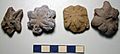
Fossils from the Conasauga Formation
_(Conasauga_Formation,_Middle_Cambrian;_Coosa_River_Valley,_Alabama,_USA).jpg)
