
Cornelius, Oregon facts for kids
Quick facts for kids
Cornelius, Oregon
|
|
|---|---|

Virginia Garcia Memorial Health Center
|
|
| Nickname(s):
Oregon's Family Town
|
|

Location in Oregon
|
|

Cornelius, Oregon
Location in the United States
|
|
| Country | United States |
| State | Oregon |
| County | Washington |
| Incorporated | 1893 |
| Government | |
| • Type | Council–manager |
| Area | |
| • Total | 2.34 sq mi (6.06 km2) |
| • Land | 2.34 sq mi (6.06 km2) |
| • Water | 0.00 sq mi (0.00 km2) |
| Elevation | 180 ft (50 m) |
| Population
(2020)
|
|
| • Total | 12,694 |
| • Density | 5,427.11/sq mi (2,095.42/km2) |
| Time zone | UTC-8 (Pacific) |
| • Summer (DST) | UTC-7 (Pacific) |
| ZIP code |
97113
|
| Area code(s) | 503, 971 |
| FIPS code | 41-15550 |
| GNIS feature ID | 2410230 |
Cornelius is a city in Washington County, Oregon, in the United States. It is part of the larger Portland metropolitan area. In 2020, about 12,694 people lived there. The city is located along the Tualatin Valley Highway, between Forest Grove to the west and Hillsboro to the east. Cornelius became an official city in 1893. It was named after its founder, Thomas R. Cornelius.
Contents
History of Cornelius
In 1845, Benjamin Cornelius and his family moved to Oregon. They settled in an area called the Tualatin Plains. This was near what is now North Plains. Around the same time, Benjamin Q. Tucker and Solomon Emerick also started farms there. This area was known as Free Orchards because of the many fruit trees.
In 1871, Thomas R. Cornelius, Benjamin's son, learned that a railroad was coming. Ben Holladay planned to build the Oregon and California Railroad right through Free Orchards. Other towns like Forest Grove and Hillsboro did not want the railroad. So, Holladay hoped to make Free Orchards a new important city.
Thomas R. Cornelius saw a great chance for the community. He built a new house, a warehouse, and a store right next to the railroad tracks. This made it easy for local farmers to trade and store their goods. He also built a creamery for milk and two sawmills for lumber. Cornelius helped build the first schoolhouse and the Methodist Church.
In 1893, Free Orchards officially became a city. It was renamed "Cornelius" to honor Thomas R. Cornelius. He had worked hard to help the community grow for many years. While the town did not become the county seat, it grew into an important farming town. Today, it is also a growing suburb of Portland. The Cornelius Public Library opened in 1912.
Geography of Cornelius
Cornelius is a city that covers about 2.01 square miles (5.21 square kilometers). All of this area is land.
Population and People
| Historical population | |||
|---|---|---|---|
| Census | Pop. | %± | |
| 1900 | 246 | — | |
| 1910 | 459 | 86.6% | |
| 1920 | 282 | −38.6% | |
| 1930 | 265 | −6.0% | |
| 1940 | 637 | 140.4% | |
| 1950 | 998 | 56.7% | |
| 1960 | 1,146 | 14.8% | |
| 1970 | 1,903 | 66.1% | |
| 1980 | 4,462 | 134.5% | |
| 1990 | 6,148 | 37.8% | |
| 2000 | 9,652 | 57.0% | |
| 2010 | 11,869 | 23.0% | |
| 2020 | 12,694 | 7.0% | |
| U.S. Decennial Census | |||
How Many People Live Here?
The census helps us count how many people live in a city. In 2010, there were 11,869 people living in Cornelius. These people lived in 3,339 households. A household is a group of people living in the same home.
Who Lives in Cornelius?
The people living in Cornelius come from many different backgrounds. In 2010:
- About 64% of residents were White.
- About 1.2% were African American.
- About 1.3% were Native American.
- About 2.2% were Asian.
- About 27.2% were from other races.
- About 4% were from two or more races.
- A large part of the population, about 50.1%, was Hispanic or Latino.
Many households (51.8%) had children under 18 years old. The average household had about 3.51 people. The average family had about 3.88 people.
The average age of people in Cornelius was 30.4 years old.
- About 32.9% of residents were under 18.
- About 30.6% were between 25 and 44 years old.
- About 6.3% were 65 years or older.
There were slightly more males (51.1%) than females (48.9%).
Education in Cornelius
The first school district in Cornelius was founded in 1851. It was called Cornelius Elementary School District 2. In 1960, this district was split up. Parts of it joined the Forest Grove district. Other parts joined the Hillsboro district.
There are also a few private schools in the area. Swallowtail School moved to Cornelius in 2016. It is now in the building that used to be Emmaus Christian School.
Getting Around Cornelius
Cornelius is part of the TriMet district. TriMet provides public transit services. You can use their bus line 57-TV Highway. This bus runs every day of the week.
Line 57 connects Cornelius with other towns. It goes to Forest Grove in the west. It also goes to Hillsboro and Beaverton in the east. This bus line uses the Tualatin Valley Highway, which locals call "TV Highway." The bus also links Cornelius to the Portland region's light rail system (MAX) in Hillsboro.
The local airport serving Cornelius is Skyport Airport.
Images for kids
-
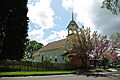
A church building in Cornelius on South Beech Street.

Template:KIDDLE XL START
See also
 In Spanish: Cornelius (Oregón) para niños Template:KIDDLE XL END
