Council Hill, Oklahoma facts for kids
Quick facts for kids
Council Hill, Oklahoma
|
|
|---|---|

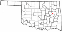
Location of Council Hill, Oklahoma
|
|
| Country | United States |
| State | Oklahoma |
| County | Muskogee |
| Area | |
| • Total | 0.32 sq mi (0.82 km2) |
| • Land | 0.32 sq mi (0.82 km2) |
| • Water | 0.00 sq mi (0.00 km2) |
| Elevation | 659 ft (201 m) |
| Population
(2020)
|
|
| • Total | 108 |
| • Density | 340.69/sq mi (131.73/km2) |
| Time zone | UTC-6 (Central (CST)) |
| • Summer (DST) | UTC-5 (CDT) |
| ZIP code |
74428
|
| Area code(s) | 539/918 |
| FIPS code | 40-17550 |
| GNIS feature ID | 2412376 |
| Website | http://www.okhistory.org/publications/enc/entry.php?entry=CO071 |
Council Hill is a small town in Muskogee County, Oklahoma, United States. In 2020, about 108 people lived there. The population was 158 at the 2010 census, which was an increase from 129 people in 2000.
History of Council Hill
Council Hill has a rich history, especially for the Creek people. Around 1840, the Creek tribe was forced to move to this area, which was then called Indian Territory. They built a council house here. The Creeks named this place Weklwa Hulwe, meaning "High Spring." They even considered it their first capital.
Smoke signals from the top of the hill were used to call for important meetings with other Creek towns nearby. During the American Civil War, Council Hill became a base for the Creek Regiment of the Confederate Army. This group was led by D. N. McIntosh.
After the Civil War, Council Hill became a quiet farming community. The first post office opened in 1905. A railroad line was built through the town in 1907. This helped farmers send their livestock and crops to markets. Cotton was the main crop, but they also grew corn, potatoes, wheat, and oats. Later, the Oklahoma Pipeline Company built a pumping station in Council Hill. This station helped move crude oil from the Glenn Pool Oil Reserve to the Gulf Coast.
Geography of Council Hill
Council Hill is located about 25 miles (40 km) south of Muskogee. It is found along U.S. Highway 62.
The United States Census Bureau states that the town covers an area of 0.3 square miles (0.8 square kilometers). All of this area is land.
Population of Council Hill
| Historical population | |||
|---|---|---|---|
| Census | Pop. | %± | |
| 1920 | 206 | — | |
| 1930 | 196 | −4.9% | |
| 1940 | 171 | −12.8% | |
| 1950 | 166 | −2.9% | |
| 1960 | 130 | −21.7% | |
| 1970 | 135 | 3.8% | |
| 1980 | 141 | 4.4% | |
| 1990 | 139 | −1.4% | |
| 2000 | 129 | −7.2% | |
| 2010 | 158 | 22.5% | |
| 2020 | 108 | −31.6% | |
| U.S. Decennial Census | |||
As of the census in 2000, there were 129 people living in Council Hill. There were 48 households and 36 families. The town had about 408.6 people per square mile (157.8 people per square kilometer).
The population was spread out by age. About 29.5% of the people were under 18 years old. About 23.3% were 65 years or older. The average age was 40 years.
See also
 In Spanish: Council Hill (Oklahoma) para niños
 | Jessica Watkins |
 | Robert Henry Lawrence Jr. |
 | Mae Jemison |
 | Sian Proctor |
 | Guion Bluford |

