Cowdenbeath facts for kids
Quick facts for kids Cowdenbeath |
|
|---|---|
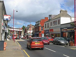
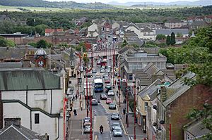 View down Cowdenbeath High Street from the North End War Memorial |
|
| Population | 12,030 (2020) |
| OS grid reference | NT160916 |
| Council area | |
| Lieutenancy area | |
| Country | Scotland |
| Sovereign state | United Kingdom |
| Post town | COWDENBEATH |
| Postcode district | KY4 |
| Dialling code | 01383 |
| Police | Fife |
| Fire | Fife |
| Ambulance | Scottish |
| EU Parliament | Scotland |
| UK Parliament |
|
| Scottish Parliament |
|
Cowdenbeath is a town in west Fife, Scotland. It is about 5 miles (8 km) northeast of Dunfermline. It is also about 18 miles (29 km) north of Edinburgh, Scotland's capital city. The town grew because of the many coal mines in the area. It became an official town (a "police burgh") in 1890. In 2008, about 14,081 people lived in Cowdenbeath. The larger area around Cowdenbeath, called the civil parish of Beath, had 17,351 people in 2011.
Contents
What Does the Name Cowdenbeath Mean?
The first part of the town's name, "Cowden," comes from a family name like Colden or Cowden. Old records sometimes show it as Cowdennyes Baith. The second part, "Beath," comes from the Gaelic word beith. This word means "birch tree." So, the name might mean "Cowden's birch trees."
Discovering Cowdenbeath's Past
Early Life in the Area
People have lived in the Cowdenbeath area for a very long time. In 1928, archaeologists found ancient pots from the late Bronze Age. These pots held the ashes of people who had died. They were found near Tollie Hill. One pot even had pieces of a special stone called Arran pitchstone. This shows that people traded goods here long ago.
The First Church and Settlement
The first signs of a lasting settlement appeared around 1429. This is when Beath Kirk became a parish church. A parish church served as a main gathering place for the surrounding area. The oldest written record of Beath is from 1178. It mentions the "Chapel of Beth." While "beath" usually means "birch," some think it means "abode" or "settlement."
In 1643, a minister named John Row helped make Beath its own parish. This meant it was separate from other church areas. A new church was built in 1640. The church you see today was built in 1834.
Protecting the Cemetery
Long ago, people sometimes tried to dig up bodies from cemeteries. This was to supply bodies for medical study. To stop this, Beath Cemetery took special steps. Heavy iron safes were placed over coffins. Also, large, heavy stones were put on graves. These stones were so heavy that a special hoist was needed to move them. This helped keep the graves safe. The heavy stone can still be seen near the church today.
How Cowdenbeath Got Its Name
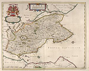
The exact time the name "Cowdenbeath" started is not known. It might have begun when new main roads were built in the 1600s. It probably marked the spot of an inn and later a tollhouse. A map from 1654 by Joan Blaeu already shows "Cowden Beth" in the area.
A Stop for Travelers
By 1790, about 100 families lived in Beath parish. Most of them worked on farms. Many "kirke roads" were created to connect people to the church. These roads are still used today.
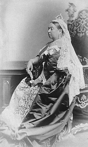
Cowdenbeath became important around 1820. It was a stop for coaches traveling north to Perth. Even Queen Victoria stopped here in 1842. She changed horses at the Cowdenbeath Coaching Inn on her way to Balmoral. This inn was at a busy crossroads.
The Rise of Coal Mining
Before 1850, Cowdenbeath was just a few farms. The area had names like Kirkford, Foulford, White Threshes, and Cowdenbeath farm. As these small areas grew together, people decided to call the new town Cowdenbeath.
Around 1850, the Oakley Iron Company arrived. This changed Cowdenbeath forever. The company started digging for iron ore. They discovered rich coal seams, which were much easier to reach than expected. Soon, coal mines opened all over the town.
Cowdenbeath: The "Chicago of Fife"
By 1850, many coal pits were operating nearby. The new railway line in 1848 made mining even more profitable. The Forth Iron Company and later the Fife Coal Company took over the mines. By 1896, the Fife Coal Company was one of Scotland's largest mining companies.
Because of all this mining, Cowdenbeath's population grew very fast. It doubled from 4,000 to 8,000 people between 1890 and 1900. This huge growth earned Cowdenbeath the nickname "Chicago of Fife."
Supporting the Mining Industry
Cowdenbeath became a key center for coal mining. The Fife and Kinross Miners' Association opened its headquarters here in 1910. The first mine rescue station in the area also opened in Cowdenbeath in 1910.
In 1924, the Fife Coal Company built "The Workshops." This helped them manage their staff and repair mining equipment.
Learning About Mining
The Fife Mining School opened in Cowdenbeath in 1895. It started small, in two rooms at Broad Street School. Later, it moved to the basement of Beath High School. In 1936, the school got its own special building. It cost £22,500 to build. The school taught young people all about mining. During the World Wars, it even trained women who worked in factories making weapons. The mining school closed in 1976 as coal mining became less important.
Where is Cowdenbeath Located?
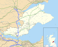
Cowdenbeath is in the southwest part of Fife, Scotland. It is close to the larger town of Dunfermline. The town sits in a mostly flat area with some gentle hills.
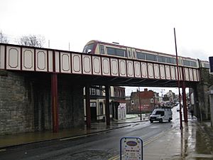
Because of all the old mine tunnels underground, some parts of the town have sunk a little. For example, the High Street used to be flat. Now, the railway bridge blocks the view from one end to the other because the ground has sunk.
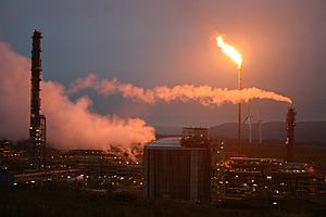
The A92 main road runs along the south and east sides of Cowdenbeath. Beyond this road is the Mossmorran petrochemical plant.
To the west, Cowdenbeath joins the village of Hill of Beath. This area has gentle slopes and a lake called Loch Fitty. The M90 motorway is also close to the south of Cowdenbeath.
To the north, Cowdenbeath meets the countryside. This area leads to the Lochore Meadows Country Park. This park used to be an industrial mining area. Now, it is a beautiful place for outdoor activities. You can still see the winding gear structure of the Mary Pit, which reminds people of the area's mining past.
Who Lives in Cowdenbeath?
In 2011, Cowdenbeath had 14,081 people living there. This was a 21% increase from 2001. There were slightly more females (51.5%) than males (48.5%), which is similar to the rest of Scotland.
| Cowdenbeath Population by Gender (2011) | |||
|---|---|---|---|
| Cowdenbeath | Fife | Scotland | |
| Total population | 14,081 | 365,198 | 5,295,403 |
| Population (male) | 6,839 | 176,943 | 2,567,444 |
| Population (female) | 7,242 | 188,255 | 2,727,959 |
Most people in Cowdenbeath are white (98.7%). The remaining 1.3% are from Asian, African, Caribbean, and other backgrounds. Compared to Scotland as a whole, Cowdenbeath has fewer people of Asian and African heritage.
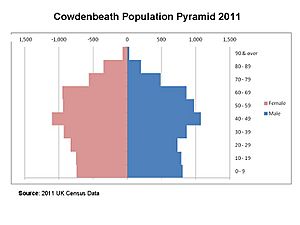
The population chart for Cowdenbeath shows that there are many people in the 40-49 age group. This group includes people born in the 1960s, often called "baby boomers."
| Cowdenbeath Population by Ethnicity (2011) | ||||
|---|---|---|---|---|
| Cowdenbeath | Cowdenbeath (%) | Scotland | Scotland (%) | |
| White Scottish | 13,210 | 93.8% | 4,445,678 | 84.0% |
| White British | 518 | 3.7% | 417,109 | 7.9% |
| White Irish | 42 | 0.3% | 54,090 | 1.0% |
| White Gypsy/traveller | 5 | 0.0% | 4,212 | 0.1% |
| White Polish | 60 | 0.4% | 61,201 | 1.2% |
| White other | 64 | 0.5% | 102,117 | 1.9% |
| White mixed/multiple | 25 | 0.2% | 19,815 | 0.4% |
| Asian | 111 | 0.8% | 140,678 | 2.7% |
| African | 17 | 0.1% | 29,638 | 0.6% |
| Caribbean | 21 | 0.1% | 6,540 | 0.1% |
| Other | 8 | 0.1% | 14,325 | 0.3% |
Sports and Fun in Cowdenbeath
Cowdenbeath has many places for sports and fun.
Cowdenbeath Leisure Centre
The Cowdenbeath Leisure Centre is in Pit Road. It has a swimming pool, a gym, and indoor sports areas. There are also three all-weather pitches for football. A small skatepark is located outside the center.
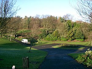
Cowdenbeath Public Park
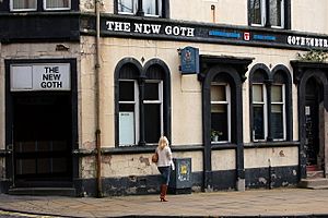
The large "Public Park" is in the north of the town. It opened in 1911. A group called the Gothenburg Public House Society helped pay for it.
In the past, the park had a bandstand, a paddling pool, and a putting course. It was a popular place for fun activities. Today, it is still a public green space for everyone to enjoy.
Golf in Cowdenbeath
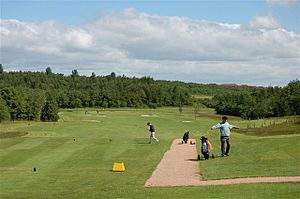
Cowdenbeath has a golf club. It was built on the site of an old coal mine. Work started in 1988, and the nine-hole course opened in 1991. It was later made into an eighteen-hole course in 1996. The course is now 6,207 yards long. A new clubhouse opened in 1998.
Central Park Stadium
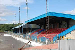
Central Park is a stadium in the middle of Cowdenbeath. It is the home of Cowdenbeath F.C., the local football team. The stadium can hold 5,270 people.
Around the football pitch, there is a tarmac track. This track is one of Britain's fastest and is used for stock car racing. Central Park also has Britain's most northerly speedway track. Speedway is a type of motorcycle racing. The local team was called the Fife Lions.
Other Places in Town
Cowdenbeath has a medical practice on Stenhouse Street. There is a library at the north end of the High Street. The Police Station moved to Brunton House in 2012. A post office is also located near Brunton House. The red sandstone Town House building is towards the north end of the High Street.
Schools in Cowdenbeath
Cowdenbeath has three primary schools:
- Cowdenbeath Primary School (for the south of town)
- Foulford Primary School (for the north of town)
- St Bride's Primary School (a Roman Catholic school for Cowdenbeath and nearby villages)
Some students in the northeast and southwest of town go to Lumphinnans and Hill of Beath primary schools.
Beath High School
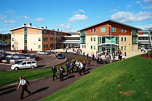
Cowdenbeath has one secondary school, Beath High School. It started in 1910 as a grammar school. The original building was made of red sandstone.
Over time, the old mine tunnels caused the ground under the school to sink. A new school was built in 1964. The old building was taken down in the 1990s. In 2003, the "new" school also had to close because of sinking ground. A brand new school was then built.
In 1983, a student's case from Beath High School helped change rules about discipline in Scottish schools. This case helped lead to the banning of physical punishment in schools across Scotland.
Famous People from Cowdenbeath
Many notable people have come from Cowdenbeath or attended Beath High School:
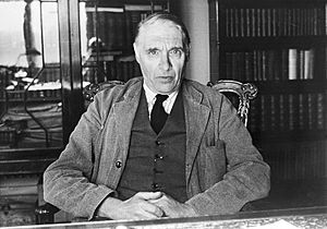
- Sir Hector Hetherington (1888–1965) was a Scottish philosopher. He was in charge of the University of Liverpool and later the University of Glasgow.
- Jennie Lee, Baroness Lee of Asheridge went to Beath High School. She became a politician and helped create the Open University.
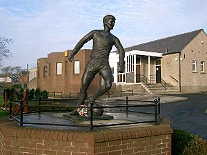
- James Curran Baxter, known as "Slim Jim," was a famous Scottish football player. He also went to Beath High School. You can find a statue of him in his home village, Hill of Beath.
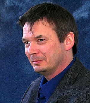
- Ian Rankin, the author of the popular Inspector Rebus detective novels, attended Beath High School.
- Dennis Canavan, a Scottish politician, was born in Cowdenbeath in 1942. He went to St Brides Primary School.
- Tom Gourdie (1913–2005) was a calligrapher and artist born and raised in Cowdenbeath.
- Harry Ewing, Baron Ewing of Kirkford was born in Cowdenbeath in 1931. He was a Member of Parliament for 21 years.
- Donald Findlay, born in Cowdenbeath in 1951, is a well-known lawyer in Scotland. He is also the chairman of Cowdenbeath FC.
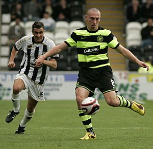
- Scott Brown is a footballer who attended Beath High School. He has played for major clubs like Celtic and the Scotland national team.
- Tricia Marwick is a politician and was the Presiding Officer of the Scottish Parliament.
- William McLaren (1923–1987) was an illustrator whose work appeared in magazines like Radio Times. He also attended Beath High School.
Getting Around Cowdenbeath
Roads
The A92 Fife Regional Road is a major dual carriageway. It connects to the M90 motorway (which goes from Edinburgh to Perth). The A92 goes around the east side of Cowdenbeath.
Trains
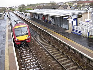
Cowdenbeath railway station is just off the High Street. It is on the Fife Circle Line. Trains run every half hour to Edinburgh during the day on weekdays and Saturdays.
The Halbeath Park & Ride, which opened in 2014, offers bus services to Edinburgh, Edinburgh Airport, and Glasgow.
Bus Services
Cowdenbeath has many local bus services connecting it to nearby towns and villages.
| Service | Destination | Via | Frequency |
|---|---|---|---|
| 17 | Kelty | Leuchatsbeath Drive | Every hour (daytime only) |
| 17 | Halbeath Park & Ride | Church Street, Mossgreen, Crossgates | Every hour (daytime only) |
| 17A | Kelty | Stenhouse Street, Foulford Road, Leuchatsbeath Drive | Every hour (evenings and Sundays only) |
| 17A | Greenbank Drive | Broad Street, Moss-Side Road | Every hour (evenings and Sundays only) |
| 17B | Kelty | Stenhouse Street, Foulford Road, Leuchatsbeath Drive | Every hour (daytime only) |
| 17B | Barclay Street | Broad Street, Selkirk Avenue, Rae Street, Greenbank Drive | Every hour (daytime only) |
| 18 | Kelty | Leuchatsbeath Drive | Every hour |
| 18 | Leven | Auchtertool, Kirkcaldy | Every hour |
| 19 | Rosyth | Hill of Beath, Crossgates, Halbeath Park & Ride, Dunfermline | Every 10 minutes |
| 19 | Ballingry | Lumphinnans, Lochgelly, Crosshill | Every 10 minutes |
| 33 | Dunfermline | Hill of Beath, Crossgates, Halbeath, QM Hospital | Every hour |
| 33 | Kirkcaldy | Lumphinnans, Lochgelly, Cardenden | Every hour |
| 81 | Queen Margaret Hospital | Stenhouse Street, Kingseat | Every hour |
| 81 | Glenrothes | Lumphinnans, Lochgelly, Crosshill, Ballingry, Kinglassie | Every hour |
| X54 | Edinburgh | Halbeath Park & Ride, Dunfermline, Rosyth, Ferrytoll Park & Ride | Every hour |
| X54 | Dundee | Glenrothes, Ladybank, Newport-on-Tay | Every hour |
See also
 In Spanish: Cowdenbeath para niños
 | Jessica Watkins |
 | Robert Henry Lawrence Jr. |
 | Mae Jemison |
 | Sian Proctor |
 | Guion Bluford |


