Cranagh (barony) facts for kids
Quick facts for kids
Cranagh
Crannach (Irish)
Barony of Cranagh
|
|
|---|---|
|
Barony
|
|

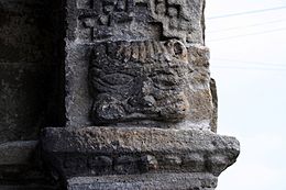
A detail from the portal of St. Lachtain's Church.
|
|
| Etymology: Abounding in Trees, or Woodland | |
|
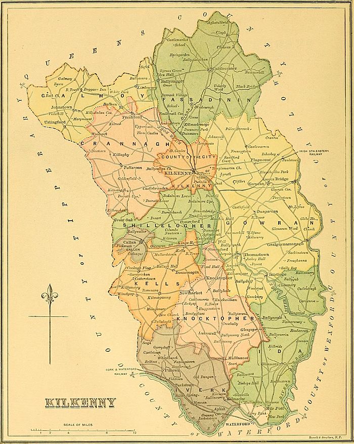
Map of Cranagh
|
|
| Country | Ireland |
| Province | Leinster |
| County | County Kilkenny |
| Civil parishes |
List
Ballinamara
Ballycallan Ballylarkin Clashacrow Clomantagh Coolcraheen Fertagh Freshford Garranamanagh Kilcooly Killahy Killaloe Kilmanagh Odagh Sheffin Tubbridbritain Tullaghanbrogue Tullaroan |
| Government | |
| • Type | County Council |
| • Body | Kilkenny County Council |
| Area | |
| • Total | 210.8 km2 (81.4 sq mi) |
Cranagh (also called Crannagh or Granagh) is a special area in the northwest of County Kilkenny, Ireland. It's known as a barony, which is like an old-fashioned district. The name Crannach comes from Irish and means "abounding in trees" or "woodland."
Cranagh is one of 12 baronies in County Kilkenny. It covers about 210.8 square kilometers (about 81 square miles). Inside Cranagh, there are 19 smaller areas called civil parishes, which are made up of 182 townlands. The main town in Cranagh is Freshford. The highest point in the barony is Clomantagh Hill.
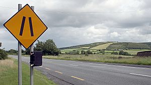
Cranagh is located in the northwest part of County Kilkenny. To its north are the baronies of Galmoy and Fassadinin. To the east is the barony of Kilkenny. To the south, you'll find Shillelogher. Cranagh also shares a border with County Tipperary to the west. A road called the R693 goes through the barony.
History of Cranagh
Cranagh has a long history! It was once part of an old kingdom called Osraige (or Ossory). In the past, the area was controlled by an Irish family known as the Ua Caibhdheanaigh (O'Coveney, Keveny).
The name "Crannagh" comes from the Irish word "crann," meaning "tree." So, it literally means a place "full of trees" or "woodland." An old poem from 1420 mentions that this area was the land of the Ua Caibhdheanaigh clan.
In 891, a place called Grane Hill in Cranagh was mentioned in old Irish records. These records talked about a battle that happened there.
Cranagh was first called the "Manor of Crannagh" in 1311. The name "Barony of Cranagh" appeared in official records in 1587. This suggests that the area has been organized as a barony for a very long time.
Even though it's an old area, Cranagh doesn't have many very old stone structures like megaliths. However, it has many raths (ancient circular forts), ruined old churches, and Norman castles. The Grace family were important lords in the area, known as the Barons of Courtstown.
Over time, the way County Kilkenny was divided changed. By the 19th century, Cranagh became one of the main baronies, along with nine others.
Exploring Cranagh's Geography

County Kilkenny is divided into 12 baronies. Cranagh is located in the northwest. It stretches from the River Nore valley in the east all the way to the border of County Tipperary in the west.
Besides the main town of Freshford, Cranagh also includes smaller places like Odagh, Threecastles, Woodsgift, Kilmanagh, Lacken, Rathmoyle, and Tullaroan.
The highest point in Cranagh is Clomantagh Hill, which is 349 meters (1,145 feet) high. This hill has interesting sandstone rocks resting on top of the county's limestone.
The River Nore flows to the east of Cranagh, and the Nuenna River flows right through the barony. There's also a special type of lake called a turlough here, known as the Loughans. This area is protected because it's important for nature. You can also find the Ballykeeffe Wood nature reserve in Cranagh.
Cranagh is made up of 19 civil parishes. These include Freshford, Odagh, Ballycallan, and Tullaroan, among others. Today, Cranagh is managed by the Kilkenny County Council, which helps run the local area.
 | Isaac Myers |
 | D. Hamilton Jackson |
 | A. Philip Randolph |


