Curra, Queensland facts for kids
Quick facts for kids CurraQueensland |
|||||||||||||||
|---|---|---|---|---|---|---|---|---|---|---|---|---|---|---|---|

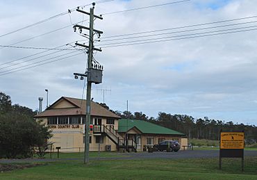
Curra Country Club
|
|||||||||||||||
| Population | 2,104 (2021 census) | ||||||||||||||
| • Density | 20.587/km2 (53.32/sq mi) | ||||||||||||||
| Postcode(s) | 4570 | ||||||||||||||
| Area | 102.2 km2 (39.5 sq mi) | ||||||||||||||
| Time zone | AEST (UTC+10:00) | ||||||||||||||
| Location | |||||||||||||||
| LGA(s) | Gympie Region | ||||||||||||||
| State electorate(s) | Gympie | ||||||||||||||
| Federal Division(s) | Wide Bay | ||||||||||||||
|
|||||||||||||||
Curra is a quiet, country-style area in Queensland, Australia. It's part of the Gympie Region. In 2021, about 2,104 people lived here. It's a place where people live on larger blocks of land, enjoying a rural feel but still close to towns.
Contents
What is Curra Like?
Curra is located in the Wide Bay–Burnett area of Queensland. The Mary River forms its western border. Curra Creek is part of the northern boundary. A large section of the Curra State Forest is to the east.
Mount Corella is a mountain in the south of Curra. It rises to 336 metres (1,102 ft) high.
How to Get Around Curra
The main road, the Bruce Highway, goes right through Curra. It enters from the south-east and leaves to the north.
The North Coast railway line also runs through Curra. It enters from the south-west and exits to the north. There are two railway stops here:
- Curra railway station
- Harvey's Siding
Curra is mostly a rural area. It has working farms and small properties where people live.
A Look at Curra's Past
The name 'Curra' comes from an Aboriginal word, 'Kurui'. This word means 'grey forest possum'. The local Aboriginal people are the Kabi Tribe. They belong to the Kabi Kabi First Nation language group.
The first land owner was Walter Hay in 1859. His cattle station was first called "Currie". Later, its name was changed to Curra.
During the gold rush that started in 1867, Curra was an important stop. Travellers between Maryborough and Gympie would stop here. They often used Cobb & Co coaches.
In 1887, a large area of land (23,500 acres (9,500 ha)) was made available. This land was offered for people to start small farms.
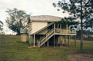
Curra Provisional School opened on July 17, 1893. It became Curra State School in 1909. The school closed in 1961.
There was once a mine in the Curra Estate Road area. Today, there is still a working limestone quarry here.
The Curra Post Office opened by 1916. It closed in 1977.
Curra used to be part of the Shire of Tiaro. Since 2008, it has been part of the Gympie Region.
In 2012, a part of the Bruce Highway near Curra was thought to be very dangerous. A new bypass for Gympie is being built. It will connect with the Bruce Highway at Curra. This new road is planned to be finished in late 2024.
How Many People Live in Curra?
The number of people living in Curra has grown over the years:
- In 2006, there were 1,372 people.
- In 2016, the population grew to 1,920 people.
- In 2021, Curra had 2,104 people living there.
What Can You Find in Curra?
Curra is a peaceful place for families and people who are retired. It has several useful facilities:
- A rural fire service helps keep the community safe.
- There are parks and a playground for kids.
- A post office box is available for mail.
- A Puma service station offers fuel, food, and groceries. It also has motel rooms.
- The Curra Country Club is a community club for locals.
- There is a large block of land approved for future shops and a hotel.
- More small businesses are starting up in the area.
Schools Near Curra
There are no schools located directly in Curra. Students usually go to schools in nearby towns.
- The closest primary schools are Gunalda State School in Gunalda to the north. Chatsworth State School in Chatsworth is to the south.
- The nearest high school is James Nash State High School in Gympie to the south-east.
 | Bessie Coleman |
 | Spann Watson |
 | Jill E. Brown |
 | Sherman W. White |


