Dalton City, Illinois facts for kids
Quick facts for kids
Dalton City, Illinois
|
|
|---|---|

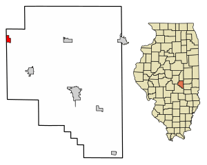
Location in Moultrie County, Illinois
|
|
| Country | |
| State | |
| County | Moultrie |
| Township | Dora |
| Area | |
| • Total | 0.53 sq mi (1.38 km2) |
| • Land | 0.53 sq mi (1.38 km2) |
| • Water | 0.00 sq mi (0.00 km2) |
| Elevation | 686 ft (209 m) |
| Population
(2020)
|
|
| • Total | 454 |
| • Density | 850.19/sq mi (328.40/km2) |
| Time zone | UTC-6 (CST) |
| • Summer (DST) | UTC-5 (CDT) |
| ZIP code |
61925
|
| Area code(s) | 217 |
| FIPS code | 17-18446 |
| GNIS ID | 2398673 |
| Wikimedia Commons | Dalton City, Illinois |
Dalton City is a small village in Moultrie County, Illinois, United States. It is located in the central part of the state. The village is near the border of Macon County. In 2020, about 454 people lived in Dalton City. This number was a bit lower than the 544 people who lived there in 2010.
Contents
Village History and Important People
Dalton City officially became a village on September 15, 1877. This means it was recognized as its own community.
A famous person named Henry Gleason was born in Dalton City. He was an important scientist in the 20th century. Henry Gleason studied ecology, which is about how living things interact with their environment. He also studied taxonomy, which is how scientists classify different plants and animals.
Where is Dalton City?
Dalton City is in the northwestern part of Moultrie County. Its western edge is right on the border with Macon County. You can find the village along Route 121. This road crosses with Route 128 right in Dalton City.
Route 121 runs along the northern and eastern sides of the village. If you go southeast on Route 121, you'll reach Bethany in about 6 miles. Keep going for 13 miles, and you'll arrive in Sullivan. Sullivan is the main town, or county seat, of Moultrie County.
If you head northwest on Route 121, you'll get to Mount Zion in about 6 miles. Another 13 miles will take you to Decatur. Route 128 runs along the west side of Dalton City. If you go south on Route 128 for about 22 miles, you'll reach Shelbyville.
The village covers an area of about 0.53 square miles (1.38 square kilometers). All of this area is land. Dalton City is also part of the West Okaw River watershed. This means that water in the area eventually flows into the West Okaw River.
Who Lives in Dalton City?
In the year 2000, there were 581 people living in Dalton City. These people made up 212 households. A household is a group of people living in the same home. Out of these, 170 were families.
Most people living in Dalton City were White (98.62%). A small number were African American (0.52%) or Native American (0.52%). Some people were from other backgrounds (0.17%) or a mix of two or more races (0.17%). About 1.55% of the population identified as Hispanic or Latino.
Many households (44.3%) had children under 18 living with them. Most households (69.8%) were married couples. About 17.5% of homes had just one person living there. The average household had about 2.74 people. The average family had about 3.09 people.
The population was spread out by age. About 31.2% of the people were under 18 years old. About 7.9% were 65 years or older. The average age in the village was 33 years old.
See also
 In Spanish: Dalton City para niños
 | Shirley Ann Jackson |
 | Garett Morgan |
 | J. Ernest Wilkins Jr. |
 | Elijah McCoy |


