Dana Butte facts for kids
Quick facts for kids Dana Butte |
|
|---|---|
 |
|
| Highest point | |
| Elevation | 4,964 ft (1,513 m) |
| Prominence | 300 ft (91 m) |
| Isolation | 2 |
| Parent peak | Hopi Point (South Rim) |
| Geography | |
| Location | Grand Canyon Coconino County, Arizona. U.S. |
| Topo map | USPS Grand Canyon |
| Geology | |
| Age of rock | Pennsylvanian |
| Mountain type | sedimentary rock: |
| Type of rock | Manakacha Formation Watahomigi Formation Redwall Limestone Tonto Group _3-Muav Limestone _2-Bright Angel Shale _1-Tapeats Sandstone Vishnu Basement Rocks Granitic (Xg). Metamorphic Rocks (Xm) |
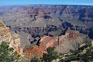
Dana Butte is a tall rock formation in the Grand Canyon. It stands about 4,964 feet (1,513 meters) high. This impressive natural landmark was named after James Dwight Dana, a famous geologist and volcanologist.
Dana Butte is found right next to the Colorado River. It sits on the south side of an area called Granite Gorge.
Contents
Where is Dana Butte Located?
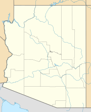
Dana Butte is in the central part of the Grand Canyon. It is about 2.5 miles (4 km) north-northwest of Grand Canyon Village. You can also find it about 2 miles (3.2 km) north of Pima Point, which is on the South Rim.
What is Dana Butte Made Of?
This butte is at the end of a long, narrow ridge. This ridge is made of bright-red rocks from the Supai Group. The main part of Dana Butte, which looks like a spire, sits on a type of rock called Redwall Limestone.
Understanding the Rocks
The Redwall Limestone forms huge cliffs and flat areas. These flat areas support younger rocks above them. The very top of Dana Butte is a dull gray color. It is made of weathered rock from the Supai Group, specifically the Manakacha Formation. This type of rock also forms cliffs.
How Does Water Flow Around Dana Butte?
Water flows from Dana Butte in two main directions. To the west, the water drains into the Salt Creek drainage system. To the east, it flows into the nearby canyon where Salt Creek ends.
 | May Edward Chinn |
 | Rebecca Cole |
 | Alexa Canady |
 | Dorothy Lavinia Brown |


