Deposit (village), New York facts for kids
Quick facts for kids
Deposit, New York
|
|
|---|---|

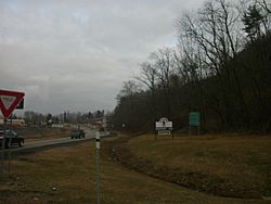
Entrance to Deposit along New York State Route 10
|
|
| Motto(s):
"Where nature blesses, there man progresses."
|
|

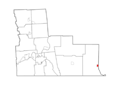
Location within Broome County
|
|
| Country | United States |
| State | New York |
| Counties | Broome, Delaware |
| Towns | Sanford, Deposit |
| Area | |
| • Total | 1.32 sq mi (3.41 km2) |
| • Land | 1.26 sq mi (3.27 km2) |
| • Water | 0.05 sq mi (0.14 km2) |
| Elevation | 991 ft (302 m) |
| Population
(2020)
|
|
| • Total | 1,387 |
| • Density | 1,098.18/sq mi (424.05/km2) |
| Time zone | UTC-5 (Eastern (EST)) |
| • Summer (DST) | UTC-4 (EDT) |
| ZIP code |
13754
|
| FIPS code | 36-20346 |
Deposit is a small village in New York, USA. It is special because it sits across two different counties: Broome and Delaware. In 2020, about 1,387 people lived there.
The village is also split between two towns. Half of Deposit is in the town of Sanford (Broome County). The other half is in the town of Deposit (Delaware County). The part of Deposit in Broome County is near the larger city of Binghamton.
History of Deposit
Deposit has an interesting past. It was once a border area between lands claimed by White settlers and Native American tribes. This boundary was set by the 1763 Fort Stanwix Treaty.
The village officially became a village in 1811. Deposit is one of only twelve villages in New York that still uses its original founding rules, called a charter. Most other villages have changed to newer state laws.
The name "Deposit" comes from its early days as a lumber center. Logs were "deposited" here before being floated down the Delaware River. Today, the dairy industry is very important to the area.
Geography of Deposit
Deposit is located right next to the West Branch of the Delaware River. A major road, New York State Route 17, also known as the Southern Tier Expressway, runs through the village.
The village is about 30 miles (48 kilometers) east of Binghamton. It is also very close to the Pennsylvania border, only about 3 miles (5 kilometers) north.
The exact location of Deposit is at 42.061856 degrees North latitude and 75.423358 degrees West longitude.
The United States Census Bureau says that Deposit covers a total area of about 1.3 square miles (3.4 square kilometers). Most of this area, about 1.26 square miles (3.3 square kilometers), is land. A small part, about 0.05 square miles (0.1 square kilometers), is water.
Population Changes Over Time
| Historical population | |||
|---|---|---|---|
| Census | Pop. | %± | |
| 1870 | 1,286 | — | |
| 1880 | 1,419 | 10.3% | |
| 1890 | 1,530 | 7.8% | |
| 1900 | 2,051 | 34.1% | |
| 1910 | 1,864 | −9.1% | |
| 1920 | 1,943 | 4.2% | |
| 1930 | 1,887 | −2.9% | |
| 1940 | 2,028 | 7.5% | |
| 1950 | 2,016 | −0.6% | |
| 1960 | 2,025 | 0.4% | |
| 1970 | 2,061 | 1.8% | |
| 1980 | 1,897 | −8.0% | |
| 1990 | 1,936 | 2.1% | |
| 2000 | 1,699 | −12.2% | |
| 2010 | 1,663 | −2.1% | |
| 2020 | 1,387 | −16.6% | |
| U.S. Decennial Census | |||
The population of Deposit has changed over many years. In 1870, there were 1,286 people living there. The population grew to over 2,000 people in the early 1900s.
By 2010, the population was 1,663. The most recent count in 2020 showed 1,387 residents. This means the number of people living in Deposit has decreased a bit in recent years.
In 2000, there were 1,699 people living in the village. There were 716 households, and 436 of these were families. The average household had about 2.37 people.
About 27.1% of the people were under 18 years old. About 17.2% were 65 years old or older. The average age in the village was 37 years.
See also
 In Spanish: Deposit (villa) para niños
 | Selma Burke |
 | Pauline Powell Burns |
 | Frederick J. Brown |
 | Robert Blackburn |


