Devilsmother facts for kids
Quick facts for kids Devilsmother |
|
|---|---|
| Magairlí an Deamhain | |

|
|
| Highest point | |
| Elevation | 645 m (2,116 ft) |
| Prominence | 280 m (920 ft) |
| Listing | Hewitt, Marilyn |
| Geography | |
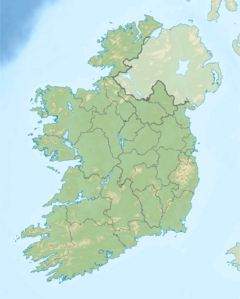
| Location | Border of County Galway and Mayo, Republic of Ireland |
| Parent range | Partry Mountains |
| OSI/OSNI grid | L915624 |
| Topo map | OSi Discovery 37 |
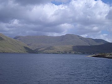
Devilsmother is a mountain in Connemara, Ireland. It stands at 645 meters (about 2,116 feet) high. This makes it a significant peak in the region.
Contents
Where is Devilsmother Located?
Devilsmother is part of the Partry Mountains range. It is found at the very end of Killary Harbour. This is a beautiful fjord, which is a long, narrow inlet of the sea.
Border Mountain
The mountain sits right on the border between two counties. To the south is County Galway. To the north is County Mayo. This means you can be in two counties at once when you are on its slopes!
Views and Trails
From Devilsmother, you can look down over the Western Way. This is a famous long-distance walking path. Hikers enjoy amazing views of the surrounding landscape from here.
What Does Devilsmother Mean?
The mountain has two names in the Irish language. One name is Magairlí an Deamhain. The other is Binn Gharbh.
Meaning of the Names
Binn Gharbh means "rough peak". This name describes the mountain's rugged look. On older maps, you might see this name spelled as Ben Garrif.
It seems that Magairlí an Deamhain originally referred to a bumpy ridge. This ridge is located north of the mountain's top. The English name Devilsmother might be a different way of saying an older name.
 | Roy Wilkins |
 | John Lewis |
 | Linda Carol Brown |


