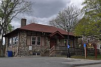
Dighton, Massachusetts facts for kids
Quick facts for kids
Dighton, Massachusetts
|
|||
|---|---|---|---|
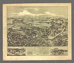
View of North Dighton Village in 1881
|
|||
|
|||
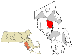
Location in Bristol County in Massachusetts
|
|||
| Country | United States | ||
| State | Massachusetts | ||
| County | Bristol | ||
| Deeded | 1672 | ||
| Incorporated | 1712 | ||
| Government | |||
| • Type | Open town meeting | ||
| Area | |||
| • Total | 22.6 sq mi (58.5 km2) | ||
| • Land | 22.0 sq mi (57.0 km2) | ||
| • Water | 0.6 sq mi (1.5 km2) | ||
| Elevation | 19 ft (6 m) | ||
| Population
(2022)
|
|||
| • Total | 8,101 | ||
| • Density | 358.7/sq mi (138.48/km2) | ||
| Time zone | UTC-5 (Eastern) | ||
| • Summer (DST) | UTC-4 (Eastern) | ||
| ZIP code |
02715 / 02764 (North Dighton)
|
||
| Area code(s) | 508 / 774 | ||
| FIPS code | 25-16950 | ||
| GNIS feature ID | 0618280 | ||
Dighton is a town in Bristol County, Massachusetts, United States. It is located on the western side of the Taunton River. In 2020, about 8,101 people lived there.
Contents
History of Dighton
Dighton was once part of Taunton and other nearby towns. It became its own separate area in 1672. Then, in 1712, it officially became a town. Dighton was named after Frances Dighton Williams, who was the wife of an important town leader.
When Dighton first became a town, it included land on both sides of the Taunton River. This included an area called Assonet Neck. This area is famous for Dighton Rock. This rock is found in the shallow part of the river and has mysterious carvings on it. No one is quite sure who made these carvings or what they mean! However, in 1799, the land on the east side of the river, where the rock is, became part of Berkley. So now, Berkley is home to the famous Dighton Rock.
Because Dighton was at the start of the river's tidewater, it was a busy place for building ships. It was even an important port where ships could stop. This made Dighton a key shipping center for southeastern Massachusetts. The town also had cotton mills, factories, and farms. Over time, many of these big industries left. Today, Dighton is mostly a quiet, rural town with some small farms.
Geography of Dighton
Dighton covers about 58.5 square kilometers (22.6 square miles). Most of this area is land, and a small part is water.
Dighton shares its borders with several other towns. To the west is Rehoboth. To the southwest is Swansea. Somerset is to the south. The Taunton River and the town of Berkley are to the east. Finally, the city of Taunton is to the north.
Besides the Taunton River, Dighton also has other rivers. The Three Mile River flows into the Taunton River on the northeast side of town. The Segreganset River also flows through the middle of Dighton. There are also many smaller streams. The highest spot in Dighton is in its northwest corner. It is about 72 meters (236 feet) above sea level.
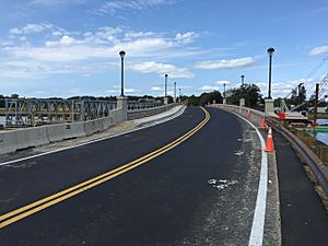
Dighton is home to the Berkley–Dighton Bridge. This bridge connects Center Street in Dighton to Elm Street in Berkley. The original bridge was built in the 1890s and only had one lane. It was the only bridge crossing the Taunton River for many miles. In 2010, the old bridge was taken down. A new, wider two-lane bridge opened in August 2015, making travel much easier.
Dighton has several smaller areas within it. These include Chestnut Tree Corner, Dighton, Dighton Rock State Park, North Dighton, Segreganset, South Dighton, and Wheeler's Corner.
Population of Dighton
| Historical population | ||
|---|---|---|
| Year | Pop. | ±% |
| 1850 | 1,641 | — |
| 1860 | 1,733 | +5.6% |
| 1870 | 1,817 | +4.8% |
| 1880 | 1,791 | −1.4% |
| 1890 | 1,880 | +5.0% |
| 1900 | 1,802 | −4.1% |
| 1910 | 2,235 | +24.0% |
| 1920 | 2,574 | +15.2% |
| 1930 | 3,147 | +22.3% |
| 1940 | 2,983 | −5.2% |
| 1950 | 2,950 | −1.1% |
| 1960 | 3,769 | +27.8% |
| 1970 | 4,667 | +23.8% |
| 1980 | 5,352 | +14.7% |
| 1990 | 5,631 | +5.2% |
| 2000 | 6,175 | +9.7% |
| 2010 | 7,086 | +14.8% |
| 2020 | 8,101 | +14.3% |
| 2023* | 8,182 | +1.0% |
Source: United States Census records and Population Estimates Program data. |
||
In 2000, Dighton had 6,175 people living there. About 26% of the population was under 18 years old. The median age was 38 years. This means half the people were younger than 38 and half were older.
Fun Events in Dighton
Annual cultural events
Dighton is famous for its "Cow Chip Festival." The Dighton Lions Club organizes this fun event. Every June, a traveling carnival comes to town and sets up behind the Town Hall. There are rides, carnival games, and lots of food. You can also enjoy musical performances and a lawn tractor pull. Recently, fireworks have also been added to the festival!
The festival gets its unique name from a special game. Squares are marked out on a field behind the town hall. Cows are then let onto these squares. People bet on which square a cow will "decorate" first!
Parks and Outdoor Fun
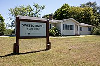
Sweets Knoll State Park is a large park in Dighton, covering 56 acres. It was bought in 2009. The park has two miles of old railroad tracks that might become a path for walking and biking. It also has picnic areas, a small boat launch, and places for fishing.
Tricentennial Park is a small park along the Taunton River. It was created by a young resident as an Eagle Scout project. This park honors the town's 300th birthday, which was in 2012.
Climate in Dighton
In Dighton, temperatures usually drop below 10°C (50°F) for about 164 days each year. The town gets about 121 centimeters (47.6 inches) of rain every year. This is more than the average for the United States. Snow usually covers the ground for about 40 days each year.
Education in Dighton
Dighton and its neighbor, Rehoboth, share a school district called the Dighton-Rehoboth School District. This district was started in 1987 to manage the schools in both towns.
The high school for both towns is Dighton-Rehoboth Regional High School. It was built in 1958 and is located in North Dighton, very close to the Rehoboth town line. The school's sports teams are called the Falcons, and their colors are green and gold. The Dighton Middle and Elementary Schools are located in the center of Dighton.
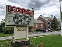
Dighton is also home to Bristol County Agricultural High School. This school has a large farm along the Taunton River. It teaches students about farming and related subjects.
Dighton Public Library
Dighton has its own public library, called the Dighton Public Library. It serves the community by providing books and other resources.
Historic Places to See
- Coram Shipyard Historic District
- Dighton Wharves Historic District
- Dighton Community Church, built in 1798
Famous People from Dighton
- Thomas Coram (1668–1751): He lived in Dighton for ten years and started the Coram Shipyard.
- Ralph Moody (1917–2004): An American race car driver and engineer. He founded Holman-Moody, a famous company in NASCAR racing.
- Samuel Shaw (1768–1827): He was a United States Representative from Vermont.
- Jesse Talbot (1805–1879): A painter from the Hudson River School. He was also a friend of the famous poet Walt Whitman.
- Silas Talbot (1751–1813): A U.S. Navy Commodore and captain of the USS Constitution.
- Ruth Tripp (1897–1971): A composer who helped manage music projects in Rhode Island.
See also
 In Spanish: Dighton (Massachusetts) para niños
 | Georgia Louise Harris Brown |
 | Julian Abele |
 | Norma Merrick Sklarek |
 | William Sidney Pittman |


