Dinas Island facts for kids
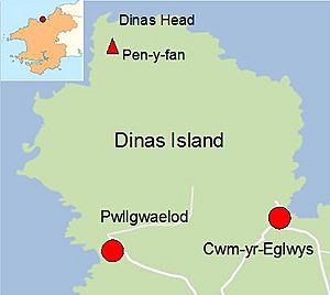
Dinas Island (in Welsh: Ynys Dinas) is a special piece of land in southwest Wales. It's a peninsula, which means it's almost an island, connected to the mainland by a narrow strip of land. You can find it between the towns of Fishguard and Newport, Pembrokeshire.
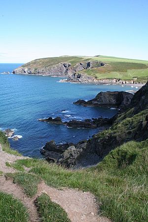
The highest point on Dinas Island is called Pen-y-fan. It stands about 466 feet (142 meters) above the sea. Even though Dinas Head is the very tip of the land where the cliffs meet the water, people sometimes use the name Dinas Island to talk about the whole high area. This beautiful place is part of the Pembrokeshire Coast National Park. The National Trust helps look after the headland, making sure it stays wild and natural for everyone to enjoy.
Contents
How Dinas Island Was Formed
The land on the side of Dinas Island that faces the mainland has a valley. This valley was created a long, long time ago during the Ice Age. It was carved out by water from melting glaciers and ice. This melting water came from the Preseli Hills as the ice slowly disappeared. It's the same kind of melting ice that helped form the Gwaun Valley, which is another interesting place further along the coast.
Plants and Animals
Dinas Island is a windy place, so the plants that grow here are tough and used to the coastal weather. You'll see lots of gorse, bracken, and bramble. There are also small, bushy trees like hawthorn, blackthorn, and hazel. In places where the wind isn't as strong, you might find small oak and ash trees.
Many pretty wildflowers grow here too. Look for ling, scabious, thyme, heather, thrift, pennywort, foxglove, and different kinds of orchids. In the spring, the eastern slopes of Dinas Island are covered in beautiful bluebells. Long ago, wild goats lived on the headland, but they were moved in 1947.
Walking the Pembrokeshire Coast Path
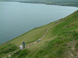
The Pembrokeshire Coast Path is a very long walking trail, stretching for 186 miles (299 kilometers) along the coast of Wales. About 3 miles (5 kilometers) of this path goes right around Dinas Island. As you walk, you'll get amazing views of the sea, including Strumble Head and both Fishguard and Newport Bays.
You can start this part of the path from two places: Pwllgwaelod on the southwest side, or Cwm-yr-Eglwys on the southeast side. Both of these spots are easy to reach from Dinas Cross (which is on the A487 road). They also have parking and public toilets. There's even a special path that connects Pwllgwaelod and Cwm-yr-Eglwys that is good for wheelchairs.
Getting Around
If you want to visit Pwllgwaelod, you can take a bus called the "Poppit Rocket." This bus travels along the coastline, going from Fishguard all the way to Cardigan, Ceredigion in the north. It's a great way to see the beautiful coastal scenery without needing a car.
Farming on Dinas Island
A big part of Dinas Island is used for sheep farming. Dinas Island Farm is a special place that is run by the National Trust and the Perkins family together. You can get to the farm from Pwllgwaelod. They have a large flock of Lleyn sheep, with about 1,600 adult ewes and 400 younger sheep, all living on 600 acres of land. The farm is known for its excellent sheep farming and grassland management.
 | Janet Taylor Pickett |
 | Synthia Saint James |
 | Howardena Pindell |
 | Faith Ringgold |


