Preseli Hills facts for kids
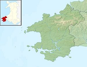
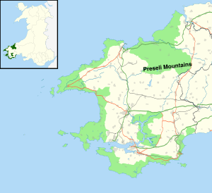
The Preseli Hills, also known as the Preseli Mountains (in Welsh: Mynyddoedd y Preseli / Y Preselau prə-SEL-ee), are a range of hills in north Pembrokeshire, west Wales. Most of these hills are part of the beautiful Pembrokeshire Coast National Park.
These hills stretch for about 13 miles (21 km) (21 km) from Newport in the west to Crymych in the east. The highest point is Foel Cwmcerwyn, which stands at 1,759 feet (536 m) (536 meters) above sea level. An old 8 miles (13 km) (13 km) path along the top of the hills is famously called the Golden Road.
The Preseli Hills are home to many different plants and animals. They also have lots of ancient sites from long ago. Because of their natural beauty and history, they are a popular place for tourists to visit. You'll find small villages and scattered homes here. The higher parts of the hills are open grazing land for animals, while the lower slopes are mostly fenced fields.
Long ago, people used to quarry (dig for) slate here. More recently, a different type of rock called igneous rock is being taken from the ground. The Preseli Hills are a special protected area for nature, known as a Special Area of Conservation. There are also three specific areas called Sites of Special Scientific Interest (SSSIs) because of their important wildlife or geology.
Contents
What are the Preseli Hills Made Of?
The Preseli Hills are mostly made of rocks formed a very long time ago, during a period called the Ordovician age. These rocks include marine mudstones and siltstones. There are also harder rocks like microgabbro (also known as dolerite) that pushed their way into the softer rocks.
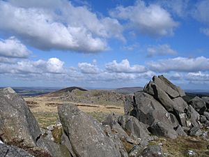
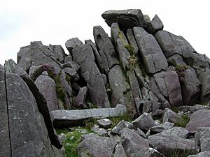
The old slate quarries near Rosebush used to dig out these softer rocks. However, it's the harder dolerite rocks, especially from places like Carnmenyn, that are famous. Many people believe these rocks are the "bluestones" used to build Stonehenge!
Towards the eastern end of the hills, at Foel Drygarn, you'll find rocks formed from tuffs and lavas, which came from ancient volcanoes. Further east, Frenni Fawr is made of mudstones and sandstones. All these rocks generally slope northwards and are cut by many geological faults (cracks in the Earth's crust).
A large valley called Cwm Gwaun was carved out by melting glaciers long ago. This valley separates some northern peaks, like Mynydd Carningli, from the main part of the hills.
Exploring the Preseli Hills
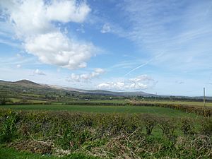
Much of the Preseli Hills is open moorland or land used for grazing animals. There are also areas of bog (wet, spongy ground). Surrounding these open areas are farms, some still active and some deserted. The fields are usually separated by earth banks with fences and plants like gorse (a spiky bush).
Rosebush Reservoir is one of only two reservoirs in Pembrokeshire. It provides water to the southern part of the area and is also a place where people can fish for brown trout. It's located on the southern slopes near the village of Rosebush. Another reservoir, Llys y Fran, is also nearby to the south. The hills don't have any natural lakes, but several rivers start here, including the Gwaun, Nevern, Syfynwy, and Tâf.
Highest Points (Peaks)
The tallest peak in the Preseli Hills is Foel Cwmcerwyn, standing at 1,759 feet (536 m) (536 meters) above sea level. There are 14 other peaks that are over 980 feet (300 m) (300 meters) tall, with three of them being higher than 1,300 feet (400 m) (400 meters).
| Peak | Height | Image | Notes |
|---|---|---|---|
| Foel Cwmcerwyn | 536 m (1,759 ft) | Highest peak; old quarries | |
| Cerrig Lladron | 468 m (1,535 ft) | Stone row from the Bronze Age | |
| Foel Feddau | 467 m (1,532 ft) | ||
| Carn Siân | 402 m (1,319 ft) | ||
| Frenni Fawr | 395 m (1,296 ft) | Ancient burial mounds (tumuli) | |
| Mynydd Bach | 374 m (1,227 ft) | Stone circle, standing stone, burial mound | |
| Foel Dyrch | 368 m (1,207 ft) | ||
| Carn Menyn | 365 m (1,198 ft) | Famous for bluestones | |
| Foel Drygarn | 363 m (1,191 ft) | Old hill fort (meaning "three cairns") | |
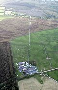
| Crugiau Dwy | 359 m (1,178 ft) | Home to the Preseli transmitting station | |
| Mynydd Carningli | 347 m (1,138 ft) | ||
| Mynydd Castlebythe | 347 m (1,138 ft) | ||
| Waun Mawn | 339 m (1,112 ft) | ||
| Mynydd Cilciffeth | 335 m (1,099 ft) | ||
| Mynydd Melyn | 307 m (1,007 ft) |
Villages and Towns
Many villages and small settlements are found within the Preseli Hills. These include Blaenffos, Brynberian, Crosswell, Crymych, Cwm Gwaun, Dinas Cross, Glandy Cross, Mynachlog-ddu, New Inn, Pentre Galar, Puncheston, Maenclochog, Rosebush, and Tafarn-y-Bwlch. The only town in the Preseli area is Newport, located at the foot of the Carningli-Dinas uplands in the northwest.
Wildlife and Nature
The Preseli Hills offer grazing land for animals for most of the year, and some areas are used for growing trees (forestry). Besides being interesting for geologists and archaeologists, the hills are home to a wide variety of birds, insects, and plants.
There are three Sites of Special Scientific Interest (SSSIs) here. Carn Ingli and Waun Fawr are important for their biological features (plants and animals), while Cwm Dewi is important for its geology. The Preseli transmitting station mast, built in 1962, stands on Crugiau Dwy near Pentre Galar. South of Crugiau Dwy is Carn Wen (Garnwen Quarry), where igneous rock was still being actively quarried in 2018.
The Preseli Hills are also a Special Area of Conservation. This means the area is very special in Wales because it has a mix of both upland (highland) and lowland features. Many rare plant and insect species live in the hills. For example, it's a very important place in the UK for the rare Southern damselfly. Efforts to help this damselfly's habitat were successful in 2020.
Getting Around and Exploring
One main road, the A478, crosses the eastern part of the hills, reaching a height of 248 metres (814 ft) (814 feet). Two smaller B-roads also cross the hills: the B4313 (northwest-southeast) reaches 278 metres (912 ft) (912 feet), and the B4329 (northeast-southwest) reaches 404 metres (1,325 ft) (1,325 feet) at Bwlch-Gwynt, which means 'windy gap'. These roads, along with many smaller lanes, offer scenic routes that are popular with people driving, cycling, and walking. The A487 road runs along the western edge of the hills, near Newport. You'll see cattle grids on the roads to stop grazing animals from wandering off the open land.
The hills are a great place for walkers who want to follow ancient trails. There are walks for all levels, from easy strolls to long-distance hikes. Most of the hills are open country, meaning walkers have the "freedom to roam" across the unfenced land, with a few rules. An east-west path called Flemings' Way or the Golden Road runs along the main part of the hills. This path, along with other smaller paths, is also open to mountain bikers and horse riders. There are also special cycle trails.
Other Interesting Places

Castell Henllys, located on the A487 road between Eglwyswrw and Felindre Farchog, is a reconstructed Iron Age settlement. It shows what life might have been like for people living in Wales thousands of years ago.
Ancient History of the Preseli Hills
The Preseli Hills are full of prehistoric remains, showing that people lived here a very long time ago, even in the Neolithic (New Stone Age) period. More of these ancient sites were discovered during an aerial survey in the hot summer of 2018.
Old records from 1833 mention that the Preseli mountain was once covered in forests. These forests provided shelter for people during ancient wars. However, by that time, the forests had mostly disappeared, leaving the hills looking bare. Pollen analysis (studying ancient plant remains) suggests that the forests were cleared by the late Bronze Age.
The Mystery of the Bluestones
In 1923, a scientist named Herbert Henry Thomas suggested that the special blue-grey stones, called bluestones, used to build the inner circle of Stonehenge came from the Preseli Hills. Later, other geologists thought that Carn Menyn was one of the sources of these bluestones.
However, more recent geological studies have changed this idea. Now, scientists believe that the bluestones at Stonehenge and the small pieces of bluestone found there came from several different places on the northern slopes of the Preseli Hills, such as Craig Rhos-y-felin. The BBC shared new details about the exact origin of the Stonehenge bluestones in November 2013.
Some people also have a different idea: they think that glaciers (huge sheets of ice) carried the bluestones from the Preseli Hills all the way to the Stonehenge area. You can find more detailed information about the bluestones in the articles about Stonehenge, Theories about Stonehenge, and Carn Menyn.
Further research has also suggested a possible connection between a site called Waun Mawn (see below) and the Stonehenge bluestones.
Important Ancient Sites
The Preseli Hills are rich in ancient and sacred sites. Many of these are marked on maps. They include burial chambers (places where ancient people were buried), tumuli (burial mounds), hill forts (old fortified settlements), hut circles (remains of ancient homes), stone circles, henges (circular earthworks), and standing stones. These sites are found across many communities in the Preseli range.
In 2010, the Dyfed Archaeological Trust did a big survey of historical sites in the Preseli Hills. They have created many notes about the mountain range and its surrounding features and villages.
Some of the most famous sites include:
- Bedd Arthur (Neolithic standing stones)
- Mynydd Carningli (a hillfort and SSSI)
- Carn Menyn (a chambered cairn, a type of burial mound)
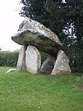
- Carreg Coetan Arthur (a Neolithic dolmen, a type of burial chamber)
- Temple Druid (a standing stone and cromlech, another type of burial chamber)
- Pentre Ifan (a famous burial chamber)
Other sites you might find are:
- Banc Du (evidence of ancient settlements)
- Carn Alw (Neolithic settlement)
- Carn Goedog (bluestones and a standing stone)
- Cerrig Lladron (a stone row from the Bronze Age)
- Foel Drygarn (a hillfort)
- Foel Cwmcerwyn (burial mounds)
- Frenni Fach & Frenni Fawr (burial mounds)
- Glandy Cross (prehistoric remains)
- Glyn Gath (a burial mound)
- Gors Fawr (a stone circle)
- Mynyedd Melyn (hut circles)
- Parc-y-Meirw (standing stones)
- Rhos fach (standing stones)
- Tafarn y Bwlch (a mountain pass with standing stones)
- Tre-Fach (a standing stone, ancient camp)
- Ty-Meini (a standing stone, known as "The Lady Stone")
- Waun Mawn (standing stones; possibly a dismantled stone circle from around 3400-3000 BC)
Recent History
Slate quarrying was once a very important industry in the Preseli Hills. You can still see the old quarries, which were active for much of the 1800s, in places like Rosebush. The slate from Preseli wasn't good for roofing, but it was very dense, making it perfect for building and crafts. Most quarries closed by the 1930s. However, there's still a workshop in Llangolman where slate is used to make various craft items today.
During the Second World War, the War Office (a government department in charge of the army) used the Preseli Hills a lot for training exercises. Both British and American air and ground forces trained here. After the war, the War Office wanted to keep using the hills for training. But local leaders protested for two years, and they eventually won! Their success was celebrated 60 years later, in 2009, with special plaques placed at each end of the Golden Road.
In 2000, a lecturer from Cardiff University, Terry Breverton, suggested that the famous rock star Elvis Presley's ancestors might have come from the Preseli Hills. He even thought they might have had connections to a chapel in a place called St Elvis.
 | Bayard Rustin |
 | Jeannette Carter |
 | Jeremiah A. Brown |


