Carn Menyn facts for kids
Quick facts for kids Carn Menyn |
|
|---|---|

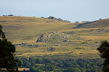
Carn Menyn on the skyline, viewed from the north
|
|
| Highest point | |
| Elevation | 365 m (1,198 ft) |
| Prominence | 48 m (157 ft) |
| Parent peak | Foel Cwmcerwyn |
| Naming | |
| English translation | Butter Rock |
| Language of name | Welsh |
| Geography | |
| Location | Pembrokeshire, United Kingdom |
| Parent range | Preseli Hills |
| OS grid | SN144324 |
| Topo map | OS Outdoor Leisure 35 |
Carn Menyn is a group of rocky hills or "tors" found in the Preseli Hills in Pembrokeshire, Wales. It's a special place with amazing views and a long history. People have used its unique rocks for thousands of years.
Contents
What is Carn Menyn?
Carn Menyn is a Welsh name that means "Butter Rock." Sometimes, people mistakenly call it Carn Meini, which means "rock of stones." But its true, older name is Carn Menyn.
Where is Carn Menyn Located?
This rocky area sits high up on the Preseli ridge. It's close to an ancient stone circle called Bedd Arthur. From the top, you can see far across the countryside. You can even see Cardigan Bay and the Llŷn Peninsula on a clear day.
What Kind of Rocks are at Carn Menyn?
Carn Menyn is made of a type of rock called "spotted dolerite." This rock is similar to what you find in other rocky hills nearby. Many ancient sites are also found close to these special rocks.
Carn Menyn and the Stonehenge Bluestones
For a long time, people have wondered where the famous bluestones at Stonehenge came from. Some researchers believe Carn Menyn was the main place where these stones were found.
Who First Thought of Carn Menyn?
Back in the mid-1800s, a geologist named Sir Andrew Ramsey first suggested Carn Menyn. Later, in the 1920s, HH Thomas studied the rocks. He showed that many bluestones came from the Preseli Hills.
Recent Discoveries and Debates
In 2005, a team led by Timothy Darvill and Geoff Wainwright supported the idea that Carn Menyn was the main source. However, other experts, like those from the Open University, disagree. They think the Stonehenge bluestones came from at least twenty different places. They believe a place called Carn Goedog, about a mile west, is more likely the source for the spotted dolerite stones.
What Do Rock Studies Show?
Scientists use something called geochemical analysis to study rocks. This helps them figure out where rocks came from. Studies show that some bluestones at Stonehenge likely came from Carn Menyn, Carn Goedog, and other spots in the Preseli Hills. Other types of rock, like rhyolite, might have come from Carn Alw.
Later Uses of Carn Menyn Stone
Even though Carn Menyn is a remote place, its stone was used for other things much later. Two chapels and many houses in the area were built using stone from Carn Menyn. Farmers also used stones from all the local hills for gateposts and building walls.
Excavations and New Ideas
In 2005, archaeologists dug at Carn Menyn to learn more about an ancient enclosure. They didn't find any old tools or objects, but they learned about the area's shape. That same year, a Welsh leader named Robyn Lewis suggested that the bluestones should be returned from Stonehenge to Wales. This idea even inspired a play called Bringing Back the Bluestones.
More recent geological studies in 2013 and 2014 by Bevins, Ixer, and Pearce have supported the idea that the spotted dolerite bluestones at Stonehenge came from Carn Goedog, not Carn Menyn.
Images for kids
 | Lonnie Johnson |
 | Granville Woods |
 | Lewis Howard Latimer |
 | James West |


