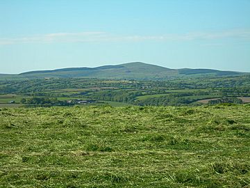
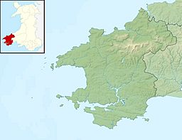
Foel Cwmcerwyn is the highest point in the beautiful Preseli Hills in Pembrokeshire, Wales. Imagine standing on top of the world in this part of Wales! This special mountain reaches 536 meters (about 1,759 feet) into the sky. Even though it's the highest spot, it's not right by the sea. It sits about 10 kilometers (6 miles) inland, but it's still part of the amazing Pembrokeshire Coast National Park.
Exploring Foel Cwmcerwyn
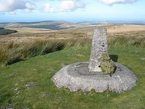
If you love hiking, you can follow a path to the top of Foel Cwmcerwyn. This path starts from a village called Rosebush, which is to the southwest of the mountain. When you reach the summit, you'll find a trig point. This is a special marker used by mapmakers to measure distances. You'll also see several cairns, which are piles of stones often built by hikers.
What is a Marilyn?
Foel Cwmcerwyn is known as a "Marilyn." This isn't a person's name! In the world of hills and mountains, a Marilyn is a peak that rises at least 150 meters (about 492 feet) above the land around it. This means it stands out quite a bit from its surroundings. Foel Cwmcerwyn is also the highest point in the county of Pembrokeshire.
The Preseli Hills
The Preseli Hills are a range of hills in west Wales. They are famous for their stunning views and ancient history. These hills are also known for the "bluestones" that were used to build Stonehenge. While Foel Cwmcerwyn itself doesn't have bluestones, it's part of this historic and beautiful landscape.


