Pembrokeshire Coast National Park facts for kids
Quick facts for kids Pembrokeshire Coast National Park |
|
|---|---|
|
IUCN Category V (Protected Landscape/Seascape)
|
|
 |
|
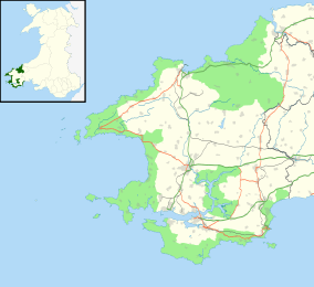
| Location | United Kingdom (Wales) |
| Area | 629 km2 (243 sq mi) |
| Established | 1952 |
Pembrokeshire Coast National Park (Welsh: Parc Cenedlaethol Arfordir Penfro) is a special protected area in west Wales, United Kingdom. It was created in 1952 to look after its amazing natural beauty. This park is unique because it's the only national park in the UK made entirely of wild coastal and sea landscapes. It's one of three national parks in Wales, along with Brecon Beacons and Snowdonia.
Contents
Exploring the Pembrokeshire Landscape
The National Park has many different types of scenery. You can find rugged cliffs, sandy beaches, and wooded river areas. There are also wild hills inland, like the Preseli Hills, and the green Gwaun valley. The park covers a total area of 629 square kilometers (243 square miles).
The park is split into four main parts. These include the south Pembrokeshire coast, which has Caldey Island. There is also the Daugleddau estuary, where rivers meet the sea. The St Bride's Bay coast includes many coastal islands. Finally, there are the Preseli Hills, which are inland.
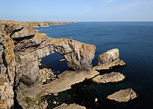
The rocks in the park are very interesting. You can see many natural features like natural arches, tall rock stacks, and sea caves. One famous stack is Stack Rocks (Creigiau Elegug). These two large limestone pillars are important nesting spots for birds like razorbills and guillemots in spring.
In the north, you'll find rocky areas like Carn Llidi and Garn Fawr. There are also wide open moorlands on Mynydd Carningli and Mynydd Preseli. These areas feel wild and mountainous. They are cut through by the wooded valleys of the Gwaun and Nevern rivers.
To the west, the park has the wide curve of St Bride's Bay. At its northern end is Ramsey Island, near the St David's peninsula. At the southern end is Skomer island. The southern coast is very different. It has limestone cliffs and a flat area called the Castlemartin peninsula. There are also steep, wooded valleys inland from Amroth.
The park also has the Bosherston lakes, which are now cared for by the National Trust. You can also find popular tourist towns like Tenby and Saundersfoot. Between the western and southern parts of the park is the Milford Haven waterway. Here, the calm Daugleddau estuary flows into one of the world's best natural deep-water harbors.
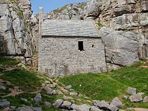
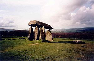
The National Park is home to many important historical and archaeological sites. These include places like Pentre Ifan, an ancient burial chamber. It also has areas that are important for nature conservation. These include 7 Special Areas of Conservation and a Marine Nature Reserve. There are also 6 national nature reserves and 75 Sites of Special Scientific Interest.
In 2011, National Geographic Traveler magazine said Pembrokeshire was the second best coastal place in the world for sustainable tourism. This means it's a great place to visit that also protects its natural environment.
Walking the Pembrokeshire Coast Path
The Pembrokeshire Coast Path is a famous National Trail for walkers. It was created in 1970. The path is 186 miles (300 km) long. Much of it runs along the top of cliffs. Walking the whole path involves climbing and descending a total of 35,000 feet (10,668 meters).
The path starts at Amroth in the south. The northern end used to be at Poppit Sands. However, the path now continues to St. Dogmaels. Here, it connects with the Ceredigion Coast Path. This path is part of the Wales Coast Path, a very long walking route around the entire coast of Wales. The Wales Coast Path is 870 miles (1,400 km) long and was officially opened in 2012.
Managing the National Park
The Pembrokeshire Coast National Park Authority manages the park. This group has about 130 staff members and a committee of 18 people. Their main goals are to protect the National Park and help people enjoy and understand it. They also work to support the communities living within the park's boundaries. The Authority's offices are in Pembroke Dock.
The Authority also looks after the entire Pembrokeshire Coast Path. This 186-mile (300 km) national trail is almost completely inside the Pembrokeshire Coast National Park.
Beautiful Beaches of Pembrokeshire
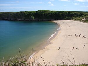
All of Pembrokeshire's beaches are located within the National Park. These beaches have won many awards over the years. In 2014, 10 beaches received the International Blue Flag Award. Many also received Green Coast Awards and Seaside Awards. In 2011, the Marine Conservation Society recommended 39 beaches in the park.
Some of the beaches you can find in the park include:
See also
 In Spanish: Parque nacional de la Costa de Pembrokeshire para niños
 | Janet Taylor Pickett |
 | Synthia Saint James |
 | Howardena Pindell |
 | Faith Ringgold |


