River Gwaun facts for kids
Quick facts for kids Afon Gwaun |
|
|---|---|
| Other name(s) | River Gwaun |
| Country | Wales |
| Counties | Pembrokeshire |
| Towns | Fishguard |
| Physical characteristics | |
| Main source | Preseli Hills 51°57′29″N 4°48′15″W / 51.9580°N 4.8043°W |
| River mouth | Fishguard, Pembrokeshire 51°59′45″N 4°58′11″W / 51.9959°N 4.9696°W |
| Length | 15 km (9.3 mi) |
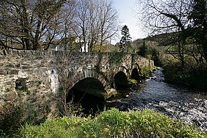
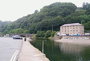
The River Gwaun is a beautiful river located in Pembrokeshire, West Wales. Its Welsh name is Afon Gwaun, which means 'marsh' or 'moor'. This river flows westwards until it reaches the sea at Fishguard. Fishguard is also known as Abergwaun, meaning 'mouth of the Gwaun'.
The River Gwaun begins its journey in the Pembrokeshire Coast National Park. It starts on the northern slopes of a hill called Foel Eryr in the Preseli Hills. This is just east of a small village named Pontfaen.
As the river flows, it moves slowly and gently. It forms curves, which are called meanders. The river passes through wet, marshy woodlands filled with alder trees. It also flows through water meadows and flood plains. A flood plain is a flat area of land next to a river that can get flooded when the river overflows.
The river's valley is deep and hidden. This part is known as the Gwaun Valley. The river goes through villages like Pontfaen and Llanychaer. Finally, it reaches the sea at Lower Fishguard Bay.
The River Gwaun is about 15 km (9.3 mi) long. You can even canoe on the lower third of the river. This part starts west of Pontfaen. Before Pontfaen, another river, the Afon Cwmau, joins the Gwaun from the south.
The river was first shown on a map of Pembrokeshire in 1578. On this old map, it was called Gwyne.
How Was the River Gwaun Formed?
The River Gwaun was created a very long time ago. It formed at the end of the Ice Age. As the giant glaciers (huge sheets of ice) melted and moved back, they left behind channels. The Gwaun River flows through one of these channels, which was carved out by the melting ice.
 | James B. Knighten |
 | Azellia White |
 | Willa Brown |


