
Carn Llidi facts for kids
Quick facts for kids Carn Llidi |
|
|---|---|
.jpg) |
|
| Highest point | |
| Elevation | 181 m (594 ft) |
| Prominence | 122 m (400 ft) |
| Listing | HuMP |
| Naming | |
| English translation | Cairn of the Gates |
| Language of name | Welsh |
| Geography | |

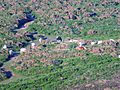
Carn Llidi
Location in Pembrokeshire
|
|
| OS grid | SM738280 |
Carn Llidi is a cool hill located in Pembrokeshire, Wales. It's found just east of St David's Head. This whole area, including Carn Llidi, is part of the beautiful Pembrokeshire Coast National Park.
This rocky hill is about 594 feet (181 m) (181 meters) tall. It stands out and overlooks Whitesands Bay. On clear days, you can see amazing views. Look west to Ramsey Island and the Bishops and Clerks islets. To the north, you might spot Strumble Head. If you're there on a clear summer evening, you might even catch a glimpse of the Wicklow Mountains in Ireland!
Contents
Discovering Carn Llidi's Past
This area is super rich in history. You can find many old things here from long ago.
Ancient Burial Places
On the higher parts of the hill, there are two burial chambers. These are thought to be from the Neolithic period. That means they are from the New Stone Age, thousands of years ago! Another large stone nearby might have been the top stone of one of these ancient chambers.
Old Settlements and Defenses
To the northwest of the hill, you can see signs of prehistoric enclosures. These were old walls and fences that people used to mark off their land. There are also old field systems, showing where people farmed. Close by, you can find an iron-age defensive wall. This wall was built to protect people during the Iron Age.
World War II History
During World War II, Carn Llidi was an important spot. A special radar station called a Chain Home Low was built here. This station helped warn people about enemy planes. Today, you can still see the concrete base of the radar station. There's also a pit where a Lewis gun used to be.
What Does "Carn Llidi" Mean?
The name Carn Llidi comes from the Welsh language. It can mean a couple of things. One idea is Cairn of the Gates. A cairn is a pile of stones. Another possible meaning is Cairn of Wrath.
How to Reach the Summit

Want to climb to the top of Carn Llidi? You can start your walk from the car park at Whitesands Bay. There are two main paths. One goes through Porthmawr Farm. The other follows the coast path towards St Davids Head.
The climb isn't too hard and you don't need special hiking skills. But it's always a good idea to wear proper outdoor clothes. This will keep you comfortable and safe on your adventure!
Images for kids
-
Welsh mountain ponies near the summit

