St David's Head facts for kids
Quick facts for kids St David's Head |
|
|---|---|
| Penmaen Dewi | |
 |
|
| Location | Pembrokeshire, Wales |
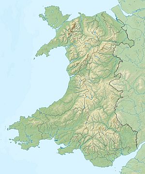
| Coordinates | 51°54′10″N 5°18′45″W / 51.902778°N 5.3125°W |
| Geology | headland |
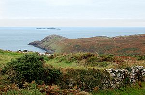
St David's Head (which is Penmaen Dewi in Welsh) is a special piece of land that sticks out into the sea in southwest Wales. It's part of the beautiful Pembrokeshire Coast National Park. This headland marks where the Irish Sea and the Celtic Sea meet.
St David's Head is famous for its pretty wildflowers and amazing wildlife. It also has many signs of people living there a very long time ago. The National Trust owns the headland and the land nearby. This means you can visit it by walking along the Pembrokeshire Coast Path. The very westernmost point of mainland Wales, called Pen Dal-aderyn, is just south of St David's Head.
Exploring St David's Head: Where Land Meets Sea
St David's Head is about 2.5 miles (4 km) northwest of the small cathedral city of St David's in Pembrokeshire. This headland is the narrowest part of St George's Channel. It also marks the southern edge of Cardigan Bay and the northern edge of the Celtic Sea.
From St David's Head, you can see amazing views. To the south, you'll see Whitesands Bay, Ramsey Sound (which separates Ramsey Island), and St Brides Bay. If you look west, you can spot the Bishops and Clerks rocks out in the water. To the east, you'll see the slopes of a large rocky hill called Carn Llidi.
Amazing Animals and Plants
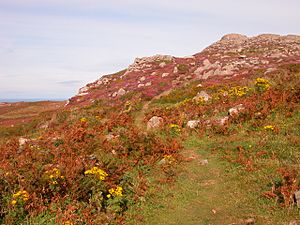
St David's Head is full of life! You can find many different kinds of wildflowers growing here. The waters around the headland are also home to lots of fish. You might even spot grey seals and porpoises swimming in the sea.
Many different seabirds live and nest on the cliffs. Keep an eye out for fast-flying peregrine falcons too! They are incredible hunters.
A Journey Through Time: Ancient History
St David's Head has a long and interesting history. There are many ancient sites that show people lived here thousands of years ago. These include an Iron Age cliff fort, which was a strong defensive place. You can also see signs of prehistoric settlements and old neolithic field systems.
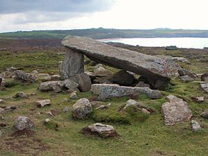
One of the most famous ancient sites is Coetan Arthur (Arthur’s Quoit). This is an ancient burial chamber made of huge stones. It's a fascinating place to imagine how people lived so long ago.
The Romans knew about this place too! In a Roman map from 140 AD, it was called the 'Promontory of the Eight Perils'. This name suggests it was a tricky or dangerous place for ships to navigate.
 | Charles R. Drew |
 | Benjamin Banneker |
 | Jane C. Wright |
 | Roger Arliner Young |


