Distington facts for kids
Quick facts for kids Distington |
|
|---|---|
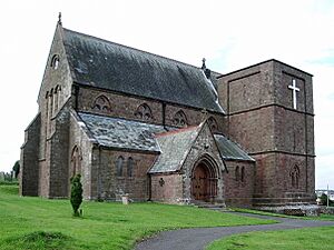
 The Church of the Holy Spirit, Distington |
|
| Population | 2,256 (2011) |
| OS grid reference | NY0023 |
| Civil parish |
|
| District | |
| Shire county | |
| Region | |
| Country | England |
| Sovereign state | United Kingdom |
| Post town | WORKINGTON |
| Postcode district | CA14 |
| Dialling code | 01946 |
| Police | Cumbria |
| Fire | Cumbria |
| Ambulance | North West |
| EU Parliament | North West England |
| UK Parliament |
|
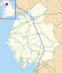
Distington is a large village in Cumbria, England. It is about 3 kilometres (2 miles) south of Workington. It is also about 6 kilometres (4 miles) north of Whitehaven.
Distington is part of a larger area called a civil parish. This parish includes smaller places like Common End, Gilgarran, and Pica. In 2011, about 2,256 people lived in the parish.
Near the village, you can find the old ruins of Hayes Castle. This was a manor house that was made stronger by Robert de Leyburn in 1322.
Contents
How Distington is Governed
Distington has different levels of government that help run the village and the wider area.
National Government
Distington is part of the Copeland area for the UK Parliament. This means people in Distington vote for a person called a Member of Parliament (MP). The MP represents them in the national government. The current MP for Copeland is Trudy Harrison.
Local Government
For local decisions, Distington is part of the Distington, Lowca & Parton Ward. This ward is managed by the Borough of Copeland. It also falls under the Howgate Ward of Cumbria County Council. These councils make choices about local services. This includes things like roads, schools, and parks.
Village Council
Distington also has its own local council called the Distington Parish Council. This council focuses on issues that are important to the village itself. It helps manage local services and projects. The area covered by the parish council is larger than just Distington village. In 2011, about 4,058 people lived in the parish council's area.
Getting Around Distington
Distington is connected to other places by roads and used to have a busy railway.
Main Roads
The main road that goes through Distington is the A595. This road helps people travel to and from the village.
Railway History
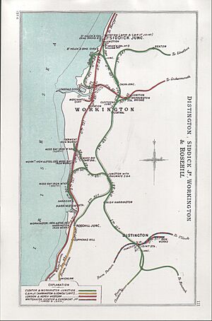
Long ago, Distington had its own railway station. This station was a very important meeting point for different railway lines. It was part of the Cleator and Workington Junction Railway.
Current Train Travel
Today, the closest train station that is still open is Harrington railway station. This station is on the Cumbria Coast Line.
See also
 In Spanish: Distington para niños
 | Isaac Myers |
 | D. Hamilton Jackson |
 | A. Philip Randolph |


