
Don (river) facts for kids
Quick facts for kids Don |
|
|---|---|
.jpg)
The Don in Voronezh Oblast.
|
|

Catchment of the Don
|
|
| Country | Russia |
| Region | Tula Oblast, Lipetsk Oblast, Voronezh Oblast, Volgograd Oblast, Rostov Oblast |
| Cities | Voronezh, Rostov-on-Don |
| Physical characteristics | |
| Main source | Novomoskovsk, Tula Oblast 238 m (781 ft) 54°00′43″N 38°16′41″E / 54.01194°N 38.27806°E |
| River mouth | Sea of Azov Kagal'nik, Rostov Oblast 0 m (0 ft) 47°05′11″N 39°14′19″E / 47.08639°N 39.23861°E |
| Length | 1,870 km (1,160 mi) |
| Basin features | |
| Basin size | 425,600 km2 (164,300 sq mi) |
| Tributaries |
|
The Don River is one of the longest rivers in Europe. It flows through Russia, starting in Central Russia and ending in the Sea of Azov in Southern Russia. The Don is very important for Russia and has been a key route for traders for a long time, even back to the time of the Byzantine Empire.
The river begins near the town of Novomoskovsk, which is about 60 kilometers (37 miles) southeast of Tula. From there, it travels 1,870 kilometers (1,162 miles) to the Sea of Azov. The first part of the river flows south. Then, it makes a big curve to the east, passing cities like Voronezh. Finally, it flows southwest into the sea. The biggest city on the Don River is Rostov-on-Don. Its most important branch, called a tributary, is the Seversky Donets River.
Contents
History of the Don River
The area around the Don River has a very long history. Some experts believe that this region was the original home of the Proto-Indo-Europeans around 4,000 BC. These were ancient groups of people whose language spread across Europe and parts of Asia. The Don River valley was a place where early farming cultures mixed with hunter-gatherer groups. This led to the development of nomadic people who herded animals.
Ancient Times and Trade Routes
In ancient times, some Greek geographers thought the Don River was the border between Europe and Asia. It was known as the Tanaïs in Greek and was a major trading route. There was even a city called Tanais located near the river's mouth. This city was important for trade.
An old Greek story, sometimes linked to Plutarch, says that the legendary Amazons lived near the Don River. These were a group of fierce female warriors in Greek mythology.
The Don Cossacks
The Don Cossacks were a group of people who settled in the fertile valley of the Don River in the 16th and 17th centuries. They were named after the river and were known for their military skills and independent way of life.
Mapping the River
For a long time, only the lower part of the Don River was well known and mapped. The middle and upper parts were not accurately mapped until the 16th century, when Muscovy (an early Russian state) gradually took control of the area.
Old maps from the 16th and 17th centuries, like those by Mercator and Blaeu, showed the Don River starting from a large lake. They also showed waterways connecting the Don to other rivers, suggesting early ideas of canals.
The Don in Literature
The Don River region is famous in modern literature. It was featured in the well-known book And Quiet Flows the Don. This book was written by Mikhail Aleksandrovich Sholokhov, who won a Nobel Prize for his work. He was from a village called Veshenskaya near the Don River.
Dams and Canals on the Don
The Don River is very close to the Volga River at its easternmost point, only about 100 kilometers (62 miles) apart. To connect these two important rivers, the Volga-Don Canal was built. This canal is 101 kilometers (65 miles) long. It is wide and deep enough for large ships, including oil tankers. This canal is one of two waterways that allow ships to travel from the Caspian Sea to other seas, like the Baltic Sea.
To help ships navigate the Don, the Tsimlyansk Dam was built. This dam created the Tsimlyansk Reservoir, which raises the water level of the Don. Below this dam, the river's depth is kept suitable for ships by a series of three dam and ship-lock systems. The most famous of these is the Kochetovsky Ship Lock, which was first built in 1914. These locks help ships move between different water levels.

Tributaries of the Don River
A tributary is a smaller river or stream that flows into a larger river. The Don River has many tributaries that feed into it along its path. Here are some of the main ones, listed from the source of the Don to its mouth:
- Nepryadva
- Krasivaya Mecha
- Bystraya Sosna
- Veduga
- Voronezh
- Tikhaya Sosna
- Bityug
- Osered
- Chyornaya Kalitva
- Khopyor – 1,010 km (628 mi) long
- Medveditsa
- Ilovlya
- Chir
- Seversky Donets – 1,053 km (654 mi) long
- Aidar – 264 km (164 mi) long
- Sal
- Manych
- Aksay
- Temernik
Images for kids
-
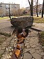
Source of the Don in Novomoskovsk, Tula Oblast

See also
 In Spanish: Río Don para niños
- Don goat
- And Quiet Flows the Don by Mikhail Sholokov
- Rostov railway drawbridge
