Don Pedro Reservoir facts for kids
Quick facts for kids Don Pedro Reservoir |
|
|---|---|

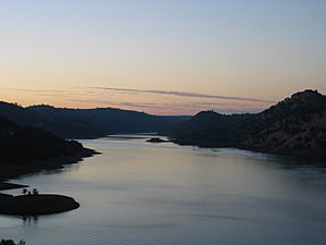
Reservoir and Sierra Nevada foothills
|
|
| Location | Tuolumne County, California |
| Coordinates | 37°44′29″N 120°22′25″W / 37.7415°N 120.3735°W |
| Type | Reservoir |
| Primary inflows | Tuolumne River |
| Primary outflows | Tuolumne River |
| Catchment area | 1,500 sq mi (3,900 km2) |
| Basin countries | United States |
| Surface area | 13,000 acres (5,300 ha) |
| Water volume | 2,030,000 acre⋅ft (2.50 km3) |
| Shore length1 | 160 mi (260 km) |
| Surface elevation | 245 m (804 ft) |
| Islands | Laughlin Ridge |
| 1 Shore length is not a well-defined measure. | |
Don Pedro Reservoir, also called Lake Don Pedro, is a large reservoir in Tuolumne County, California. It was created when the New Don Pedro Dam was built across the Tuolumne River. This reservoir is very important for storing water in California.
It's good to know that the California Office of Environmental Health Hazard Assessment has given advice about eating fish from Don Pedro Reservoir. This is because some fish caught there might have higher levels of certain substances. This advice helps people know how much fish is safe to eat.
Exploring Don Pedro Reservoir

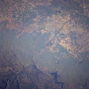
Don Pedro Reservoir is located in the beautiful foothills of the Sierra Nevada mountains. Nearby towns include Moccasin and La Grange. This reservoir is one of the biggest in California, ranking as the sixth-largest.
The name "Don Pedro" comes from Don Pedros Bar, a place named after Pierre ("Don Pedro") Sainsevain. He was one of the first people to look for gold after it was discovered in 1848, which started the famous California Gold Rush.
When the reservoir is completely full, its shoreline stretches for about 160 mi (260 km). The water covers about 26 mi (42 km) of the original Tuolumne River bed. The surface area of the lake is around 13,000 acres (5,300 ha).
This huge amount of water, about 2,030,000 acre⋅ft (2.50 km3), comes from a large area called a watershed, which is over 1,500 sq mi (3,900 km2). The water is used by local irrigation districts, like the Modesto Irrigation District (MID) and the Turlock Irrigation District (TID). They use it to water many farms in the San Joaquin Valley. Some of this water is also cleaned and used as drinking water in the city of Modesto.
Fun Activities at Don Pedro
The Don Pedro Recreation Area offers many fun things to do around the lake. It's managed by the Don Pedro Lake Recreation Agency.
You can find places to camp with your car or even by boat. There are also areas for houseboats. The lake is a great spot for fishing, water skiing, and exploring. You can also enjoy mountain biking and hiking trails around the area.
There are three public places where you can launch your boat into the lake. These are located in the Blue Oaks Area, Moccasin Point Area, and Fleming Meadows Area.
Water for San Francisco
Don Pedro Reservoir is not directly part of the Hetch Hetchy Aqueduct system, which supplies water to San Francisco. However, the tunnels for the Hetch Hetchy project actually pass underneath the upper part of Don Pedro Reservoir.
The San Francisco Public Utilities Commission (SFPUC) helped pay for the New Don Pedro Dam in 1971. Because of this, they have the right to store a certain amount of water, about 570,000 acre-feet (700,000,000 m3), in the reservoir. Each year, San Francisco usually takes about 230,000 acre-feet (280,000,000 m3) of water from here.
 | William Lucy |
 | Charles Hayes |
 | Cleveland Robinson |


