List of largest reservoirs of California facts for kids
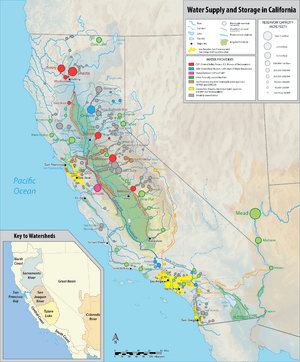
This article lists the biggest reservoirs in the U.S. state of California. Reservoirs are like giant, man-made lakes. They are built to store water for people to use. We'll look at all 53 reservoirs that can hold more than 100,000 acre-feet (0.12 km3) of water. This includes some natural lakes, like Lake Tahoe, where dams have made them even bigger.
Most of California's large reservoirs are managed by the U.S. government. Agencies like the Bureau of Reclamation and the Army Corps of Engineers run them. Many of these reservoirs help with big water projects, like the Central Valley Project or the State Water Project. Smaller reservoirs are often managed by local water groups.
California has over a thousand large reservoirs. The top 200 of these can hold more than 41,000,000 acre-feet (51 km3) of water combined! Most of the really big ones are in central and northern California. They are often found along the large rivers in the Central Valley. These rivers can flood easily, so reservoirs help control that. Eleven reservoirs in California are huge, each holding over 1,000,000 acre-feet (1.2 km3). Almost all of these feed into the Central Valley. The very biggest reservoir in California is Shasta Lake. It can hold more than 4,552,000 acre-feet (5.615 km3) of water!
Contents
California's Biggest Man-Made Lakes
What are Reservoirs For?
Reservoirs are super important for California. They store water from rain and melting snow. This water is then used for many things. It helps farmers grow crops, provides drinking water for cities, and even creates electricity. They also help prevent floods by holding back extra water during heavy rains.
Understanding Water Storage Sizes
When we talk about how much water a reservoir holds, we use terms like "acre-feet" and "cubic kilometers."
- An acre-foot is the amount of water needed to cover one acre of land (about the size of a football field) with water one foot deep. It's a lot of water!
- A cubic kilometer is a huge cube of water, one kilometer long, one kilometer wide, and one kilometer high. It's used for very large amounts of water.
List of Giant Reservoirs
Here is a list of California's largest reservoirs. The table shows their names, where they are, how much water they hold, and what river flows out of them. It also shows the dam that created the reservoir.
| Key |
|---|
| Name | County(s) | Coordinates | Volume (acre-feet) | Volume (km3) | Outflow River | Dam | Image |
|---|---|---|---|---|---|---|---|
| Shasta Lake | Shasta | 40°45′15″N 122°21′13″W / 40.75417°N 122.35361°W | 4,552,000 | 5.615 | Sacramento River | Shasta Dam |  |
| Lake Oroville | Butte | 39°32′14″N 121°29′00″W / 39.53722°N 121.48333°W | 3,537,577 | 4.364 | Feather River | Oroville Dam |  |
| Trinity Lake | Trinity | 40°51′36″N 122°43′24″W / 40.86000°N 122.72333°W | 2,448,000 | 3.020 | Trinity River | Trinity Dam |  |
| New Melones Lake | Tuolumne, Calaveras |
38°00′02″N 120°31′12″W / 38.00056°N 120.52000°W | 2,400,000 | 2.960 | Stanislaus River | New Melones Dam |  |
| San Luis Reservoir | Merced | 37°04′04″N 121°07′52″W / 37.06778°N 121.13111°W | 2,041,000 | 2.518 | San Luis Creek |
San Luis Dam |  |
| Don Pedro Reservoir | Tuolumne | 37°44′30″N 120°22′25″W / 37.74167°N 120.37361°W | 2,030,000 | 2.504 | Tuolumne River | New Don Pedro Dam |  |
| Lake Berryessa | Napa | 38°31′53″N 122°09′49″W / 38.53139°N 122.16361°W | 1,602,000 | 1.976 | Putah Creek | Monticello Dam |  |
| Lake Almanor | Plumas | 40°13′47″N 121°09′29″W / 40.22972°N 121.15806°W | 1,308,000 | 1.613 | North Feather River | Canyon Dam |  |
| Folsom Lake | Sacramento, El Dorado, Placer | 38°43′26″N 121°07′03″W / 38.72389°N 121.11750°W | 1,120,200 | 1.382 | American River | Folsom Dam |  |
| Lake McClure | Mariposa | 37°38′11″N 120°16′49″W / 37.63639°N 120.28028°W | 1,024,600 | 1.264 | Merced River | New Exchequer Dam |  |
| Pine Flat Lake | Fresno | 36°49′57″N 119°19′33″W / 36.83250°N 119.32583°W | 1,000,000 | 1.233 | Kings River | Pine Flat Dam |  |
| New Bullards Bar Reservoir | Yuba | 39°23′32″N 121°08′30″W / 39.39222°N 121.14167°W | 996,103 | 1.229 | North Yuba River | New Bullards Bar Dam | 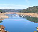 |
| Diamond Valley Lake | Riverside | 33°40′42″N 117°02′30″W / 33.67833°N 117.04167°W | 810,000 | 0.999 | Domenigoni Creek |
West Dam |  |
| Lake Tahoe | Placer, El Dorado, Douglas (NV) |
39°04′59″N 120°02′03″W / 39.08306°N 120.03417°W | 732,000 | 0.903 | Truckee River | Lake Tahoe Dam | 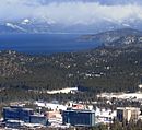 |
| Lake Havasu | San Bernardino, Mohave (AZ) |
34°23′00″N 114°14′33″W / 34.38333°N 114.24250°W | 646,200 | 0.797 | Colorado River | Parker Dam | 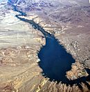 |
| Lake Isabella | Kern | 35°38′47″N 118°28′56″W / 35.64639°N 118.48222°W | 568,000 | 0.701 | Kern River | Isabella Dam |  |
| Clear Lake Reservoir | Modoc | 41°50′59″N 121°10′14″W / 41.84972°N 121.17056°W | 527,000 | 0.650 | Lost River | Clear Lake Dam | |
| Millerton Lake | Fresno, Madera | 36°59′51″N 119°41′36″W / 36.99750°N 119.69333°W | 520,500 | 0.642 | San Joaquin River | Friant Dam |  |
| Camanche Reservoir | San Joaquin, Amador, Calaveras | 38°13′26″N 120°58′04″W / 38.22389°N 120.96778°W | 431,000 | 0.532 | Mokelumne River | Camanche Dam | |
| Lake Sonoma | Sonoma | 38°43′05″N 123°00′34″W / 38.71806°N 123.00944°W | 381,000 | 0.470 | Dry Creek | Warm Springs Dam |  |
| Lake Nacimiento | San Luis Obispo | 35°44′40″N 120°54′14″W / 35.74444°N 120.90389°W | 378,480 | 0.467 | Nacimiento River | Nacimiento Dam |  |
| Hetch Hetchy Reservoir | Tuolumne | 37°56′21″N 119°43′32″W / 37.93917°N 119.72556°W | 360,000 | 0.444 | Tuolumne River | O'Shaughnessy Dam |  |
| Lake San Antonio | Monterey | 35°52′13″N 121°00′19″W / 35.87028°N 121.00528°W | 335,000 | 0.413 | San Antonio River | San Antonio Dam |  |
| Castaic Lake | Los Angeles | 34°31′12″N 118°36′23″W / 34.52000°N 118.60639°W | 323,700 | 0.399 | Castaic Creek |
Castaic Dam |  |
| New Hogan Lake | Calaveras | 38°09′03″N 120°48′47″W / 38.15083°N 120.81306°W | 317,000 | 0.391 | Calaveras River | New Hogan Dam |  |
| Prado Flood Control Basin | Riverside | 33°54′33″N 117°37′07″W / 33.90917°N 117.61861°W | 314,400 | 0.389 | Santa Ana River | Prado Dam |  |
| Clear Lake | Lake | 39°03′42″N 122°49′38″W / 39.06167°N 122.82722°W | 313,000 | 0.386 | Cache Creek | Cache Creek Dam |  |
| Indian Valley Reservoir | Lake | 39°07′31″N 122°32′34″W / 39.12528°N 122.54278°W | 300,600 | 0.371 | North Fork Cache Creek | Indian Valley Dam |  |
| Cherry Lake | Tuolumne | 38°00′20″N 119°54′25″W / 38.00556°N 119.90694°W | 274,300 | 0.338 | Cherry Creek | Cherry Valley Dam |  |
| Lake Casitas | Ventura | 34°23′09″N 119°20′08″W / 34.38583°N 119.33556°W | 254,000 | 0.313 | Coyote Creek |
Casitas Dam |  |
| San Vicente Reservoir | San Diego | 32°55′51″N 116°54′22″W / 32.93083°N 116.90611°W | 242,000 | 0.298 | San Vicente Creek |
San Vicente Dam |  |
| Whiskeytown Lake | Shasta | 40°37′41″N 122°33′51″W / 40.62806°N 122.56417°W | 241,100 | 0.297 | Clear Creek |
Whiskeytown Dam |  |
| Union Valley Reservoir | El Dorado | 38°52′35″N 120°24′00″W / 38.87639°N 120.40000°W | 230,000 | 0.284 | Silver Creek |
Union Valley Dam |  |
| Stampede Reservoir | Sierra | 39°28′38″N 120°08′26″W / 39.47722°N 120.14056°W | 226,500 | 0.279 | Little Truckee River | Stampede Dam |  |
| Twitchell Reservoir | Santa Barbara, San Luis Obispo | 35°00′44″N 120°18′25″W / 35.01222°N 120.30694°W | 224,300 | 0.277 | Cuyama River | Twitchell Dam |  |
| Pardee Reservoir | Amador, Calaveras | 38°15′27″N 120°51′01″W / 38.25750°N 120.85028°W | 209,950 | 0.259 | Mokelumne River | Pardee Dam | |
| Hell Hole Reservoir | Placer | 39°03′33″N 120°24′35″W / 39.05917°N 120.40972°W | 208,400 | 0.257 | Rubicon River | Hell Hole Dam |  |
| Lake Cachuma | Santa Barbara | 34°35′12″N 119°58′52″W / 34.58667°N 119.98111°W | 205,000 | 0.253 | Santa Ynez River | Bradbury Dam |  |
| New Spicer Meadow Reservoir | Alpine, Tuolumne |
38°24′26″N 119°57′46″W / 38.40722°N 119.96278°W | 190,000 | 0.234 | Highland Creek | New Spicer Meadow Dam | 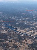 |
| Lake Kaweah | Tulare | 36°24′19″N 118°58′22″W / 36.40528°N 118.97278°W | 185,600 | 0.229 | Kaweah River | Terminus Dam |  |
| Los Vaqueros Reservoir | Contra Costa | 37°49′09″N 121°44′04″W / 37.81917°N 121.73444°W | 160,000 | 0.197 | Kellogg Creek | Los Vaqueros Dam |  |
| Black Butte Lake | Glenn, Tehama |
39°47′28″N 122°21′51″W / 39.79111°N 122.36417°W | 143,700 | 0.177 | Stony Creek | Black Butte Dam |  |
| Salt Springs Reservoir | Amador, Calaveras |
38°29′50″N 120°10′56″W / 38.49722°N 120.18222°W | 141,900 | 0.175 | Mokelumne River | Salt Springs Dam | |
| French Meadows Reservoir | Placer | 39°06′53″N 120°26′23″W / 39.11472°N 120.43972°W | 136,400 | 0.168 | Middle Fork American River | L.L. Anderson Dam | |
| Shaver Lake | Fresno | 37°07′33″N 119°17′26″W / 37.12583°N 119.29056°W | 135,283 | 0.167 | Stevenson Creek | Shaver Lake Dam |  |
| Lake Perris | Riverside | 33°51′21″N 117°10′36″W / 33.85583°N 117.17667°W | 131,452 | 0.162 | N/A | Perris Dam | |
| Lake Thomas A. Edison | Fresno | 37°22′58″N 118°58′34″W / 37.38278°N 118.97611°W | 125,000 | 0.154 | Mono Creek | Vermilion Valley Dam |  |
| Courtright Reservoir | Fresno | 37°06′10″N 118°58′32″W / 37.10278°N 118.97556°W | 123,300 | 0.152 | Helms Creek | Courtright Dam |  |
| Mammoth Pool Reservoir | Fresno | 37°19′50″N 119°19′15″W / 37.33056°N 119.32083°W | 123,000 | 0.152 | San Joaquin River | Mammoth Pool Dam |  |
| Lake Mendocino | Mendocino | 39°12′56″N 123°10′24″W / 39.21556°N 123.17333°W | 122,400 | 0.151 | Russian River | Coyote Valley Dam |  |
| Wishon Reservoir | Fresno | 37°01′04″N 118°57′47″W / 37.01778°N 118.96306°W | 118,000 | 0.146 | North Fork Kings River | Wishon Dam | |
| Camp Far West Reservoir | Yuba | 39°01′54″N 121°17′12″W / 39.03167°N 121.28667°W | 104,500 | 0.129 | Bear River | Camp Far West Dam | 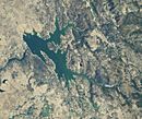 |
| Bucks Lake | Plumas | 39°52′56″N 121°09′52″W / 39.88222°N 121.16444°W | 103,000 | 0.127 | Bucks Creek | Bucks Storage Dam |  |
| Calaveras Reservoir | Alameda, Santa Clara |
37°28′29″N 121°49′10″W / 37.47472°N 121.81944°W | 100,000 | 0.123 | Calaveras Creek | Calaveras Dam |  |
See also
 | Janet Taylor Pickett |
 | Synthia Saint James |
 | Howardena Pindell |
 | Faith Ringgold |

