French Meadows Reservoir facts for kids
Quick facts for kids French Meadows Reservoir |
|
|---|---|

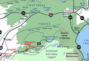
Map of area around reservoir
|
|
| Location | Placer County, California |
| Coordinates | 39°06′42″N 120°28′06″W / 39.11167°N 120.46833°W |
| Primary inflows | North Fork American River |
| Basin countries | United States |
| Max. length | 2.9 mi (4.7 km) |
| Max. width | 0.6 mi (0.97 km) |
| Water volume | 125,601 acre⋅ft (154,927,000 m3) |
| Shore length1 | 7.3 mi (11.7 km) |
| Surface elevation | 5,263 ft (1,604 m) |
| 1 Shore length is not a well-defined measure. | |

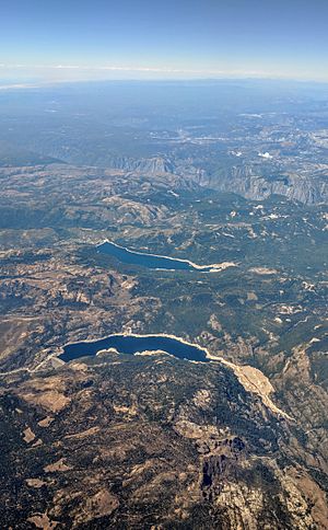
French Meadows Reservoir is a large, man-made lake in California. It is about 36 miles (58 km) northeast of Foresthill, California. This beautiful reservoir is located on the Middle Fork of the American River.
The lake is about 2.9 miles (4.7 km) long and 0.6 miles (1.0 km) wide. It has a shoreline that stretches for 7.3 miles (11.7 km). The reservoir sits high up, at an elevation of 5,263 feet (1,604 meters). It is only nine miles (14 km) from the top of the Sierra Nevada Mountain Range.
About French Meadows Reservoir
The Tahoe National Forest helps manage this area. They make sure there are great places for people to visit. You can find five campgrounds and two group campgrounds here. There are also two paved ramps for launching boats.
Many fun activities are popular at the lake. You can enjoy powerboating, kayaking, and canoeing. Fishing, picnicking, and hiking are also great ways to spend time. The entire reservoir is part of a state game refuge. This means that certain weapons, like firearms or pellet guns, are not allowed.
History and Purpose
French Meadows Reservoir was created in December 1964. This happened when the L.L. Anderson Dam was built. The dam is made of rock and earth. It holds a lot of water, about 125,601 acre-feet (154,923,000 cubic meters).
The reservoir is an important part of the Middle Fork Project. This project helps create hydroelectric power. Most of the water from French Meadows Reservoir goes through a tunnel. It travels to the French Meadows Powerhouse. This powerhouse is located near Hell Hole Reservoir.
Water started flowing to the powerhouse on December 13, 1965. A small amount of water is always released into the Middle Fork of the American River. This "fish flow" helps protect fish and other wildlife. The Placer County Water Agency operates this entire project.
Important Safety Information
The California Office of Environmental Health Hazard Assessment (OEHHA) has some advice for fishing here. They have a safe eating advisory for fish caught in French Meadows Reservoir. This advice is based on levels of mercury found in the fish. It helps people know how much fish is safe to eat. You can find more details on their website.
 | Claudette Colvin |
 | Myrlie Evers-Williams |
 | Alberta Odell Jones |


