Hell Hole Reservoir facts for kids
Quick facts for kids Hell Hole Reservoir |
|
|---|---|
 |
|
| Location | Placer County, California |
| Coordinates | 39°04′48″N 120°23′32″W / 39.08011°N 120.39230°W |
| Type | Reservoir |
| Basin countries | United States |
| Water volume | 208,400 acre⋅ft (257,100,000 m3) |
| Surface elevation | 4,630 ft (1,411 m) |
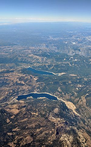
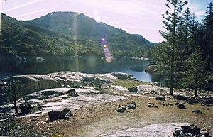
Hell Hole Reservoir is a cool, crescent-shaped lake high up in the Sierra Nevada mountains of California. It's about 10 miles (16 km) west of Lake Tahoe. When the lake is full, it stretches for about 3.5 miles (5.6 km).
This lake isn't natural; it was created in 1966. That's when the Lower Hell Hole Dam was finished across the Rubicon River. The Rubicon River is a big stream that flows into the Middle Fork of the American River. The lake is named "Hell Hole" because it covers a very deep canyon that used to be there.
Contents
What's in a Name? The Story of Hell Hole
The name "Hell Hole" has some interesting stories behind it. An old writer named George Wharton James visited the canyon in 1913. He heard that a miner looking for gold in 1862 said it was "a hell of a hole to get out of." This miner was probably talking about how hard it was to climb out of the deep canyon.
James's guide, Bob Watson, was a famous camping guide from the Lake Tahoe area. He probably told James many local stories, including this one about the miner.
The United States Board on Geographic Names says the name "Hell Hole" first appeared on a U.S. Geological Survey map in 1894. This board helps decide official names for places.
Even with its tough-sounding name, George Wharton James really liked the canyon. He wrote that it was "a paradise of delightful surprises." He enjoyed that it was so wild and rugged. This meant people hadn't changed it much with logging, mining, or building roads.
About the Lake Today
The Lower Hell Hole Dam is managed by the Placer County Water Agency. This agency also controls another dam in the Eldorado National Forest and Tahoe National Forest. They got the power to build these dams after voters in Placer County approved it in 1961.
Plans for the dam started in 1958. The first Hell Hole Dam was partly built in 1964. But it sadly collapsed on December 23, 1964, during a big storm. A new, stronger dam was finished in 1966. The main goal was to get drinking water for growing towns like Auburn and Roseville in Placer County. They also wanted to make electricity from the water.
Fun Things to Do at Hell Hole Reservoir
Today, Hell Hole Reservoir has modern places for fun water activities. Because the lake is far away, it doesn't get too crowded, even in summer. Most people use small fishing boats, canoes, and kayaks. Be careful though, strong winds can pick up in the afternoons!
The lake has three main parts: Lower Hell Hole, the Narrows, and Upper Hell Hole. You can only drive to Lower Hell Hole. There, you'll find a paved boat launch and a forest service ranger station. The Hell Hole campground is also located here.
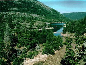
The campground offers great views of the smooth granite rocks along the lake. It's not right on the shore because the land is very steep. The campground has parking, but the 10 campsites are walk-in only. Many visitors choose the Big Meadows campground, which is about one mile (1.6 kilometres (0.99 mi)) away. It has 54 campsites where you can drive right in, perfect for RVs.
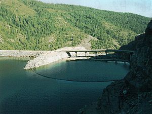
Another forest service campground is at Upper Hell Hole. You can reach it by boat or by hiking a 3.5-mile (5.6 km) trail. This trail starts by crossing the dam's breakwater and then goes along the lake, high above the water.
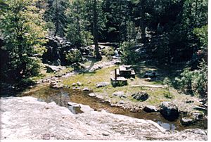
Upper Hell Hole campground has about 15 campsites and two basic toilets. It doesn't have trash service or other fancy things. There's no camping fee here. The campground is built on three levels of rock, with steps connecting them. In spring, when snow melts, some campsites have small creeks and waterfalls nearby. Others are protected by huge granite boulders. You can also camp anywhere along the rugged shore where you can land a boat.
Water Flow and Islands
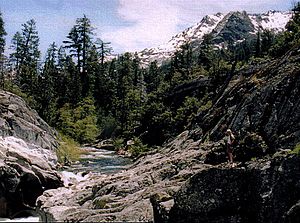
The main streams flowing into the lake are the Rubicon River and Five Lakes Creek. The lake's water now covers where these two streams used to meet. The Rubicon River enters the lake over a waterfall where it has cut through the granite rock.
The lake also has many small granite islands. These islands get bigger or smaller depending on the lake's water level. Hell Hole usually has the most water in May. The water level then slowly goes down through summer and fall. The forest service offers visitor services from May 15 to September 15. You can visit the lake until snow makes the roads impossible to use.
Exploring the Wilderness Nearby
In 1984, the Granite Chief Wilderness was created by the United States Congress. This protected area was made after a long effort by the Sierra Club, a group that works to protect nature.
Upper Hell Hole forms the western edge of the Granite Chief Wilderness. There's a small area between the lake and the wilderness to prevent people from accidentally going into the protected zone. The lake and wilderness together offer amazing chances for rustic boat and backpacking trips. You can explore the rugged and beautiful 25,680 acres (103.9 km2) of wilderness. Like the lake, the western part of the wilderness is not heavily used. The Hell Hole Trail goes into the wilderness from near the lake, but it can be hard to find.
The Granite Chief Wilderness is managed by the Tahoe National Forest. However, the visitor areas at Hell Hole are managed by the El Dorado National Forest. Forest rangers suggest being careful in Granite Chief. They recommend bringing maps and knowing how to use them because there are not many signs and the area is remote. You don't need a special permit to enter the Granite Chief Wilderness. But you always need a Campfire permit if you plan to have a fire.
The California Office of Environmental Health Hazard Assessment (OEHHA) has given advice about eating fish from Hell Hole Reservoir. This is because of mercury levels found in some fish there.
How Water Moves Through the System
Building the Hell Hole Dam changed how the Rubicon River flows. Before the dam, the river flowed for several miles to meet the Middle Fork of the American River. Now, water from Hell Hole can be sent down the old river path. It can also be sent through a pipeline to the Middle Fork Powerhouse. From there, it goes into another reservoir called Interbay. Then, it can be sent through a tunnel to Ralston Powerhouse and into Ralston Afterbay. This is where it joins the water from the old river path.
Water for making electricity also comes to Hell Hole from French Meadows Reservoir. This reservoir holds water from the Middle Fork of the American River. The water travels through a tunnel to a powerhouse on the north side of Hell Hole. French Meadows is higher up (at 5,200 feet (1,600 m)) than Hell Hole (at 4,700 feet (1,400 m)). The powerhouse at Hell Hole is actually called the French Meadows Powerhouse.
The original path of the Rubicon River still has water flowing from the Hell Hole Dam's spillway. It also gets water from streams below the dam, like Gerle Creek.
The Placer County Water Agency doesn't take water directly from Hell Hole. Instead, they claim rights to the water as it flows through the American River System. This water eventually ends up at Folsom Lake near Sacramento. Folsom Dam was first built to help control floods. The dams run by the Placer Water Agency, including Hell Hole, are part of what's called the Middle Fork Project.
A Look Back: How Hell Hole Was Used
For a long time, Hell Hole canyon and the areas nearby were mostly untouched by people. But events in the late 1800s set the stage for the dam to be built in the 1960s.
The California Gold Rush in 1849 led to towns like Auburn, Placerville, Nevada City, and Georgetown being built. Gold mining didn't happen high in the Sierra Nevada mountains. But these towns needed water and timber, which led people to the higher areas. For example, in 1873, a company planned to dam Loon Lake, south of Hell Hole. They wanted to send the water closer to Georgetown for people and farms to use.
Later, in 1862, people in Placer County tried to build a road from Foresthill to Squaw Valley. They hoped to attract travelers away from other towns. But the road was very difficult. George Wharton James described it as having a "frightful" uphill climb, making it hard even for horses.
The Comstock Lode silver rush in Nevada in the 1860s also made people try to find paths over the mountains. They wanted to reach the riches of the Comstock and the local Squaw Valley silver excitement.
These roads then brought people who claimed land for timber or to build homes. Old homesteads and timber claims were bought by private water companies or hotel owners. They wanted to attract visitors to "healthy" mineral springs after much of the timber was cut down by the mid-1880s.
Railroads brought tourists. By the late 1800s, tourists could reach Truckee, California by train from San Francisco or Ogden, Utah. The Lake Tahoe Railway and Transportation Company then took them to Lake Tahoe. One resort east of Hell Hole, called Deer Park, was important to the canyon's history. It was a hotel that had a hidden camp at Five Lakes, which is now in the Granite Chief Wilderness. James described this camp as having cabins and rowboats for fishing on the five small lakes.
The Five Lakes are where Five Lakes Creek starts. This creek led James on his 1913 horseback trip into Hell Hole with his guide, Bob Watson. They camped at Hell Hole, then went up the Rubicon River to Rockbound Lake, where they camped again. Rockbound Lake is now in the Desolation Wilderness. The Sacramento Municipal Utility District controls a dam there called Rubicon Reservoir. The Desolation Wilderness was created in 1969.
Recent History of Hell Hole Dam
When Placer County approved the bond in 1961, their water agency could look for water supplies that no one else had claimed. Loon Lake, south of Hell Hole, was already claimed. But the wild Hell Hole area was not. In 1934, California started to claim any unclaimed water rights along the American River's three forks. In 1962, the rights to the Rubicon River water were given to Placer County.
The Hell Hole Dam, which is a rock-fill type of dam, was finished across the Rubicon River in December 1964. As the lake started to fill, the dam developed a leak during a flood. The next day, it completely broke! The huge flood of water rushed down the Middle Fork of the American River. It even washed away the Greenwood Bridge near Auburn.
The Placer County Water Agency started building a new dam. This one was finished two years later in 1966. It has been standing strong for many years since then.
The first Hell Hole Dam was only partly built when huge storms hit in December 1964. The lower part of the dam was about 220 feet above the river. But the inner, waterproof part was only about 35 feet high. Debris from the storm blocked the water's exit, and water quickly built up behind the dam. As the water rose, it seeped through the dam's rock. When the water went over the top, the whole dam collapsed in minutes. A huge wave of water rushed down the canyon. It washed out two old bridges and even the State Highway 49 bridge near Auburn. Luckily, the Folsom Dam reservoir below that point was able to hold back the surge of water.
 | Misty Copeland |
 | Raven Wilkinson |
 | Debra Austin |
 | Aesha Ash |


