New Melones Lake facts for kids
Quick facts for kids New Melones Lake |
|
|---|---|
 |
|
| Location | Calaveras County, California Tuolumne County, California |
| Coordinates | 37°59′56″N 120°31′16″W / 37.9990°N 120.5212°W |
| Lake type | Reservoir |
| Primary inflows | Stanislaus River |
| Primary outflows | |
| Catchment area | 2,300 km2 (890 sq mi) |
| Basin countries | United States |
| Max. length | 12 km (7.5 mi) |
| Max. width | 4 km (2.5 mi) |
| Surface area | 5,100 ha (13,000 acres) |
| Water volume | 2,400,000 acre⋅ft (3,000,000 dam3) |
| Shore length1 | 160 km (99 mi) |
| Surface elevation | 331 m (1,086 ft) |
| 1 Shore length is not a well-defined measure. | |
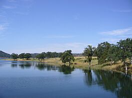
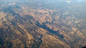
New Melones Lake is a large reservoir (an artificial lake) located in the central Sierra Nevada foothills of California. It sits partly in Calaveras County and partly in Tuolumne County. This lake was created by the New Melones Dam on the Stanislaus River.
The lake and dam are part of the United States Bureau of Reclamation's Central Valley Project. New Melones Lake helps provide water for farms, generates hydroelectric power (electricity from water), and helps prevent floods. It also offers a home for wildlife. Many people enjoy visiting the lake for fun activities like fishing, camping, and boating.
It's important to know that the California Office of Environmental Health Hazard Assessment suggests safe eating guidelines for fish caught here. This is because small amounts of certain chemicals, like mercury, have been found in some fish species.
Contents
Geography of New Melones Lake
New Melones Lake is held back by the New Melones Dam. When the lake is full, it can hold about 2.4 million acre-feet of water. This is a huge amount! Its surface area covers about 12,500 acres. The shoreline stretches for more than 100 miles, which is like driving from one city to another.
The lake and dam are located west of the towns of Jamestown and Sonora. They are also south of Angels Camp. A special bridge, the Archie Stevenot Bridge, crosses over the lake. This bridge, built in 1976, carries Highway 49 and marks the border between Calaveras and Tuolumne Counties.
Climate Around New Melones Lake
The area around New Melones Lake has a climate with warm summers and mild winters. It gets most of its rain during the cooler months.
| Climate data for New Melones Lake, California | |||||||||||||
|---|---|---|---|---|---|---|---|---|---|---|---|---|---|
| Month | Jan | Feb | Mar | Apr | May | Jun | Jul | Aug | Sep | Oct | Nov | Dec | Year |
| Record high °F (°C) | 73 (23) |
78 (26) |
86 (30) |
97 (36) |
103 (39) |
111 (44) |
109 (43) |
108 (42) |
109 (43) |
98 (37) |
86 (30) |
72 (22) |
111 (44) |
| Mean daily maximum °F (°C) | 55.5 (13.1) |
60.2 (15.7) |
64.0 (17.8) |
69.5 (20.8) |
78.8 (26.0) |
88.6 (31.4) |
96.1 (35.6) |
95.3 (35.2) |
90.0 (32.2) |
79.0 (26.1) |
65.2 (18.4) |
55.7 (13.2) |
74.8 (23.8) |
| Mean daily minimum °F (°C) | 36.8 (2.7) |
38.2 (3.4) |
41.9 (5.5) |
44.7 (7.1) |
50.0 (10.0) |
56.9 (13.8) |
63.3 (17.4) |
62.9 (17.2) |
58.4 (14.7) |
48.7 (9.3) |
42.5 (5.8) |
36.7 (2.6) |
48.4 (9.1) |
| Record low °F (°C) | 16 (−9) |
17 (−8) |
25 (−4) |
27 (−3) |
29 (−2) |
37 (3) |
37 (3) |
44 (7) |
40 (4) |
30 (−1) |
23 (−5) |
11 (−12) |
11 (−12) |
| Average precipitation inches (mm) | 6.13 (156) |
4.85 (123) |
4.65 (118) |
2.60 (66) |
1.37 (35) |
0.03 (0.76) |
0.05 (1.3) |
0.10 (2.5) |
0.22 (5.6) |
1.35 (34) |
2.85 (72) |
5.50 (140) |
29.7 (754.16) |
| Source: WRCC | |||||||||||||
History of New Melones Lake
The area around the Stanislaus River changed a lot starting with the California Gold Rush in the 1840s. Miners came looking for gold, and they began to use the river's water. Towns and businesses grew up along the riverbanks. By the early 1900s, people were using the flowing water to make electricity. Some water was also sent through canals to help farms in the San Joaquin Valley.
The first Melones Dam was finished in 1926. This created a smaller lake, also called Melones Lake.
Building the New Melones Project
The plan for the New Melones Project was approved in 1944. The goal was to build a much larger reservoir and a new power plant to make electricity. It was also designed to be very good at preventing floods.
Building this new dam was a big topic of discussion. Some people were against it because they worried it would flood the river valley. They feared it would cover up natural whitewater rapids, unique limestone caves, and important historical sites along the river. An environmental group called Friends of the River was even formed to try and stop the dam.
However, after many studies, the decision was made to build the dam. When it was finished, the valley filled with water. This covered the old mining town of Melones and the original Melones Dam.
The U.S. Army Corps of Engineers built the lake. After it was completed in 1980, it was given to the U.S. Bureau of Reclamation to manage.
New Melones Visitor Center and Museum
If you visit New Melones Lake, you can stop by the New Melones Visitor Center and Museum. It has lots of interesting information about the area's past. You can learn about how different groups of people used the Stanislaus River over time. This includes the Miwok Indians, the gold miners during the California Gold Rush, and early ranchers. You can also learn about the old town of Robinson Ferry, which was later called Melones.
The museum also has exhibits about the area's geology (how the land was formed), its natural history, and how the New Melones Project was built.
See also
 | Laphonza Butler |
 | Daisy Bates |
 | Elizabeth Piper Ensley |


