
Shasta County, California facts for kids
Quick facts for kids
Shasta County
|
||
|---|---|---|
| County of Shasta | ||
   |
||
|
||

Location in the state of California
|
||
| Country | United States | |
| State | California | |
| Region | Sacramento Valley/Cascade Range | |
| Incorporated | February 18, 1850 | |
| Named for | Mount Shasta, which was named after the Shasta people | |
| County seat | Redding | |
| Largest city | Redding | |
| Government | ||
| • Type | Council–CEO | |
| Area | ||
| • Total | 3,847 sq mi (9,960 km2) | |
| • Land | 3,775 sq mi (9,780 km2) | |
| • Water | 72 sq mi (190 km2) | |
| Highest elevation | 10,457 ft (3,187 m) | |
| Population | ||
| • Total | 182,155 | |
| • Density | 47.350/sq mi (18.2819/km2) | |
| GDP | ||
| • Total | $9.921 billion (2022) | |
| Time zone | UTC−8 (Pacific Standard Time) | |
| • Summer (DST) | UTC−7 (Pacific Daylight Time) | |
| Congressional district | 1st | |
| Website | www.shastacounty.gov | |

Shasta County is a county in the northern part of California. It is officially called the County of Shasta. As of 2020, about 182,155 people live here. The main city and county seat is Redding.
Shasta County is in the northern part of the Sacramento Valley. It also reaches into the southern Cascade Range mountains. Important places in Shasta County include Shasta Lake, Lassen Peak, and the famous Sundial Bridge.
Contents
History of Shasta County
Shasta County was one of the very first counties in California. It was created in 1850 when California became a state. The county got its name from Mount Shasta. The mountain was named after the Shasta people, who were the native people of this area.
In the 1850s, the population of the Shasta people went down. This happened because of diseases, low birth rates, hunger, and conflicts with new settlers. The name of the tribe was spelled in different ways. But the current spelling was chosen when the county was formed.
Mount Shasta is a very tall mountain, about 14,179 feet (4,322 meters) high. You can see it from most of Shasta County. Even though it was once part of Shasta County, it is now in Siskiyou County to the north. Some parts of Shasta County were moved to Siskiyou County in 1852. Other parts were moved to Tehama County in 1856.
Major Events in Shasta County History
In 1992, a large wildfire called the Fountain Fire happened. It burned over 63,000 acres (25,000 hectares) of land. Hundreds of homes and buildings were destroyed. Many people had to leave their homes for safety. The fire caused about $105.6 million in damage.
More recently, there was a plan for a wind energy project called Fountain Wind. It would have included up to 71 tall wind turbines. In 2021, the Shasta County Planning Commission decided not to approve the project. One main reason was the risk of wildfires and how hard it would be to fight fires near the turbines.
Geography and Nature
Shasta County covers a total area of about 3,847 square miles (9,964 square kilometers). A small part of this area, about 72 square miles (186 square kilometers), is covered by water. Mountains surround the county on the east, north, and west sides. The Sacramento River flows from the northern mountains, through the middle of the county, and south towards the Sacramento Valley.
Plants and Animals of Shasta County
Scientists did not study the plants and animals of Shasta County much until around 1900. In the past, large areas of natural grasslands were owned by a railroad company. But in the 1920s, much of this land was sold. This led to many natural areas being cleared for farming.
Shasta County has many forests. Over half of the land is covered by forests that produce wood. Common types of forests include mixed-oak woodlands and mixed conifer-oak woodlands. Douglas fir forests are also common. Some trees you might see here are white-bark pine, California black oak, and California buckeye.
Neighboring Counties
Shasta County shares borders with several other counties:
- Siskiyou County to the north
- Modoc County to the northeast
- Lassen County to the east
- Plumas County to the southeast
- Tehama County to the south
- Trinity County to the west
Protected Natural Areas
Parts of Shasta County are home to important protected natural areas:
- Shasta-Trinity National Forest
- Whiskeytown National Recreation Area
Population and People
| Historical population | |||
|---|---|---|---|
| Census | Pop. | %± | |
| 1850 | 378 | — | |
| 1860 | 4,360 | 1,053.4% | |
| 1870 | 4,173 | −4.3% | |
| 1880 | 9,492 | 127.5% | |
| 1890 | 12,133 | 27.8% | |
| 1900 | 17,318 | 42.7% | |
| 1910 | 18,920 | 9.3% | |
| 1920 | 13,361 | −29.4% | |
| 1930 | 13,927 | 4.2% | |
| 1940 | 28,800 | 106.8% | |
| 1950 | 36,413 | 26.4% | |
| 1960 | 59,468 | 63.3% | |
| 1970 | 77,640 | 30.6% | |
| 1980 | 115,715 | 49.0% | |
| 1990 | 147,036 | 27.1% | |
| 2000 | 163,256 | 11.0% | |
| 2010 | 177,223 | 8.6% | |
| 2020 | 182,155 | 2.8% | |
| 2023 (est.) | 180,366 | 1.8% | |
| U.S. Decennial Census 1790–1960 1900–1990 1990–2000 2010–2015 |
|||
In 2020, the population of Shasta County was 182,155 people. Most people in the county are White. Other groups include Native American, Asian, Black or African American, and Pacific Islander people. About 10.8% of the population is Hispanic or Latino.
In 2000, the average household income in the county was about $34,335. The average family income was about $40,491. About 15.4% of the people in Shasta County lived below the poverty line. This included 21% of children under 18.
Fun Annual Events
Shasta County hosts many exciting events throughout the year:
- Kool April Nites (April): A classic car show.
- Rodeo Week Festivities (May): Celebrates rodeo culture.
- Art Fair and Fiddler's Jamboree (May): Showcases local art and music.
- Whiskeytown Regatta (May): A boat race on Whiskeytown Lake.
- Strawberry Festival (May): A celebration of strawberries.
- Shasta Dragonwood Celtic Faire (May): A festival with a Celtic theme.
- Redding Exchange Club Air Show (June): Features amazing aerial displays.
- Shasta District Fair (June): A traditional county fair with rides and exhibits.
- Fourth of July Fireworks Celebration (July): A big fireworks show.
- Burney Basin Days (July): A local community festival.
- Fall River Valley Wild Rice Festival (August): Celebrates local agriculture.
- Stillwater Pow Wow (September): A gathering to celebrate Native American culture.
- Palo Cedro Honey Bee Festival (September): Focuses on honey bees and their importance.
Getting Around Shasta County
Main Roads
Several important highways run through Shasta County:
 Interstate 5: A major north-south highway.
 State Route 36
 State Route 44
 State Route 89
 State Route 151
 State Route 273
 State Route 299
Public Transportation
The Redding Area Bus Authority (RABA) provides bus services in and around Redding. There is also a bus route that goes to Burney.
You can also travel by train. Amtrak's Coast Starlight train stops at Redding Station once a day. There are also bus services called Amtrak Thruway that connect Redding to other train lines. These buses can take you to places like the San Francisco Bay Area and Los Angeles.
Airports
Redding Municipal Airport has flights for passengers. Other smaller airports in the county are used for general aviation. These include Benton Field, Fall River Mills Airport, and Shingletown Airport.
Education in Shasta County
Shasta County has many schools for students of all ages. There are:
- 43 elementary schools
- 10 junior high schools
- 8 high schools
- 35 private schools
Colleges and Universities
For students who want to continue their education after high school, Shasta County has four colleges and universities:
- Shasta College, in Redding, offers two-year programs.
- Simpson University, in Redding, offers four-year programs.
- National University, in Redding, also offers four-year programs.
- Shasta Bible College offers four-year programs.
Cool Places to Visit
Shasta County has many interesting places to explore:
- Shasta Dam: This is the second-largest dam in the United States.
- Lassen Peak: A volcano and a great place for hiking.
- Lassen Volcanic National Park: A national park with volcanoes, hot springs, and mud pots.
- Shasta Lake: A large reservoir perfect for boating and fishing.
- Turtle Bay Exploration Park: A fun place to learn about nature and history.
- Sundial Bridge: A beautiful bridge that acts as a giant sundial.
- Burney Falls: A stunning waterfall often called one of the most beautiful in California.
- Whiskeytown Dam and Lake: Another beautiful lake area with outdoor activities.
Cities and Towns
Shasta County has three main cities:
- Anderson
- Redding (the county seat)
- Shasta Lake
There are also many smaller communities, often called "unincorporated communities" or "CDPs" (Census-Designated Places). Some of these include:
Images for kids
-
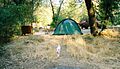
Bailey Cove Campground near Lake Shasta within the Shasta-Trinity National Forest.

See also
 In Spanish: Condado de Shasta para niños
