
Palo Cedro, California facts for kids
Quick facts for kids
Palo Cedro
|
|
|---|---|

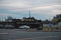
Windmill, Downtown Palo Cedro
|
|

Location in Shasta County and the state of California
|
|
| Country | |
| State | |
| County | Shasta |
| Area | |
| • Total | 3.754 sq mi (9.722 km2) |
| • Land | 3.679 sq mi (9.528 km2) |
| • Water | 0.075 sq mi (0.194 km2) 2.00% |
| Elevation | 465 ft (143 m) |
| Population
(2020)
|
|
| • Total | 2,931 |
| • Density | 780.77/sq mi (301.48/km2) |
| Time zone | UTC−8 (Pacific (PST)) |
| • Summer (DST) | UTC−7 (PDT) |
| ZIP code |
96073
|
| Area code(s) | 530 |
| FIPS code | 06-55296 |
| GNIS feature ID | 0230275 |
Palo Cedro is a small community in Shasta County, California, United States. Its name means "Cedar Wood" in Spanish. It is located about 8 miles (13 km) east of Redding. In 2020, its population was 2,931 people.
Long ago, Native American tribes lived in Northern California, including the area where Palo Cedro is now. European explorers started coming to California in the late 1700s. Cow Creek, a stream that flows through Palo Cedro, was an important path for fur trappers. The town was named after the cedar trees that grew there in the 1800s.
Famous country musician Merle Haggard lived in Palo Cedro for many years until he passed away in 2016.
Contents
History of Palo Cedro
Early Native American Life
Long ago, many Native American tribes lived in Northern California. These tribes included the Wintu, Patwins, Pit Rivers, Shastas, and Modoc tribes. The Wintus were a large and peaceful group who lived in Northern California and Oregon.
Historians say California had more native tribes and languages than almost anywhere else in the United States.
Explorers and Settlers (18th and 19th Centuries)
The first recorded European exploration of California happened in 1769. This led to the founding of Alta California, which reached as far north as San Francisco.
In the 1800s, many explorers came to California's northern areas.
- In 1812, Russians set up a colony called Fort Ross on the coast.
- Mountains like Mount Shasta and Mount Lassen were seen by explorers in the 1820s.
- Fur traders like Peter Skene Ogden and Jedediah Smith also saw Mount Shasta.

One of the first European Americans to explore the Palo Cedro area was Alexander Roderick McLeod. In 1829, he traveled along Cow Creek, which flows through Palo Cedro. He was looking for a mythical river and found the Sacramento River instead.
In 1832, another fur trader named John Work also traveled through the area. He was looking for a route to connect two major rivers. He noted that local Native Americans lived in huts and that many animals, like deer, elk, and grizzly bears, lived there too.

In 1846, explorer John C. Frémont and his group followed the Cow Creek trail north. His guide was the famous mountain man Kit Carson.
In 1883, a post office was opened in the area. The town was first called Albertson, then Roberts, and finally Palo Cedro in 1893. The name "Palo Cedro" means "cedarwood" in Spanish, named after the cedar trees that grew there.
In 1897, the Anderson and Bella Vista Railroad was built. It passed through Palo Cedro and was used by miners and a lumber company. The train also delivered groceries and mail and carried passengers.
Palo Cedro in the 20th and 21st Centuries
In the early 1900s, a stagecoach route connected Redding, Palo Cedro, and other towns.
Palo Cedro's first school was moved a few times before the "new" Junction School was built in 1960.
The first general store in Palo Cedro was owned by Frank and Mary Love. Later, Sarah Addington owned it and was also the postmaster. The post office moved several times as the town grew.
The first Grange Hall and Feed Store were built in the early 1930s. This building burned down but was quickly replaced. The new building is still used today.
As Palo Cedro grew, more services were added. In 1975, the first independent pharmacy opened. Today, Palo Cedro has banks, gas stations, restaurants, and many other businesses.
Geography of Palo Cedro
Palo Cedro is located at an elevation of 465 feet (143 meters) above sea level.
The community covers about 3.8 square miles (9.8 square kilometers). Most of this area is land, with a small amount of water.
Population and People
In 2010, Palo Cedro had a population of 1,269 people. By 2020, the population had grown to 2,931.
Most residents are White, but the community also has people of African American, Native American, Asian, and other backgrounds. About 5.8% of the population in 2010 was Hispanic or Latino.
The average household size in 2010 was about 2.66 people. Many households were married couples living together.
Notable People
- Merle Haggard: A very famous country musician. He lived in Palo Cedro for many years until he passed away on April 6, 2016.
Education in Palo Cedro
Palo Cedro has several schools for different age groups:
- Elementary Schools
- North Cow Creek School
- Junction Elementary School
- Chrysalis Charter School
- Redding Christian School
- Middle Schools
- Junction Intermediate School
- Saint Francis Middle School
- Chrysalis Charter School
- North Cow Creek School
- Redding Christian School
- High Schools
- Foothill High School: This school is known for being one of the best public schools in northern California.
- Bishop Quinn High School
- Redding Christian School
Images for kids
-
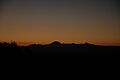
View from Palo Cedro of Sunrise over Mount Lassen (September 2007)
-
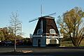
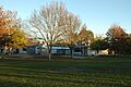
Windmill landmark in Palo Cedro shopping center (November 2007)
-
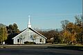
Local Church with Mount Lassen in the Background (November 2007)
-
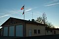
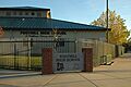
Palo Cedro Fire Department (November 2007)
-
Junction Middle School (Thanksgiving Holiday 2007)
-
Foothill High School (November 2007)
-
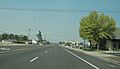
Deschutes Road Looking North, From Junction Elementary School (September 2007)
-
Palo Cedro Church of Jesus Christ of Latter-day Saints (November 2007)
-
The Palo Cedro Inn—A Palo Cedro Landmark (November 2007)


See also
 In Spanish: Palo Cedro para niños
