Shasta Lake, California facts for kids
Quick facts for kids
City of Shasta Lake
|
|
|---|---|

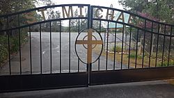
St. Michael's Catholic Church
|
|

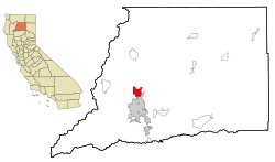
Location in Shasta County and the state of California
|
|
| Country | |
| State | |
| County | Shasta |
| Incorporated | July 2, 1993 |
| Area | |
| • Total | 10.93 sq mi (28.30 km2) |
| • Land | 10.92 sq mi (28.29 km2) |
| • Water | 0.01 sq mi (0.01 km2) 0.07% |
| Elevation | 810 ft (246 m) |
| Population
(2020)
|
|
| • Total | 10,371 |
| • Density | 948.9/sq mi (366.47/km2) |
| Time zone | UTC-8 (Pacific (PST)) |
| • Summer (DST) | UTC-7 (PDT) |
| ZIP codes |
96019, 96079, 96089
|
| Area code(s) | 530 |
| FIPS code | 06-71225 |
| GNIS feature ID | 1662287 |
| Website | https://www.cityofshastalake.org/ |
Shasta Lake City is a town in Shasta County, California. It is very close to the famous Shasta Dam and Shasta Lake reservoir. These spots are popular places for tourists to visit. Before it became an official city, people called it Central Valley or CV. In 2020, about 10,371 people lived there. This was a small increase from 10,164 people in 2010.
Contents
A Look Back: Shasta Lake's Story
Shasta Lake City started as five smaller communities. These were Central Valley, Toyon, Project City, Pine Grove, and Summit City. They all grew when workers began building the Shasta Dam in 1938. Project City was built where two main roads met. Central Valley was in the middle of Shasta Dam Boulevard. Summit City was at another important intersection. Pine Grove was near what is now Interstate 5. These towns provided homes for the many workers building the dam.
Toyon: A Special Community
The government agency, the Bureau of Reclamation, built a town called Toyon. It was first known as Government Camp. Toyon was the most important community. It was built on 41 acres of land that used to be the Seaman Ranch. By 1950, Toyon had many great features. It had two tennis courts and an outdoor basketball court. There was also a Community Center. The town had green lawns and concrete sidewalks. It received water and power from Shasta Dam. Toyon even had its own sewage plant and landfill. At first, there were also two large buildings for single workers. Everyone living in Toyon worked for the US Bureau of Reclamation.
By the end of 1964, all government workers had to leave Toyon. The site was given to the Job Corps. This was a program to help young people. The Job Corps left in 1972. After that, local Native Americans moved into Toyon. They hoped the land would be recognized as tribal land. However, this did not happen. The water and electricity were turned off. This was because a large utility bill was not paid. There were conflicts between the Native Americans and law enforcement. Many homes in Toyon burned down. The historic Seaman Ranch Community House also burned. Today, only one metal storage building and a flagpole remain. The area is now fenced off.
The workers building Shasta Dam needed affordable homes. Land was cheap, so these communities grew. Central Valley later became the main business area for the dam workers. At first, these new towns had trouble getting enough water. Digging wells did not provide much water.
In the 1970s, oil production slowed down. The nearby city of Redding grew larger than Central Valley in 1965. This happened when Redding added the community of Enterprise. By 1980, Central Valley had 3,424 people. Project City had 1,659, and Summit City had 1,139. In the early 1990s, people started talking about making the area an official city. This finally happened on July 2, 1993. About 60% of the people voted for it.
Today, you can find restaurants, gas stations, and motels near the main highway. These were mostly built around the year 2000. More fast food places and motels are planned for the future.
Shasta Lake City covers about 10.9 square miles (28.3 square kilometers). Almost all of this area is land. Only a tiny part is covered by water.
Weather in Shasta Lake
Shasta Lake has a hot-summer Mediterranean climate. This means summers are hot and dry. There are big differences between day and night temperatures. Winters are wet and cool.
| Climate data for Shasta Dam, California (normals 1981-2010)(extremes 1943-2020) | |||||||||||||
|---|---|---|---|---|---|---|---|---|---|---|---|---|---|
| Month | Jan | Feb | Mar | Apr | May | Jun | Jul | Aug | Sep | Oct | Nov | Dec | Year |
| Record high °F (°C) | 80 (27) |
80 (27) |
88 (31) |
97 (36) |
107 (42) |
111 (44) |
115 (46) |
115 (46) |
114 (46) |
104 (40) |
90 (32) |
76 (24) |
115 (46) |
| Mean daily maximum °F (°C) | 53.0 (11.7) |
57.0 (13.9) |
62.3 (16.8) |
68.6 (20.3) |
77.6 (25.3) |
86.5 (30.3) |
95.3 (35.2) |
94.3 (34.6) |
88.1 (31.2) |
76.0 (24.4) |
60.3 (15.7) |
52.7 (11.5) |
72.6 (22.6) |
| Daily mean °F (°C) | 46.3 (7.9) |
49.2 (9.6) |
53.0 (11.7) |
58.0 (14.4) |
66.3 (19.1) |
74.5 (23.6) |
81.8 (27.7) |
80.6 (27.0) |
75.2 (24.0) |
65.2 (18.4) |
52.9 (11.6) |
46.3 (7.9) |
62.4 (16.9) |
| Mean daily minimum °F (°C) | 39.5 (4.2) |
41.4 (5.2) |
43.6 (6.4) |
47.4 (8.6) |
55.0 (12.8) |
62.5 (16.9) |
68.3 (20.2) |
66.8 (19.3) |
62.2 (16.8) |
54.4 (12.4) |
45.4 (7.4) |
40.0 (4.4) |
52.5 (11.4) |
| Record low °F (°C) | 19 (−7) |
21 (−6) |
25 (−4) |
28 (−2) |
35 (2) |
38 (3) |
50 (10) |
44 (7) |
43 (6) |
34 (1) |
30 (−1) |
14 (−10) |
14 (−10) |
| Average precipitation inches (mm) | 10.84 (275) |
11.33 (288) |
9.48 (241) |
4.75 (121) |
3.23 (82) |
1.37 (35) |
0.20 (5.1) |
0.25 (6.4) |
1.00 (25) |
3.68 (93) |
7.63 (194) |
12.06 (306) |
65.82 (1,672) |
| Average precipitation days | 14 | 12 | 12 | 9 | 7 | 3 | 1 | 1 | 3 | 5 | 11 | 14 | 93 |
| Source: NOAA | |||||||||||||
Who Lives Here: Population Facts
| Historical population | |||
|---|---|---|---|
| Census | Pop. | %± | |
| 2000 | 9,008 | — | |
| 2010 | 10,164 | 12.8% | |
| 2020 | 10,371 | 2.0% | |
| U.S. Decennial Census | |||
In 2010, the Census counted 10,164 people living in Shasta Lake.
- Most people, about 86.1%, were White.
- About 3.8% were Native American.
- About 2.3% were Asian.
- About 8.5% of the people were Hispanic or Latino.
There were 3,943 homes in the city.
- About 33.6% of these homes had children under 18.
- The average home had about 2.57 people.
The population was spread out by age:
- About 24.3% of people were under 18.
- About 14.4% were 65 years old or older.
The average age in Shasta Lake was 38.8 years.
Learning in Shasta Lake
Shasta Lake has five schools for students. They are all part of the Gateway Unified School District.
- Grand Oaks Elementary School (Kindergarten to 5th grade)
- Shasta Lake School (Kindergarten to 8th grade)
- Buckeye School of the Arts (Kindergarten to 8th grade)
- Central Valley High School (9th to 12th grade)
- Mountain Lakes High School (10th to 12th grade)
The first elementary school in the area was Toyon School. It was in Summit City. It has since closed. Mountain Lakes High School is now in that building. Central Valley High School opened in 1956.
See also
 In Spanish: Shasta Lake (California) para niños
 | Selma Burke |
 | Pauline Powell Burns |
 | Frederick J. Brown |
 | Robert Blackburn |


