Dougherty County, Georgia facts for kids
Quick facts for kids
Dougherty County
|
|
|---|---|

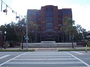
Dougherty County Government Center
|
|

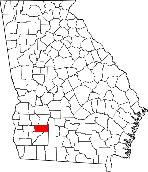
Location within the U.S. state of Georgia
|
|
 Georgia's location within the U.S. |
|
| Country | |
| State | |
| Founded | 1853 |
| Named for | Charles Dougherty |
| Seat | Albany |
| Largest city | Albany |
| Area | |
| • Total | 335 sq mi (870 km2) |
| • Land | 329 sq mi (850 km2) |
| • Water | 5.9 sq mi (15 km2) 1.8%% |
| Population
(2020)
|
|
| • Total | 85,790 |
| • Density | 288/sq mi (111/km2) |
| Time zone | UTC−5 (Eastern) |
| • Summer (DST) | UTC−4 (EDT) |
| Congressional district | 2nd |
Dougherty County is a place in the southwestern part of Georgia. In 2020, about 85,790 people lived there. The main city and county seat is Albany. Dougherty County is part of the larger Albany area. Long ago, it was known for growing cotton on big farms.
Contents
History of Dougherty County
Dougherty County was formed on December 15, 1853. It was created from a part of Baker County. The county was named after Charles Dougherty. He was a respected judge and lawyer from Athens. Later, small parts of Worth County were added in 1854 and 1856.
In the past, the county grew a lot of cotton. This was done on large farms using enslaved African Americans as workers. The main city, Albany, Georgia, is on the Flint River. This river was important for moving goods. Later, many railroad lines came to Albany. This made it an even more important place for trade. Albany was also a key location during the Civil Rights Movement in the early 1960s.
Geography of Dougherty County
Dougherty County covers about 335 square miles. Most of this area, about 329 square miles, is land. The rest, about 5.9 square miles, is water.
Most of the county is in the lower part of the Flint River area. This river basin is called the ACF River Basin. A small part of the county, northeast of Albany, is in the middle Flint River area. Other parts are in the Kinchafoonee-Muckalee and Ichawaynochaway Creek areas.
Major Roads in Dougherty County
Counties Next to Dougherty County
- Lee County – to the north
- Worth County – to the east
- Mitchell County – to the south
- Baker County – to the southwest
- Calhoun County – to the west
- Terrell County – to the northwest
Communities in Dougherty County
City
Unincorporated Communities
- Acree
- Doublegate
- Pecan City
- Pretoria
- Radium Springs
Population of Dougherty County
| Historical population | |||
|---|---|---|---|
| Census | Pop. | %± | |
| 1860 | 8,295 | — | |
| 1870 | 11,517 | 38.8% | |
| 1880 | 12,622 | 9.6% | |
| 1890 | 12,206 | −3.3% | |
| 1900 | 13,679 | 12.1% | |
| 1910 | 16,035 | 17.2% | |
| 1920 | 20,063 | 25.1% | |
| 1930 | 22,306 | 11.2% | |
| 1940 | 28,565 | 28.1% | |
| 1950 | 43,617 | 52.7% | |
| 1960 | 75,680 | 73.5% | |
| 1970 | 89,639 | 18.4% | |
| 1980 | 100,718 | 12.4% | |
| 1990 | 96,311 | −4.4% | |
| 2000 | 96,065 | −0.3% | |
| 2010 | 94,565 | −1.6% | |
| 2020 | 85,790 | −9.3% | |
| 2023 (est.) | 82,645 | −12.6% | |
| U.S. Decennial Census 1790-1880 1890-1910 1920-1930 1930-1940 1940-1950 1960-1980 1980-2000 2010 2020 |
|||
As of the 2020 census, there were 85,790 people living in Dougherty County. These people lived in 32,630 households.
Education in Dougherty County
To learn more about schools and learning in the area, see the Education section of the Albany, Georgia article.
See also
 In Spanish: Condado de Dougherty para niños

