Duvergé facts for kids
Quick facts for kids
Duvergé
|
||
|---|---|---|
 |
||
|
||
| Country | ||
| Province | Independencia | |
| Founded | 1772 | |
| Municipality since | 1891 | |
| Area | ||
| • Total | 521.64 km2 (201.41 sq mi) | |
| Elevation | 2 m (7 ft) | |
| Population
(2012)
|
||
| • Total | 19,598 | |
| • Density | 37.5700/km2 (97.306/sq mi) | |
| • Urban | 13,668 | |
| • Demonym | Damero(a) | |
| Distance to – Jimaní – Santo Domingo |
41 km 245 km |
|
| Municipal Districts | 1 |
|
| Climate | BSh | |
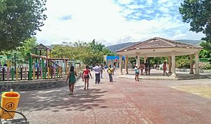
Duvergé, also known locally as Las Damas (which means "the ladies" in Spanish), is the biggest city in the Independencia province of the Dominican Republic. It got its nickname from the local Las Damas River. The first people to settle here were Christopher Pérez and María del Pulgar, who came from San Juan de la Maguana.
Contents
Duvergé's Journey Through History
Duvergé has a long history with many changes! It started as a small village.
Becoming Part of Different Provinces
On May 9, 1850, Duvergé became part of the Baoruco Province, which was then part of Azua. This happened because of a law about how the country was divided.
Later, on May 17, 1876, Duvergé was important because it had many people and lots of farms. So, the president at the time, Ulises Francisco Espaillat, signed a special order. This order made Duvergé part of Azua Province.
Then, on September 12, 1881, Duvergé moved again! It became part of the Maritime District of Barahona. Today, this area is known as the Municipality of Enriquillo.
How Duvergé Got Its Name
The city's original name was Las Damas. But on June 22, 1891, during the time of President Ulises Heureaux, the vice president, Wenceslao Figuereo, changed the name. He renamed it Duvergé to honor Antonio Duvergé. Antonio Duvergé was a brave general who fought in the Dominican War of Independence.
More Changes Over Time
Duvergé was later made part of Barahona Province. This change happened on March 18, 1943, by a new law.
Finally, in 1949, when Rafael Trujillo was in charge, another law was passed. This law placed Duvergé into the Independencia Province, where it still is today.
Where is Duvergé? (Geography)
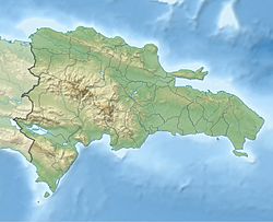
The city of Duvergé is located in a flat area. This flat land is nestled between hills and mountains. It's part of a larger area called the Neiba Valley. Even though it's in the Neiba Valley, it officially belongs to the Independencia Province.
Distances to Other Cities
Duvergé is about 17 kilometers (about 10.5 miles) from Neiba. It is also about 42 kilometers (about 26 miles) from Jimaní. Jimaní is the capital city of the Independencia Province.
Climate and Land
Duvergé is in a dry area. You can see many cacti plants here, like the Melocactus lemairei. Even though the climate is dry, the land is very fertile. This is because it gets water from underground sources and rivers. This water helps the land stay moist and good for farming.
What Borders Duvergé? (Limits)
Duvergé shares its borders with several other places:
- North: Lago Enriquillo and Baoruco Province
- South: Pedernales Province
- East: Cristóbal
- West: Jimaní
How Big is Duvergé? (Area and Population)
The main city area of Duvergé stretches out about 6 to 8 kilometers (about 3.7 to 5 miles) from its center.
Land Size
The entire municipality of Duvergé covers a land area of 501.43 square kilometers.
Population
About 17,320 people live in this area.
- 12,053 people live in the city part (urban zone).
- 5,267 people live in the countryside (rural zone).
The number of people living here has changed over time as some people move in and others move out.
Duvergé's Weather (Climate)
Duvergé has a hot semi-arid climate. This means it's generally hot and dry, but not a desert. It gets some rain, but not a lot.
| Climate data for Duvergé (1971-2000) | |||||||||||||
|---|---|---|---|---|---|---|---|---|---|---|---|---|---|
| Month | Jan | Feb | Mar | Apr | May | Jun | Jul | Aug | Sep | Oct | Nov | Dec | Year |
| Record high °C (°F) | 38.0 (100.4) |
38.9 (102.0) |
40.0 (104.0) |
40.4 (104.7) |
40.2 (104.4) |
— | 41.2 (106.2) |
42.8 (109.0) |
41.4 (106.5) |
41.6 (106.9) |
41.0 (105.8) |
— | 42.8 (109.0) |
| Mean daily maximum °C (°F) | 32.1 (89.8) |
32.9 (91.2) |
34.0 (93.2) |
34.9 (94.8) |
34.7 (94.5) |
36.0 (96.8) |
35.9 (96.6) |
36.0 (96.8) |
35.8 (96.4) |
34.8 (94.6) |
33.6 (92.5) |
32.3 (90.1) |
34.4 (93.9) |
| Daily mean °C (°F) | 26.6 (79.9) |
27.1 (80.8) |
27.9 (82.2) |
28.8 (83.8) |
28.9 (84.0) |
29.8 (85.6) |
29.9 (85.8) |
30.0 (86.0) |
29.8 (85.6) |
29.1 (84.4) |
28.0 (82.4) |
26.8 (80.2) |
28.6 (83.4) |
| Mean daily minimum °C (°F) | 21.0 (69.8) |
21.2 (70.2) |
21.8 (71.2) |
22.7 (72.9) |
23.1 (73.6) |
23.6 (74.5) |
23.9 (75.0) |
23.9 (75.0) |
23.8 (74.8) |
23.3 (73.9) |
22.3 (72.1) |
21.3 (70.3) |
22.7 (72.8) |
| Record low °C (°F) | 10.2 (50.4) |
— | 10.0 (50.0) |
— | — | — | — | — | — | — | — | — | 10.0 (50.0) |
| Average rainfall mm (inches) | 10.6 (0.42) |
18.2 (0.72) |
27.4 (1.08) |
32.5 (1.28) |
87.1 (3.43) |
54.7 (2.15) |
23.2 (0.91) |
70.1 (2.76) |
73.9 (2.91) |
65.1 (2.56) |
36.4 (1.43) |
20.2 (0.80) |
519.4 (20.45) |
Source 1: National Bureau of Meteorology (ONAMET)
|
|||||||||||||
| Source 2: freemeteo.com [16] — acqweather.com [17] | |||||||||||||
How People Make Money (Economy)
The main way people in Duvergé earn money is through farming. Most of the farmland is used to grow crops like bananas, plantains, cassava, yams, and coconuts. They also grow many different kinds of vegetables.
Since Duvergé is close to Lago Enriquillo, fishing is also very important. People catch a lot of tilapia fish from the lake. These fish are eaten by local people and also sold to nearby towns.
See also
 In Spanish: Duvergé para niños
 | William L. Dawson |
 | W. E. B. Du Bois |
 | Harry Belafonte |


