Eagle Mountain, Utah facts for kids
Quick facts for kids
Eagle Mountain, Utah
|
|
|---|---|

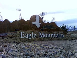
Eagle Mountain monument
|
|

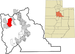
Location in Utah County and the state of Utah
|
|
| Country | United States |
| State | Utah |
| County | Utah |
| Incorporated | December 3, 1996 |
| Became a city | May 31, 2001 |
| Government | |
| • Type | Six Member Council |
| Area | |
| • Total | 50.43 sq mi (130.61 km2) |
| • Land | 50.43 sq mi (130.61 km2) |
| Elevation | 4,885 ft (1,489 m) |
| Population
(2020)
|
|
| • Total | 43,623 |
| • Density | 865.02/sq mi (333.99/km2) |
| Time zone | UTC-7 (Mountain (MST)) |
| • Summer (DST) | UTC-6 (MDT) |
| ZIP code |
84005
|
| Area code(s) | 385, 801 |
| FIPS code | 49-20810 |
| GNIS feature ID | 2410380 |
| Website | www.emcity.org |
Eagle Mountain is a city in Utah County, Utah. It is part of the Provo–Orem metropolitan area. The city is located west and north of the Lake Mountains, which are west of Utah Lake. It became an official town in December 1996 and has been growing very quickly. In 2020, about 43,623 people lived there. Eagle Mountain was first a town in 2000. It became a third-class city in September 2001. It is known for how fast it has grown.
Contents
History of Eagle Mountain
How Eagle Mountain Started
In 1994, a real estate developer named John Walden and two doctors, Scott Gettings and Andrew Zorbis, bought about 8,000 acres of land. They bought this land in the Cedar Valley. No one lived in this area at the time.
So, they worked with Debbie Hooge, who lived nearby. They talked to people in two communities about five miles away. These communities were Cedar Pass Ranch and Harvest Haven. The people agreed, and the area became the Town of Eagle Mountain in December 1996. It was about 24 square miles big. Debbie Hooge became the first Mayor of the town. In 2001, the town was reclassified and officially became Eagle Mountain City. In 2011, Eagle Mountain grew even more. It added the White Hills neighborhood and another area for future development.
Important Landmarks
Eagle Mountain has some cool natural and man-made landmarks. One spot is along the original Pony Express trail. This was a famous route for mail delivery a long time ago. There is also a big rock with ancient petroglyphs. These are rock carvings made by the Fremont Indians about 1,800 years ago.
Geography and Climate
Eagle Mountain is located at the western and northern bases of the Lake Mountains. It sits in the flat Cedar Valley, east and northeast of Cedar Fort. The city covers about 50.3 square miles of land.
Eagle Mountain's Climate
The weather in Eagle Mountain can be quite different depending on where you are. The Ranches area in the northeast has slightly milder temperatures. This is because it is closer to the Salt Lake and Utah Valleys and the Great Salt Lake, which help keep the temperatures from getting too extreme.
The City Center area, near Fairfield, is in the Cedar Valley. This valley blocks it from the warming effects of the Salt Lake Valley and Great Salt Lake. Because of this, nights in the City Center area get much colder. It also gets less rain and more sunshine than the Ranches part of the city.
| Climate data for Eagle Mountain (Ranches), Utah (1980-2010 Averages) | |||||||||||||
|---|---|---|---|---|---|---|---|---|---|---|---|---|---|
| Month | Jan | Feb | Mar | Apr | May | Jun | Jul | Aug | Sep | Oct | Nov | Dec | Year |
| Mean daily maximum °F (°C) | 37.1 (2.8) |
41.9 (5.5) |
52.5 (11.4) |
61.1 (16.2) |
71.0 (21.7) |
82.0 (27.8) |
90.7 (32.6) |
89.0 (31.7) |
78.2 (25.7) |
63.6 (17.6) |
49.3 (9.6) |
38.6 (3.7) |
62.9 (17.2) |
| Mean daily minimum °F (°C) | 18.9 (−7.3) |
22.4 (−5.3) |
30.3 (−0.9) |
36.3 (2.4) |
45.2 (7.3) |
54.3 (12.4) |
62.5 (16.9) |
61.5 (16.4) |
51.5 (10.8) |
39.2 (4.0) |
28.9 (−1.7) |
20.6 (−6.3) |
39.3 (4.1) |
| Average precipitation inches (mm) | 1.0 (25) |
1.1 (28) |
1.8 (46) |
1.9 (48) |
2.2 (56) |
1.0 (25) |
1.0 (25) |
0.9 (23) |
1.4 (36) |
1.6 (41) |
1.6 (41) |
1.3 (33) |
16.75 (425) |
| Average snowfall inches (cm) | 8.0 (20) |
7.0 (18) |
3.9 (9.9) |
2.8 (7.1) |
0.2 (0.51) |
0.0 (0.0) |
0.0 (0.0) |
0.0 (0.0) |
0.0 (0.0) |
0.7 (1.8) |
4.2 (11) |
8.8 (22) |
35.48 (90.1) |
| Climate data for Fairfield (near Eagle Mountain City Center), Utah (1950-2005 Averages) | |||||||||||||
|---|---|---|---|---|---|---|---|---|---|---|---|---|---|
| Month | Jan | Feb | Mar | Apr | May | Jun | Jul | Aug | Sep | Oct | Nov | Dec | Year |
| Mean daily maximum °F (°C) | 38.6 (3.7) |
43.6 (6.4) |
53.0 (11.7) |
62.2 (16.8) |
71.8 (22.1) |
81.7 (27.6) |
89.3 (31.8) |
87.7 (30.9) |
79.3 (26.3) |
66.7 (19.3) |
50.6 (10.3) |
39.7 (4.3) |
63.7 (17.6) |
| Mean daily minimum °F (°C) | 12.4 (−10.9) |
16.9 (−8.4) |
24.0 (−4.4) |
29.6 (−1.3) |
36.9 (2.7) |
43.9 (6.6) |
50.7 (10.4) |
49.4 (9.7) |
39.7 (4.3) |
29.0 (−1.7) |
20.3 (−6.5) |
13.2 (−10.4) |
30.5 (−0.8) |
| Average precipitation inches (mm) | 1.04 (26) |
0.99 (25) |
1.11 (28) |
1.06 (27) |
1.21 (31) |
0.73 (19) |
0.94 (24) |
0.99 (25) |
0.92 (23) |
1.09 (28) |
0.95 (24) |
0.93 (24) |
11.95 (304) |
| Average snowfall inches (cm) | 9.2 (23) |
6.5 (17) |
4.6 (12) |
1.9 (4.8) |
0.3 (0.76) |
0.0 (0.0) |
0.0 (0.0) |
0.0 (0.0) |
0.0 (0.0) |
0.9 (2.3) |
4.3 (11) |
8.0 (20) |
35.9 (91) |
| Climate data for Eagle Mountain, Utah (combined averages) | |||||||||||||
|---|---|---|---|---|---|---|---|---|---|---|---|---|---|
| Month | Jan | Feb | Mar | Apr | May | Jun | Jul | Aug | Sep | Oct | Nov | Dec | Year |
| Mean daily maximum °F (°C) | 37.9 (3.3) |
42.7 (5.9) |
52.8 (11.6) |
61.6 (16.4) |
71.4 (21.9) |
81.9 (27.7) |
90.0 (32.2) |
88.3 (31.3) |
78.8 (26.0) |
65.1 (18.4) |
50.0 (10.0) |
39.1 (3.9) |
63.3 (17.4) |
| Mean daily minimum °F (°C) | 15.7 (−9.1) |
19.6 (−6.9) |
27.2 (−2.7) |
32.9 (0.5) |
41.1 (5.1) |
49.1 (9.5) |
56.6 (13.7) |
55.4 (13.0) |
45.6 (7.6) |
34.1 (1.2) |
24.6 (−4.1) |
16.9 (−8.4) |
34.9 (1.6) |
| Average precipitation inches (mm) | 1.02 (26) |
1.05 (27) |
1.40 (36) |
1.48 (38) |
1.71 (43) |
0.86 (22) |
0.97 (25) |
0.95 (24) |
1.16 (29) |
1.34 (34) |
1.28 (33) |
1.11 (28) |
14.33 (364) |
People and Population
| Historical population | |||
|---|---|---|---|
| Census | Pop. | %± | |
| 2000 | 2,157 | — | |
| 2010 | 21,415 | 892.8% | |
| 2020 | 43,623 | 103.7% | |
In 2010, there were 21,415 people living in Eagle Mountain. There were 5,111 households, which are groups of people living together in one home. About 72.9% of these households had children under 18. Most households (84.7%) were married couples. The average household had about 4.19 people.
In 2010, almost half of the people (49.5%) were under 18 years old. The average age of people in Eagle Mountain was 20.3 years.
The average income for a household in Eagle Mountain was about $64,676. The average income per person was about $17,814. About 7.6% of the people lived below the poverty line, meaning they had a very low income.
Parks and Fun Things to Do
Eagle Mountain has many parks for everyone to enjoy. The city has four large regional parks and about 35 smaller local parks. You can find all the parks on the city's Parks Finder Map.
In 2009, Eagle Mountain opened the Mountain Ranch Bike Park. This was the first park of its kind in the Wasatch Front area. It has special tracks for bike jumps, slopestyle riding, and a network of single tracks. There's also a skills area with a pump track and wooden features for practicing tricks. In 2015, the city decided to make Cory B. Wride Memorial Park even bigger.
Schools and Education
Eagle Mountain is part of the Alpine School District. The city has eight elementary schools:
- Eagle Valley
- Hidden Hollow
- Mountain Trails
- Pony Express
- Blackridge
- Brookhaven
- Silver Lake
- Desert Sky
Most students in grades 7-8 go to Frontier Middle School. However, students in the Silverlake area attend Vista Heights Middle School in Saratoga Springs.
Cedar Valley High School opened in August 2019. Some students from the Silverlake area go to Westlake High School. The superintendent of Alpine School District is Dr. Shane J. Farnsworth.
The city also has three public charter schools:
- The Ranches Academy
- John Hancock Charter School
- Rockwell Charter High School
Getting Around Eagle Mountain
Transportation in the City
There are six main roads that lead into Eagle Mountain. Utah State Route 73 runs through the northern part of the city and along its western edge. Eagle Mountain Boulevard goes directly to the city center. Ranches Parkway connects the Ranches area to State Route 73. Aviator Avenue runs between Eagle Mountain Boulevard and Pony Express Parkway, near the new Cedar Valley High School. Pole Canyon Boulevard connects White Hills to the City Center.
The Pony Express Parkway was extended in 2010 to connect to Redwood Road in Saratoga Springs. This makes it easier to get to other parts of Utah County by connecting to Pioneer Crossing, which goes from Redwood Road to I-15.
State Route 73, Eagle Mountain Boulevard, and Ranches Parkway help people get to the city from the Salt Lake Valley. Pioneer Crossing, Redwood Road, and Pony Express Parkway provide access from the Utah Valley. The city center is about 15 miles from the main highway, Interstate 15. The Utah Department of Transportation is also building a new freeway called the Mountain View Corridor for the Salt Lake Valley. This new road will connect to State Route 73, which is only a few miles from Eagle Mountain.
In 2008, the Utah Transit Authority (UTA) started a special express bus route (#806) to Eagle Mountain. This was the first UTA bus service for the city. It runs only on weekday mornings and evenings for people who commute to work or school.
Famous People from Eagle Mountain
- David Blair – A Paralympic discus thrower.
- Daniel Burton – A computer programmer and bicycle enthusiast.
- Gregg Hale – A guitar player for the famous British band Spiritualized.
- David Lifferth – A former member of the Utah House of Representatives.
- Noelle Pikus-Pace – A retired skeleton racer who competed in the Olympics.
- Eric James Stone – An author.
See also
 In Spanish: Eagle Mountain (Utah) para niños
 | John T. Biggers |
 | Thomas Blackshear |
 | Mark Bradford |
 | Beverly Buchanan |


