East Fork San Gabriel River facts for kids
Quick facts for kids East Fork San Gabriel River |
|
|---|---|
 |
|
|
Location of the East Fork in California
|
|
| Country | United States |
| State | California |
| Physical characteristics | |
| Main source | San Gabriel Mountains Angeles National Forest 4,483 ft (1,366 m) 34°20′35″N 117°43′30″W / 34.34306°N 117.72500°W |
| River mouth | San Gabriel River San Gabriel Reservoir 1,473 ft (449 m) 34°14′23″N 117°51′24″W / 34.23972°N 117.85667°W |
| Length | 17 mi (27 km) |
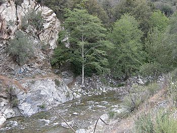
The East Fork is a really important part of the San Gabriel River in Los Angeles County, California. It's like the main starting point for the river. It begins high up in the San Gabriel Mountains within the Angeles National Forest. It flows for about 17 miles (27 km) until it reaches the San Gabriel Reservoir. Here, it joins another part of the river called the West Fork San Gabriel River. Even though many people think of the East Fork as its own river, the U.S. Geological Survey actually considers it the upper part of the main San Gabriel River.
Contents
Exploring the East Fork San Gabriel River
The East Fork is the biggest "headwater" (which means the very beginning) of the San Gabriel River. It starts where two smaller streams, Prairie Fork and Vincent Gulch, meet. This happens near Mount Baden-Powell, high in the mountains.
Where the River Begins
The East Fork begins in the San Gabriel Mountains, which are part of the Angeles National Forest. It flows south and then west. Its journey ends when it reaches the San Gabriel Reservoir. At this point, it meets up with the West Fork San Gabriel River.
Important Streams and Canyons
Many smaller streams flow into the East Fork. These are called tributaries. Some of the main ones are the Prairie Fork, Fish Fork, Iron Fork, and Cattle Canyon. The Fish Fork starts near Mount San Antonio, also known as Mount Baldy, which is the highest peak in the area.
The "Narrows" of the San Gabriel River is a very deep canyon. It flows as much as 6,000 feet (1,800 meters) below the nearby Iron Mountain. A large part of the upper river flows through the Sheep Mountain Wilderness, a protected natural area.
The Mysterious Bridge to Nowhere
One very interesting spot along the East Fork is the Bridge to Nowhere. It's a concrete arch bridge, about 120 feet (37 meters) high. This bridge was once part of a road called East Fork Road. However, the rest of the road was destroyed by a big flood in 1938.
The East Fork Road was supposed to connect Los Angeles to the Angeles Crest Highway. But building it was too expensive because of the tough mountain terrain. Later, in the 1950s, another attempt was made to build a road through Shoemaker Canyon, but it also ran out of money.
Visiting the East Fork Today
Today, the old East Fork Road is used to reach the Heaton Flats trailhead. This is a popular starting point for people who want to explore the San Gabriel Mountains. The area around East Fork Road is one of the most visited parts of the Angeles National Forest.
Many people come here to hike, camp, and even look for gold. Sometimes, as many as 15,000 visitors come each day in the summer. This large number of visitors has unfortunately caused some environmental problems for the East Fork.
 | John T. Biggers |
 | Thomas Blackshear |
 | Mark Bradford |
 | Beverly Buchanan |


