Mount Baden-Powell facts for kids
Quick facts for kids Mount Baden-Powell |
|
|---|---|

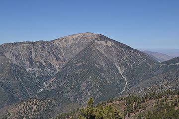
Mount Baden-Powell as seen from Blue Ridge
|
|
| Highest point | |
| Elevation | 9,407 ft (2,867 m) NAVD 88 |
| Prominence | 2,799 ft (853 m) |
| Parent peak | Mount San Antonio |
| Listing | Hundred Peaks Section |
| Geography | |
| Location | Los Angeles County, California, U.S. |
| Parent range | San Gabriel Mountains |
| Topo map | USGS Crystal Lake |
| Climbing | |
| First ascent | 1933 by Weldon Heald |
| Easiest route | Hike |
Mount Baden-Powell is a tall mountain peak in the San Gabriel Mountains of California. It is named after Robert Baden-Powell, 1st Baron Baden-Powell, who started the World Scouting Movement. The United States Geological Survey (USGS) officially recognized the mountain's name in 1931. Before that, people called it East Twin or North Baldy.
About Mount Baden-Powell
Mount Baden-Powell stands at 9,407 feet (2,867 m) high. It is usually considered the fifth highest peak in the San Gabriel Range. However, it is the second highest peak in the range that stands out by more than 1,000 feet (300 m) from its surroundings. It is also the highest peak not connected to the Mount San Antonio mountain group.
This mountain is located within the Angeles National Forest and the San Gabriel Mountains National Monument. These areas help protect the natural beauty and wildlife of the region.
Hiking Adventures
Mount Baden-Powell is a popular spot for hikers. The famous Pacific Crest Trail passes very close to the summit, about 0.25 miles (0.40 km) away. At 9,360 feet (2,850 m), this is the highest point on the Pacific Crest Trail south of the Sierra Nevada mountain range.
Hikers often reach the summit from two main starting points:
- The Mount Islip Saddle, which is near the Little Jimmy Trail Camp.
- The Vincent Gap Trail, which is a moderate to challenging hike with many switchbacks (zigzag paths) starting from Wrightwood.
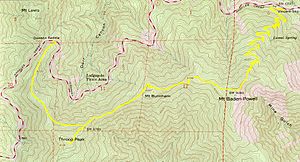
Mount Baden-Powell is also the highest point along The Silver Moccasin Trail. This historic Boy Scout hiking trail is 53-mile (85 km) long. It connects this summit to other peaks like Mount Burnham (less than 1 mile (1.6 km) away), Throop Peak, and Mount Hawkins.
The Vincent Gap hike takes you through different types of forests. You will see trees like Jeffrey Pine, Ponderosa Pine, Lodgepole Pine, and Incense-cedar. There is also an ancient forest of Limber Pine trees, some of which are more than 2,000 years old!
In 1957, several Boy Scout councils from Southern California placed a special marker at the summit. This marker has a plaque dedicated to Lord Baden-Powell, honoring his legacy.
See also
 In Spanish: Monte Baden-Powell para niños
 | Valerie Thomas |
 | Frederick McKinley Jones |
 | George Edward Alcorn Jr. |
 | Thomas Mensah |


