East Greenbush, New York facts for kids
Quick facts for kids
East Greenbush
|
|
|---|---|

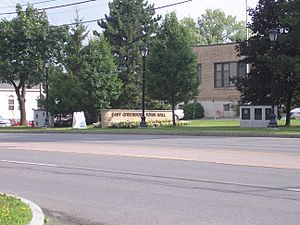
The East Greenbush Town Hall on Columbia Turnpike
|
|
| Etymology: Dutch Greenen Bosch, "pine woods." | |

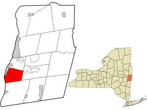
Location in Rensselaer County and the state of New York.
|
|

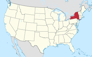
Location of New York in the United States
|
|
| Country | United States |
| State | New York |
| County | Rensselaer |
| Incorporation as town | 1855 |
| Area | |
| • Total | 24.29 sq mi (62.92 km2) |
| • Land | 24.02 sq mi (62.21 km2) |
| • Water | 0.27 sq mi (0.71 km2) |
| Elevation | 236 ft (72 m) |
| Lowest elevation | 0 ft (0 m) |
| Population
(2020)
|
|
| • Total | 16,748 |
| • Density | 689.50/sq mi (266.179/km2) |
| Time zone | UTC-5 (EST) |
| • Summer (DST) | UTC-4 (EDT) |
| Area code(s) | 518 |
| FIPS code | 36-083-22117 |
| FIPS code | 36-22117 |
| GNIS feature ID | 0978918 |
| Wikimedia Commons | East Greenbush, New York |
East Greenbush is a town in Rensselaer County, New York, United States. It's like a neighborhood right next to Albany. In 2020, about 16,748 people lived there. The name "Greenbush" comes from a Dutch phrase meaning "pine woods." This is because the area used to be covered in pine trees.
The first people to settle here were tenants of Kiliaen van Rensselaer around 1630. The town officially became "Clinton" in 1855. Later, in 1858, its name was changed to East Greenbush. Today, it has suburban areas along its main roads and more rural parts in its corners.
Major highways like Interstate 90 go through the town. You'll also find the start of US Route 4 and the end of NY Route 9J here. US Route 9 and US Route 20 run together through the town. Locals often call this combined road "9 and 20."
Contents
Discovering East Greenbush History
East Greenbush was once part of a larger area called the Manor of Rensselaerswyck. It was also part of Albany County before Rensselaer County was created in 1791. The town of Clinton was formed on February 23, 1855. This happened at the same time as the creation of North Greenbush. A few years later, on April 14, 1858, the town's name officially changed to East Greenbush.
Early Settlements and Important Figures
European settlers first arrived along the Hudson River around 1628-1629. A fort was built on Papscanee Island in 1669. The area of East Greenbush itself was settled around 1630. A Dutch Reformed church was built in 1787, and a post office opened in 1845.
From the late 1700s until 1834, a famous person named Edmond-Charles Genêt lived in East Greenbush. He was a French ambassador to the United States. Later, as an American citizen, he served in the New York state government and as a major-general in the state militia.
Historic Roads and Conflicts
The main roads in East Greenbush are very old. They started as post roads built by the English during the French and Indian Wars. The Boston and Albany Turnpike was built in 1800. Today, this road is known as the Columbia Turnpike, which includes US Routes 9 and 20. Another important old road, the Farmer's Turnpike, is now NY Route 9J.
The town also saw events during the Anti-Rent War. This was a time when tenants protested against rent payments. During the War of 1812, a large military camp was set up behind the current Town Hall. Over 5,000 soldiers stayed there, along with a hospital and barracks.
Protecting Natural Areas
In the late 1980s, people worried about new buildings spreading into Papscanee Island. To protect the land, the Open Space Institute bought large parts of it. This helped create the Papscanee Preserve. In 1997, the county took over managing the park. Now, it has signs, trails, and picnic areas. It also celebrates the history of the Mohican people who lived there long ago.
Two historic homes, the John Carner Jr. House and Craver Farmstead, are recognized on the National Register of Historic Places.
Where is East Greenbush?
 |
City of Rennselaer | Town of North Greenbush |  |
|
| Town of Bethlehem | Town of Sand Lake | |||
| Town of Schodack |
East Greenbush Geography
East Greenbush covers about 24.4 square miles (63.1 square kilometers). Most of this area is land, with a small part being water.
The western part of the town, near the Hudson River, has tall bluffs. These bluffs rise between 100 and 300 feet high. There's a small flat area along the river on Papscanee Island. This "island" is actually a peninsula, separated by Papscanee Creek. As you go east, the town becomes rolling hills. Mill Creek and Morden Creek are the main streams here.
East Greenbush shares borders with several other towns. To the north is North Greenbush. To the east is Sand Lake. To the south is Schodack. To the west, it borders the city of Rensselaer. Further west, across the Hudson River, is the town of Bethlehem in Albany County.
Famous People from East Greenbush
Many interesting people have connections to East Greenbush:
- Citizen Genêt: A French ambassador during the French Revolution.
- Solomon Van Rensselaer: A politician and soldier who fought in the War of 1812.
- James Gage: A soldier from the War of 1812. A major battle happened on his farm.
- Mary Edmonia Lewis: A talented sculptor.
- Steven Owens: A member of the Massachusetts House of Representatives.
- Ernie Stautner: A professional football player for the Pittsburgh Steelers.
- Wavy Gravy: An entertainer and peace activist, famous for his role at Woodstock.
- Rich Romer: A professional football player for the Cincinnati Bengals.
- Jennifer Farley: A TV personality known from MTV's Jersey Shore.
- Brian and Matt Lashoff: Brothers who are professional hockey players in the NHL.
- Kevin Smith: A professional baseball player for the New York Yankees.
Community Safety Incidents
East Greenbush has experienced a few notable public safety incidents:
- On February 9, 2004, an incident occurred at Columbia High School. A student fired a shotgun, injuring a teacher.
- On January 10, 2009, New York State Police stopped a taxi on Interstate 90. A passenger in the taxi opened fire, leading to a large police response. The individual was later injured by police and died.
East Greenbush Population Facts
| Historical population | |||
|---|---|---|---|
| Census | Pop. | %± | |
| 1860 | 1,607 | — | |
| 1870 | 1,845 | 14.8% | |
| 1880 | 2,127 | 15.3% | |
| 1890 | 2,171 | 2.1% | |
| 1900 | 2,036 | −6.2% | |
| 1910 | 1,350 | −33.7% | |
| 1920 | 1,558 | 15.4% | |
| 1930 | 3,267 | 109.7% | |
| 1940 | 4,550 | 39.3% | |
| 1950 | 6,338 | 39.3% | |
| 1960 | 9,107 | 43.7% | |
| 1970 | 10,679 | 17.3% | |
| 1980 | 12,913 | 20.9% | |
| 1990 | 14,076 | 9.0% | |
| 2000 | 15,560 | 10.5% | |
| 2010 | 16,473 | 5.9% | |
| 2020 | 16,748 | 1.7% | |
| U.S. Decennial Census | |||
In 2000, there were 15,560 people living in East Greenbush. About 94% of the people were White, and nearly 3% were Black or African American. About 2% were Asian. In 2016, the average household income was estimated to be around $93,984.
Learning in East Greenbush
The East Greenbush Central School District serves the town's students. It includes five public elementary schools: Bell Top, Genêt, Green Meadow, Red Mill, and Donald P. Sutherland. There's also a private Catholic school (Holy Spirit School) and a Montessori school (Woodland Hill Montessori School). For older students, there's Howard L. Goff Middle School and Columbia High School.
East Greenbush Community Library
The East Greenbush Community Library is a great resource for the town. It serves almost 30,000 people, including parts of Schodack. The library is part of the Upper Hudson Library System. This system allows 29 public libraries in Albany and Rensselaer counties to share resources. In 2001, the library moved to its current building on Michael Road.
Neighborhoods and Areas in East Greenbush
East Greenbush has many different communities and locations:
- August Gate: A large neighborhood on Red Mill Road (NY 151).
- Avian Meadows: A neighborhood west of Best, near Best Road.
- Best: A small community in the northeastern part of town.
- Clinton Heights: A suburban neighborhood in the western part of town.
- Clinton Park: A suburban neighborhood along Sherwood Avenue.
- Couse Corners: A small community where US 4 and NY 151 meet.
- East Greenbush: A main community on the Columbia Turnpike (US 9 / US 20).
- Governors' Square East: A neighborhood with a homeowners' association.
- Hampton Manor: A suburban community in the western part of town.
- Luther: A small community on Route 151, east of East Greenbush.
- Onderdonk Estates: A large neighborhood along Columbia Turnpike (US 9 / US 20).
- Plaza View: A neighborhood near the border with Rensselaer City.
- Prospect Heights: A suburban neighborhood in the western part of town.
- Sherwood Park: A suburban neighborhood south of Columbia Turnpike.
- Woodland Park: Another suburban neighborhood south of Columbia Turnpike.
See also
 In Spanish: East Greenbush para niños
 | Roy Wilkins |
 | John Lewis |
 | Linda Carol Brown |

