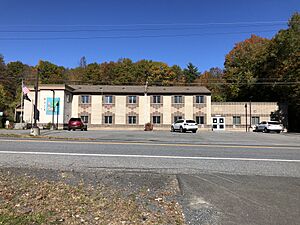
Sand Lake, New York facts for kids
Quick facts for kids
Sand Lake, New York
|
|
|---|---|
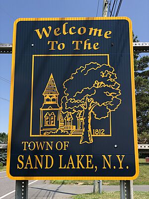
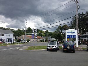
Sign at the west entrance to Sand Lake
|
|
| Motto(s):
A Place of Picnics, Porches and Progress
|
|
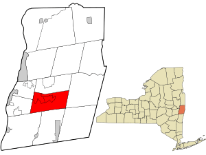
Location in Rensselaer County and the state of New York.
|
|
| Country | United States |
| State | New York |
| County | Rensselaer |
| Government | |
| • Type | Town Board and Council |
| Area | |
| • Total | 36.17 sq mi (93.68 km2) |
| • Land | 35.05 sq mi (90.78 km2) |
| • Water | 1.12 sq mi (2.90 km2) |
| Elevation | 823 ft (251 m) |
| Population
(2020)
|
|
| • Total | 8,348 |
| • Density | 230.80/sq mi (89.112/km2) |
| Time zone | UTC-5 (Eastern (EST)) |
| • Summer (DST) | UTC-4 (EDT) |
| ZIP code |
12153
|
| Area code(s) | 518 |
| FIPS code | 36-65013 |
| GNIS feature ID | 0979455 |
Sand Lake is a town located in the south-central part of Rensselaer County, New York, United States. It is about 13 miles east of Albany. In 2020, the town had a population of 8,348 people.
Sand Lake is known for its four beautiful lakes, which are great for outdoor fun. In the past, many businesses used the power from the Wynants Kill Creek and Burden Lake mills to operate. The area also has very good soil for farming and raising animals.
Contents
History of Sand Lake
Early Beginnings
Long ago, Native Americans lived in the area that is now Sand Lake. In 1629, a Dutch merchant named Kiliaen van Rensselaer received a huge land grant. This land, called the Manor of Rensselaerswyck, became a Dutch colony. It was a massive area, about 48 miles wide and 24 miles long, and included what would become Sand Lake.
In 1664, the English took control, and it became the Province of New York. It briefly returned to Dutch rule in 1672 but was back with the English by 1674.
Dutch settlers began moving into the Sand Lake area in the 1750s, followed by German pioneers. By 1772, Sand Lake was part of the Rensselaerwyck District in Albany County. This area remained under English control until the American Revolutionary War (1775–1783). After the war, in 1792, the larger town of Rensselaerwyck was split into two towns: Greenbush and Stephentown. The area we now know as Sand Lake was part of both these new towns.
An important building, the Union Meetinghouse, was built in 1805. It was used by different church groups and was also a secret stop on the Underground Railroad, helping enslaved people find freedom.
Forming the Town
The town of Sand Lake was officially created on March 21, 1812, from parts of Greenbush and Berlin. It became a full town on March 1, 1813. The town set up official roles like town clerk and assessors to serve its citizens. Calvin Thompson was the first Supervisor, a leader for the town. Daniel M. Gregory became the first postmaster in 1815. The land here is very good for farming, especially for growing small fruits like strawberries.
New church buildings were built in the early 1800s, like the Trinity Lutheran Church in 1816. The Zion Evangelical Lutheran Church also opened in West Sand Lake that same year.
The current borders of Sand Lake were set on March 2, 1848. At that time, the town was divided into two: Sand Lake and Poestenkill. For many years, town meetings were held in homes and inns.
Many schools, both public and private, were started in Sand Lake from 1825 into the early 1900s. A one-room schoolhouse was used from 1895 to 1929.
In 1866, the Wynantskill Improvement Association created three Burden Lakes from the Wynantskill Creek. The water from these lakes powered water wheels for businesses during the Industrial Revolution, like mills.
From 1895 to 1925, an electric trolley service, the Troy and New England Railway, connected Sand Lake to Troy. This nine-mile route helped the town's economy grow by bringing in tourists and summer residents.
In 1964, a new law gave towns more power to manage themselves. In 1968, Rensselaer County changed its government structure. In 1972, Sand Lake opened its first official town hall in a former church building.
The Albert R. Fox House was recognized as an important historical place in 2001.
Hamlets of Sand Lake
The town of Sand Lake includes several smaller communities called hamlets. The main ones are Averill Park, Sand Lake, and West Sand Lake.
Averill Park
Averill Park is a hamlet located near the center of the town. It got its post office in 1880, and the name was changed to Averill Park in 1882. Many textile factories, like Faith Mills, were built here in the 1800s. They used water power from the Wynantskill Creek. Today, Averill Park has retail stores, two churches, and the Averill Park High School. Its main street features buildings from the mid-1800s.
Sand Lake Hamlet
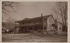
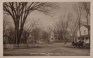
The hamlet of Sand Lake is the smallest of the main hamlets. It has several shops, the Sand Lake Center for the Arts, a post office, and the town hall. You can also find a tavern, a cemetery, and an elementary school here. The hamlet has historic houses, which are spaced out more than in the other hamlets.
West Sand Lake
West Sand Lake is a hamlet in the northwestern part of the town. In 1793, Bernhard Uhlein, a soldier from the American Revolutionary War, settled here. He started a 325-acre farm on land he received. The settlement was first called Ulinesville. Its post office opened in 1834.
The community officially became West Sand Lake in 1838. It is the largest of the four hamlets, with the most people living there. Many houses in the western part of the hamlet date back to the early 1800s. West Sand Lake has many retail businesses, schools, banks, two churches, and a post office.
Other Places in Sand Lake
Besides the main hamlets, Sand Lake also has smaller populated areas like Maple Grove, Sliter's Corner, and Taborton.
Glass Lake Area
The Glass Lake area grew around the Rensselaer Glass Factory, which was started in 1804. This factory community had homes for 34 workers, a store, a school, and a doctor's office. Glass Lake is where the Wynants Kill Creek begins. You can find a historical marker about this area at the intersection of Routes 43 and 66 at Glass Lake Road.
South Sand Lake
The South Sand Lake post office was opened in 1854.
Geography and Nature
The western part of Sand Lake has rolling hills, while the eastern part is quite mountainous. This eastern area is part of the Rensselaer Plateau. Hills like Oak and Perigo are about 900 feet above sea level. The town covers about 36.2 square miles, with most of it being land and a smaller part being water.
Lakes of Sand Lake
Sand Lake is home to four beautiful lakes: Burden Lake, Crooked Lake, Crystal Lake, and Glass Lake. These lakes are filled with many types of freshwater fish, which makes them popular for tourists and fishing.
- Glass Lake is located between Crooked and Crystal Lakes. It covers 123 acres and is partly in Averill Park and Nassau.
- Burden Lake is in the southern part of the town and also partly in Nassau. It is the largest, covering 369 acres.
- Crystal Lake, once called Sand Lake, is the biggest lake in the Averill Park hamlet. It is 66 acres in size.
- Crooked Lake is in the southern part of the town, south of Glass Lake. It covers 113 acres.
The Wynants Kill is a stream that starts at Crooked Lake. It flows through Glass and Burden Lakes and eventually drains into the Hudson River.
Where Sand Lake Is Located
 |
Town of Poestenkill |  |
||
| Town of North Greenbush Town of East Greenbush |
Town of Berlin | |||
| Town of Schodack, Town of Nassau | Town of Stephentown |
Population Information
| Historical population | |||
|---|---|---|---|
| Census | Pop. | %± | |
| 1820 | 3,302 | — | |
| 1830 | 3,671 | 11.2% | |
| 1840 | 4,303 | 17.2% | |
| 1850 | 2,558 | −40.6% | |
| 1860 | 2,502 | −2.2% | |
| 1870 | 2,633 | 5.2% | |
| 1880 | 2,550 | −3.2% | |
| 1890 | 2,555 | 0.2% | |
| 1900 | 2,299 | −10.0% | |
| 1910 | 2,128 | −7.4% | |
| 1920 | 1,916 | −10.0% | |
| 1930 | 2,022 | 5.5% | |
| 1940 | 2,488 | 23.0% | |
| 1950 | 3,254 | 30.8% | |
| 1960 | 4,629 | 42.3% | |
| 1970 | 5,843 | 26.2% | |
| 1980 | 7,022 | 20.2% | |
| 1990 | 7,642 | 8.8% | |
| 2000 | 7,987 | 4.5% | |
| 2010 | 8,530 | 6.8% | |
| 2020 | 8,348 | −2.1% | |
| U.S. Decennial Census | |||
As of the 2020 census, Sand Lake had 8,348 residents. In 2010, there were 8,530 people living in 3,009 households. About 2,229 of these were families. The population density was about 227 people per square mile.
Most of the people in Sand Lake are White (96.4%). Other groups include African American (0.4%), Native American (0.11%), Asian (0.50%), and people of two or more races (1.1%). About 1.5% of the population was of Hispanic or Latino origin. Many residents have German (25.2%), Irish (22.6%), English (14.6%), Italian (13.8%), French (8.9%), or Polish (6.1%) ancestry.
About 37.1% of households had children under 18 living with them. Most households (58.6%) were married couples living together. About 20.6% of households were single individuals. The average household had 2.65 people, and the average family had 3.08 people.
The median age in the town was 39 years old. About 26.6% of the population was under 18, and 10.6% was 65 or older.
The median income for a household in Sand Lake was $77,372. For families, the median income was $97,009. The average income per person in the town was $36,103. About 7.7% of the population lived below the poverty line. This included 6.3% of those under 18 and 10.3% of those 65 or older.
Famous People
- Levancia Holcomb Plumb (1841-1923), a successful businesswoman and reformer.
See also
 In Spanish: Sand Lake (Nueva York) para niños
 | Shirley Ann Jackson |
 | Garett Morgan |
 | J. Ernest Wilkins Jr. |
 | Elijah McCoy |


