Rensselaer, New York facts for kids
Quick facts for kids
Rensselaer
|
||
|---|---|---|
| City of Rensselaer | ||
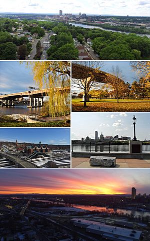
Clockwise from top: Looking Southwest on Washington Ave. towards Albany; Riverfront Park boat dock; Fall foliage beneath the Dunn Memorial Bridge in Riverfront Park; CDTA Albany-Rensselaer Amtrak Station; Albany skyline from the Rensselaer esplanade at DeLaet's Landing; and the sun sets over Albany on a cold winter night.
|
||
|
||
| Etymology: From Kiliaen van Rensselaer, patroon of the region | ||
| Motto(s):
The home of "Yankee Doodle"
|
||
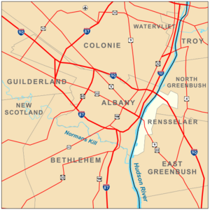
Boundaries of and major thoroughfares through Rensselaer
|
||
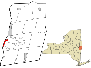
Location in Rensselaer County and the state of New York.
|
||
| Country | ||
| State | ||
| Region | Capital District | |
| County | Rensselaer | |
| Settled | 1630 | |
| Incorporation | 1897 | |
| Government | ||
| • Type | Mayor-council | |
| • Body | ||
| Area | ||
| • Total | 3.51 sq mi (9.10 km2) | |
| • Land | 3.18 sq mi (8.23 km2) | |
| • Water | 0.33 sq mi (0.87 km2) | |
| Elevation | 16 ft (5 m) | |
| Lowest elevation | 0 ft (0 m) | |
| Population
(2020)
|
||
| • Total | 9,210 | |
| • Density | 2,897.14/sq mi (1,118.75/km2) | |
| Time zone | UTC-5 (EST) | |
| • Summer (DST) | UTC-4 (EDT) | |
| ZIP Code |
12144
|
|
| Area codes | 518, 838 | |
| FIPS code | 36-083-61148 | |
| FIPS code | 36-61148 | |
| GNIS feature ID | 0962384 | |
| Wikimedia Commons | Rensselaer, New York | |
| Website | http://www.rensselaerny.gov | |
Rensselaer (pronounced ren-suh-LEER) is a city in Rensselaer County, New York. It sits on the east side of the Hudson River, right across from Albany. In 2020, about 9,210 people lived here.
The Dutch first settled this area in the 1600s, calling it 't Greyn Bos, which later became Greenbush in English. Rensselaer was important for making dyes and was home to the first aspirin factory in the United States. In the 1800s, it became a major railroad center. Today, the Albany-Rensselaer train station is one of the busiest Amtrak stations in the country.
Contents
History of Rensselaer
![]() New Netherland 1609
New Netherland 1609
![]() Province of New York 1667
Province of New York 1667
![]() New York State 1776
New York State 1776
Early Settlement and Growth
Native Americans called this area Petuquapoern and Juscum catick. The Dutch claimed the land in 1609 after Henry Hudson explored the Hudson River. The area was first called "De Laet's Burg." People started settling here around 1628. By 1642, there was a brewery and many farms. A ferry also connected this area to Beverwyck (now Albany).
Greenbush was the first Dutch settlement here. The village of Bath (also called Bath-on-Hudson) was planned in 1795 and became a village before 1874.
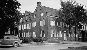
The Van Rensselaer family owned all the land that would become Rensselaer County. They built a home in what is now Rensselaer. Hendrick van Rensselaer, a grandson of Kiliaen van Rensselaer, built Fort Crailo around 1712. This fort was built where Dominie Megapolensis had his house in 1642. Fort Crailo was made bigger between 1762 and 1768.
British and colonial soldiers often camped at Fort Crailo. It's said that in 1755, a British Army surgeon named Richard Shuckburgh wrote the song "Yankee Doodle" here. He wrote it to make fun of the colonial soldiers who fought with the British in the French and Indian Wars. Fort Crailo became a National Historic Landmark in 1961.
The area known as Greenbush was about one square mile. It was bought in 1810. The village of Greenbush was officially formed in 1815. In 1897, Greenbush became a city and its name was changed to Rensselaer. In 1902, the city grew by adding the village of Bath and part of the town of East Greenbush.
Industrial Growth and Modern Changes
In the 1800s, Rensselaer became important for the Boston and Albany Railroad. It had a passenger station, shops, and freight houses. People used a ferry to go between Van Rensselaer Island and downtown Albany. In 1871, the Maiden Lane Bridge replaced the ferry. In 1903, the water separating the island from the mainland was filled in.
In 1881, the Hudson Riverfront Art Park in Rensselaer was where the first major league Grand Slam in baseball history happened.
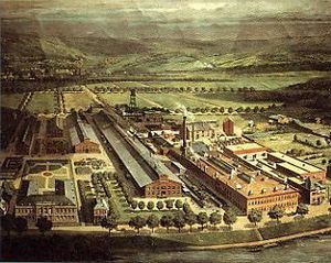
In 1882, the Hudson River Aniline and Color Works built its first dye plant in Rensselaer. It burned down 13 years later but was rebuilt. In 1903, the Bayer Corporation bought the plant. They built a large, modern factory, and the Rensselaer plant became the main place in the US for making brand-name Aspirin.
During World War I in 1917, the US government took over the plant because Bayer was a German company. Later, it was owned by other companies like General Aniline and Film and BASF. In 1927, it was the first plant in the US to make solid diazo salts, which are used in dyes. The plant was the oldest dye plant in continuous operation in the 1990s. It also made more dye than any other plant in the US. The plant closed on December 28, 2000.
In 1932, the Port of Albany-Rensselaer was built next to the BASF plant. Most of it is in Albany, but about 35 acres are in southern Rensselaer. The docks on the Rensselaer side were built in the 1970s.
The 1960s brought big changes to Rensselaer. In 1967, the current Dunn Memorial Bridge was built between Albany and Rensselaer. In 1968, the Amtrak train station moved from Albany to Rensselaer. The old Maiden Lane Bridge and railroad buildings were torn down. In 1969, the Rensselaer City School high/middle school campus was built.
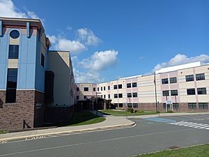
In the 2000s, new developments started in Rensselaer. In 2007, a new campus for the Rensselaer City School District was built. This new school replaced the old Rensselaer Middle High School and Van Rensselaer Elementary. The old elementary school is now home to the Doane Stuart School. The land where the old middle-high school was is being redeveloped into a waterfront area called DeLaet's Landing. The first apartment building there opened in 2019.
In 2023, plans were approved for the Barnet Mills Apartments. This project will improve an area along the Hudson River that used to be Barnet Mills, which made wool products. The city is also planning to build a riverfront trail system. This trail will connect the city's boat launch to the Hudson Riverfront Art Park.
Library Services
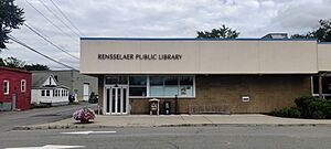
The Rensselaer Public Library is part of the Upper Hudson Library System. This system allows libraries in Albany and Rensselaer counties to share resources. In 2009, the library moved to its current location on East Street from Broadway.
Geography and Location
Rensselaer covers about 3.3 square miles (9.1 square kilometers). Most of this is land, with about 0.3 square miles (0.87 square kilometers) being water. The western and southern parts of the city are flat. However, the center and northern areas have steep slopes going east.
The city is next to the Hudson River, with Albany County and the city of Albany on the other side. To the north, Rensselaer borders the town of North Greenbush. To the south and east, it borders the town of East Greenbush.
City Areas and Parks
Neighborhoods
- Northern Rensselaer Hills
- Eastland Park
- The Mansions
- Sterling Ridge
- Eastern Rensselaer Hills
- East Street Neighborhood
- Western Rensselaer Hills
- 1st Street Neighborhood
- 2nd Street Neighborhood
- 3rd Street Neighborhood
- Washington Avenue Neighborhood
- Broadway Neighborhood
- Southern Development Plain
- Downtown Development District
- Hudson River Shoreline
Parks and Recreation Spots
- Coyne Field
- Huyck Memorial Park
- Hudson Riverfront Art Park
- Waterfront Esplanade at DeLaet's Landing
- Plum Street Park
- Walter S. Pratt Memorial Playground (Sprinkler Park)
- Hollow Park
- First Street Park
- Tracy Street Park
- Hilton Park Boat Launch
- 8th Street Park
- Eastland Park
- Valley View Playground
Population and People
| Historical population | |||
|---|---|---|---|
| Census | Pop. | %± | |
| 1880 | 3,295 | — | |
| 1890 | 7,301 | 121.6% | |
| 1900 | 7,466 | 2.3% | |
| 1910 | 10,711 | 43.5% | |
| 1920 | 10,823 | 1.0% | |
| 1930 | 11,233 | 3.8% | |
| 1940 | 10,768 | −4.1% | |
| 1950 | 10,856 | 0.8% | |
| 1960 | 10,506 | −3.2% | |
| 1970 | 10,136 | −3.5% | |
| 1980 | 9,047 | −10.7% | |
| 1990 | 8,255 | −8.8% | |
| 2000 | 7,761 | −6.0% | |
| 2010 | 9,392 | 21.0% | |
| 2020 | 9,210 | −1.9% | |
| U.S. Decennial Census | |||
In 2010, there were 9,392 people living in Rensselaer. About 82.11% of the people were White, and 12.06% were African American. About 4.72% of the population was Hispanic or Latino.
The average age in the city was 36 years old. About 25% of the population was under 18.
Education in Rensselaer
The Rensselaer City School District runs the public schools in the city. It has one campus that includes an elementary, middle, and high school. The Doane Stuart is the only private school in Rensselaer. It opened its campus at 199 Washington Ave. on September 16, 2009. This campus teaches students from Kindergarten through 12th grade. It used to be the location of Van Rensselaer Elementary school.
Transportation
Roads
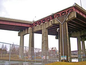
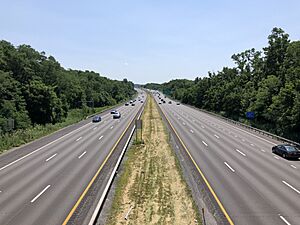
Interstate 90 (I-90) is a major highway that goes across the United States. It passes through the northern part of Rensselaer. I-90 crosses the Hudson River on the Patroon Island Bridge, connecting Rensselaer to Albany. Other important roads in the city include U.S. Route 9 and U.S. Route 20.
Train Travel
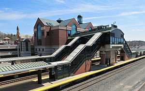
The Albany-Rensselaer Amtrak station is the main train station for Rensselaer, Albany, and Troy. Many trains, like the Empire Service, travel from here to New York City. Other trains like the Ethan Allen, Adirondack, and Maple Leaf also stop here, connecting to places like Vermont, Montreal, Buffalo, and Toronto.
As of 2020, this was Amtrak's ninth-busiest station in the country. It is also the second busiest in New York State, after Pennsylvania Station (New York City) in New York City. This is because many people travel to and from New York City from this station.
The Lake Shore Limited is a long-distance train that also uses this station. It has two parts: one from New York City and one from Boston. These two parts join at Albany-Rensselaer to travel together to Chicago. When traveling east, the train splits into two parts at Albany-Rensselaer.
Power Facilities
New York Independent System Operator (NYISO)
The headquarters for the New York Independent System Operator (NYISO) is located nearby. The NYISO manages how electricity flows across New York State. It also runs the market where electricity is bought and sold in New York.
Empire Generating Company
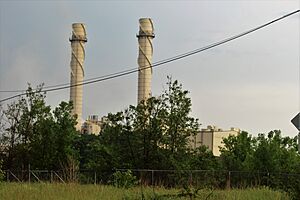
The Empire Generating Co. operates a large power plant in Rensselaer. This plant started working in 2010. It uses natural gas to create electricity. It has two combustion turbines that produce steam. This steam then powers a steam turbine. All the turbines are made by General Electric. The plant uses a special system to cool itself with air, which helps save water.
The power plant is located on 88 acres of land that used to be an industrial area. In 2017, it produced a lot of electricity for the state. A walking and biking path was built near the plant as part of its development.
See also
 In Spanish: Rensselaer (Nueva York) para niños
 | Emma Amos |
 | Edward Mitchell Bannister |
 | Larry D. Alexander |
 | Ernie Barnes |


