
East Kingston, New Hampshire facts for kids
Quick facts for kids
East Kingston, New Hampshire
|
||
|---|---|---|

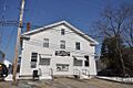
The former railroad station
|
||
|
||

Location in Rockingham County and the state of New Hampshire.
|
||
| Country | United States | |
| State | New Hampshire | |
| County | Rockingham | |
| Incorporated | 1738 | |
| Villages |
|
|
| Area | ||
| • Total | 9.97 sq mi (25.83 km2) | |
| • Land | 9.92 sq mi (25.68 km2) | |
| • Water | 0.06 sq mi (0.15 km2) 0.56% | |
| Elevation | 141 ft (43 m) | |
| Population
(2020)
|
||
| • Total | 2,441 | |
| • Density | 246/sq mi (95.0/km2) | |
| Time zone | UTC-5 (Eastern) | |
| • Summer (DST) | UTC-4 (Eastern) | |
| ZIP code |
03827
|
|
| Area code(s) | 603 | |
| FIPS code | 33-21380 | |
| GNIS feature ID | 0873585 | |

East Kingston is a small town located in Rockingham County, New Hampshire, in the United States. In 2020, about 2,441 people lived there. It's known for its quiet, rural feel.
Contents
History of East Kingston
East Kingston was once part of a larger town called Kingston. It was known as "Kingston East Parish." In 1738, the people living there asked for their own town. They felt it was too far to go to school and church in Kingston. Governor Jonathan Belcher agreed and gave East Kingston its own official town charter.
The town started growing around a mill. This mill used water power from Trickling Falls, which is near Powwow Pond. Farms in East Kingston did very well because the soil was good for growing crops.
Before refrigerators were common, cutting ice from the Powwow River was a big business in winter. The ice was stored and used to keep food cool. The New England Brick Company was also a major industry in the town for a long time.
Geography of East Kingston
East Kingston covers about 25.8 square kilometers (about 10 square miles). Most of this area is land, with only a small part being water.
Rivers and Waterways
The southern part of East Kingston is drained by the Powwow River. This river is a smaller stream that flows into the Merrimack River. The rest of the town's water flows into Great Brook, which then joins the Exeter River. The Exeter River eventually reaches the Atlantic Ocean through Great Bay.
A small part of Powwow Pond, which is about 285 acres, is also located within East Kingston. The town is split between two main water systems, called watersheds. The northern part of town sends its water towards the coast (Piscataqua River watershed). The southern part sends its water towards the Merrimack River.
Highest Point
The highest spot in East Kingston is the top of Morse Hill. It stands about 96 meters (315 feet) above sea level.
Neighboring Towns
East Kingston shares its borders with several other towns:
- Exeter to the northeast
- Kensington to the east
- South Hampton to the south
- Newton to the southwest
- Kingston to the west
People of East Kingston
The number of people living in East Kingston has changed over time. Here's a look at the population counts from different years:
| Historical population | |||
|---|---|---|---|
| Census | Pop. | %± | |
| 1790 | 358 | — | |
| 1800 | 392 | 9.5% | |
| 1810 | 442 | 12.8% | |
| 1820 | 443 | 0.2% | |
| 1830 | 442 | −0.2% | |
| 1840 | 551 | 24.7% | |
| 1850 | 532 | −3.4% | |
| 1860 | 598 | 12.4% | |
| 1870 | 553 | −7.5% | |
| 1880 | 576 | 4.2% | |
| 1890 | 461 | −20.0% | |
| 1900 | 496 | 7.6% | |
| 1910 | 413 | −16.7% | |
| 1920 | 384 | −7.0% | |
| 1930 | 347 | −9.6% | |
| 1940 | 424 | 22.2% | |
| 1950 | 449 | 5.9% | |
| 1960 | 574 | 27.8% | |
| 1970 | 838 | 46.0% | |
| 1980 | 1,135 | 35.4% | |
| 1990 | 1,352 | 19.1% | |
| 2000 | 1,784 | 32.0% | |
| 2010 | 2,357 | 32.1% | |
| 2020 | 2,441 | 3.6% | |
| U.S. Decennial Census | |||
In 2000, there were 1,784 people living in East Kingston. Most families were married couples living together. About 38% of households had children under 18. The average age of people in town was 38 years old.
Notable People
Some well-known people have connections to East Kingston:
- Tom Eaton (born 1971), a composer who has been nominated for a Grammy Award.
- Daniel Tilton (1763–1830), who served as a judge in the Mississippi territory.
- Ebenezer Webster (1739–1806), a military leader during the American Revolution.
Images for kids
-
The East Kingston Town Hall.

See also
 In Spanish: East Kingston (Nuevo Hampshire) para niños
