East Loch Tarbert, Argyll facts for kids

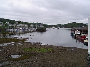
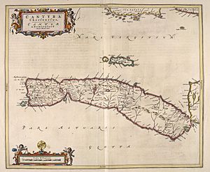
East Loch Tarbert, Argyll is a small sea loch (which is a Scottish word for a lake or a narrow arm of the sea) in Scotland. It is on the eastern side of the Kintyre peninsula. This loch is actually part of a much larger sea loch called Loch Fyne.
The village of Tarbert sits along the shores of East Loch Tarbert. This loch is separated from West Loch Tarbert by a very narrow strip of land, called an isthmus. This land bridge is only about 1.5 kilometers (0.93 miles) long.
Contents
A Clever Viking King
Magnus Barefoot's Trick
Long ago, a powerful Viking ruler named Magnus Barefoot was the King of Norway. He wanted to own more land in the Hebrides, a group of islands off the west coast of Scotland.
Around the year 1098, King Magnus came up with a very clever plan. He made a deal with the Scottish King, Malcolm III of Scotland. The agreement said that Magnus could claim any land on the west coast that a ship could sail around.
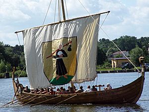
Magnus thought the Kintyre peninsula was very good land. To claim it, he had his longship dragged across the narrow strip of land at Tarbert. He even sat at the ship's steering oar, pretending to "sail" across the land. Because his ship technically "sailed" around Kintyre, he claimed the whole peninsula! Kintyre then stayed under Norse (Viking) rule for more than twelve years.
Robert the Bruce's Journey
More than two hundred years later, another famous king, Robert the Bruce, did something similar. This was during the Scottish Wars of Independence, when Scotland was fighting for its freedom from England.
In 1326, Robert the Bruce also had his ship pulled across the Tarbert isthmus. He used tree trunks as rollers to help move the ship. He did this to show his strength and impress the powerful clan leaders in Argyll.
Plans for a Canal
Avoiding Dangerous Seas
In the 1700s, people realized that dragging ships across the land was a lot of work. They also wanted to avoid the dangerous storms and strong currents around the Mull of Kintyre, which is the very southern tip of the peninsula.
A writer named Thomas Pennant noted that even large sea-going boats, weighing up to 10 tons, were being pulled over the Tarbert isthmus. This showed how important it was to find a safer route.
James Watt's Idea
The famous inventor James Watt, known for improving the steam engine, looked at the area. He thought it would be possible to build a canal between East Loch Tarbert and West Loch Tarbert. A canal would allow ships to sail straight through, avoiding the long and risky journey around the Mull of Kintyre.
About 60 years later, people estimated that building a canal without any locks would cost about £90,000. However, the plan was never carried out. Another canal, the Crinan Canal, was built in 1801. This made the Tarbert canal plan unnecessary.
Tarbert Today
Today, the Tarbert (Loch Fyne) Harbour Commissioners manage East Loch Tarbert. Their control covers the area from Garvell Point in the north to Oakenhead or Rudha Loigste Point in the south.
The inner harbour has several places for boats to dock and ramps for launching them. There are also 80 special berths (parking spots) for yachts and other boats used for fun. This makes Tarbert a popular spot for sailing and leisure activities.
 | Delilah Pierce |
 | Gordon Parks |
 | Augusta Savage |
 | Charles Ethan Porter |


