
East Trinity facts for kids
Quick facts for kids East TrinityQueensland |
|||||||||||||||
|---|---|---|---|---|---|---|---|---|---|---|---|---|---|---|---|
.jpg)
East Trinity in the foreground with Trinity Inlet beyond and Cairns suburbs through to Mount Sheridan, 2013
|
|||||||||||||||

East Trinity
Location in Queensland
|
|||||||||||||||
| Population | 238 (2021 census) | ||||||||||||||
| • Density | 2.527/km2 (6.54/sq mi) | ||||||||||||||
| Postcode(s) | 4871 | ||||||||||||||
| Area | 94.2 km2 (36.4 sq mi) | ||||||||||||||
| Time zone | AEST (UTC+10:00) | ||||||||||||||
| Location |
|
||||||||||||||
| LGA(s) | Cairns Region | ||||||||||||||
| State electorate(s) | Mulgrave | ||||||||||||||
| Federal Division(s) | Kennedy | ||||||||||||||
|
|||||||||||||||
East Trinity is a small coastal area in Queensland, Australia. It is a rural locality within the Cairns Region. It used to be called Trinity East.
In 2021, about 238 people lived in East Trinity. The small town of Giangurra is located on its northern coast.
Contents
Exploring East Trinity's Geography
East Trinity is a unique place. It completely surrounds another small area called Glen Boughton.
The northern part of East Trinity touches the Coral Sea. To the west, you'll find Trinity Inlet. Pine Creek forms the south-western border. The Murray Prior Range makes up the eastern boundary.
Some areas here have had problems with "acid sulfate soil." This happens when certain soils are exposed to air. It can harm the land and water. Luckily, people have worked to fix these issues. They are making the environment healthier again.
Mountains of East Trinity

East Trinity has several mountains. They are all part of the Murray Prior Range. This range runs along the eastern edge of the area.
Here are some of the mountains, from north to south:
- Mount Yarrabah (16°54′17″S 145°50′37″E / 16.9048°S 145.8435°E) is 632 metres (2,073 ft) tall.
- Mount Murray Prior (16°55′49″S 145°50′54″E / 16.9302°S 145.8483°E) reaches 774 metres (2,539 ft).
- Mount Gorton (16°56′56″S 145°51′50″E / 16.9490°S 145.8639°E) is 798 metres (2,618 ft) high.
- May Peak (16°58′12″S 145°51′32″E / 16.9701°S 145.8589°E) is the tallest at 834 metres (2,736 ft).
Bays and Headlands

Along the coast of East Trinity, you'll find many beautiful bays and headlands. These are natural features of the coastline.
Here are some of them, from west to east:
- Trinity Bay is west of False Cape. Lieutenant James Cook named it in 1770. He named it after Trinity Sunday.
- Trinity Inlet (16°55′35″S 145°46′59″E / 16.9263°S 145.7830°E)
- Stafford Point (16°55′07″S 145°47′23″E / 16.9185°S 145.7898°E)
- Rolling Bay (16°54′25″S 145°48′35″E / 16.9070°S 145.8098°E)
- Bessie Point (16°54′13″S 145°48′45″E / 16.9035°S 145.8124°E)
- Sturt Cove (16°53′51″S 145°49′12″E / 16.8976°S 145.8201°E)
- Lyons Point (16°53′24″S 145°49′33″E / 16.8899°S 145.8257°E)
- Brown Bay (16°53′07″S 145°49′57″E / 16.8852°S 145.8324°E)
- Sunny Bay (16°52′31″S 145°50′42″E / 16.8754°S 145.8451°E)
- False Cape (16°52′17″S 145°50′56″E / 16.8713°S 145.8488°E)
- Mission Bay is east of False Cape (16°53′12″S 145°52′51″E / 16.8868°S 145.8808°E).
A Look at East Trinity's History
East Trinity is part of the traditional land of the Yidiny people. They are an Aboriginal group.
Before 2002, the area was known as Trinity East.
In 2020, people discussed ideas for the future of East Trinity. These included building a new town and a bridge or tunnel. This would connect East Trinity to Cairns City. There were also ideas for eco-tourism, which means tourism that protects nature.
Population of East Trinity
The number of people living in East Trinity has grown over the years.
- In 2011, there were 111 people.
- By 2016, the population grew to 212 people.
- In 2021, the population was 238 people.
Special Places: Heritage Listings
East Trinity has some special places called heritage listings. These are sites that are important to history or culture. They are protected so future generations can enjoy them.
Here are some heritage-listed places:
- Bessie Point, off Pine Creek-Yarrabah Road: This is a Hydrographic Survey Bench Mark. It's a marker used for mapping water areas.
- Yarrabah Road: This is where you can find the False Cape Battery. This was a military defense site.
Schools and Education
There are no schools directly in East Trinity. Students usually go to schools in nearby towns.
The closest primary schools are Yarrabah State School in Yarrabah and Gordonvale State School in Gordonvale. For high school, students can attend Yarrabah State School (up to Year 10) or Gordonvale State High School.
Images for kids
-
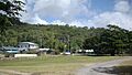
Giangurra town in East Trinity
-
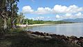
View across Rolling Bay and Trinity Bay from the beach at Pine Creek Yarrabah Road, East Trinity, 2018


