Echo, Utah facts for kids
Quick facts for kids
Echo
|
|
|---|---|

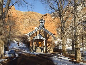
The Old Echo Church
|
|

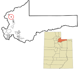
Location in Summit County and the state of Utah
|
|
| Country | United States |
| State | Utah |
| County | Summit |
| Settled | 1854 |
| Founded by | James Bromley |
| Named for | Echo Canyon |
| Elevation | 5,748 ft (1,752 m) |
| Population
(2010)
|
|
| • Total | 56 |
| Time zone | UTC-7 (Mountain (MST)) |
| • Summer (DST) | UTC-6 (MDT) |
| ZIP code |
84024
|
| Area code(s) | 435 |
| GNIS feature ID | 2584763 |
Echo is a small community in Summit County, Utah, in the United States. It's called a census-designated place because it's a special area defined for gathering population data. In 2010, only 56 people lived there. Echo was started in 1854 and got its name from the beautiful Echo Canyon nearby.
History of Echo
Echo began as a resting spot for travelers on the Mormon Trail. This was a famous route used by pioneers heading west. Later, Echo became an important meeting point for trains. It connected the First transcontinental railroad with a smaller train line. This smaller line went to the silver mines near Park City.
As cars became popular, Echo also became a key road junction. The main road from Wyoming split here. One path went towards Salt Lake City and then to San Francisco, California. The other path went to Ogden and continued to Portland, Oregon. Today, these main roads are modern freeways called Interstate 80 and Interstate 84.
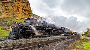
Echo was very important for the Union Pacific Railroad. It was a place where steam trains could stop to get more coal and water. This was needed before they entered the steep Echo Canyon. Sometimes, extra helper locomotives were added at Echo. These helped push trains up the very steep hill to Wahsatch. There used to be a huge coaling tower and many other railroad buildings in Echo. The town was busiest during World War II.
After the war, trains started using diesel fuel instead of steam. This meant they didn't need coal and water stops anymore. So, the coaling tower and most of the old railroad buildings were taken down.
By the 1960s, Echo had become much smaller. Even though it was still at the crossing of two major highways, it mostly had just a few buildings left. These included some homes, a motel, a restaurant, and a bus station. Nearby, Echo Canyon is still a stunning place. It has tall rock walls and amazing scenery. The canyon starts just east of Echo and ends outside of Wahsatch, Utah.
People of Echo
In 2010, there were 56 people living in Echo. There were 31 houses. Most of the people (96.4%) were White. About 3.6% were American Native and Alaska Native. Also, 19.6% of the people were Hispanic or Latino.
Schools in Echo
Children in Echo go to schools in the North Summit School District.
Echo's Climate
Echo has a continental climate. This means it has cold, snowy winters. Summers are hot, but the temperature changes a lot between day and night.
| Climate data for Echo Dam, Utah, 1991–2020 normals, extremes 1940–present | |||||||||||||
|---|---|---|---|---|---|---|---|---|---|---|---|---|---|
| Month | Jan | Feb | Mar | Apr | May | Jun | Jul | Aug | Sep | Oct | Nov | Dec | Year |
| Record high °F (°C) | 59 (15) |
67 (19) |
76 (24) |
85 (29) |
91 (33) |
101 (38) |
100 (38) |
100 (38) |
99 (37) |
86 (30) |
75 (24) |
65 (18) |
101 (38) |
| Mean maximum °F (°C) | 48.5 (9.2) |
53.8 (12.1) |
66.0 (18.9) |
74.4 (23.6) |
82.3 (27.9) |
90.7 (32.6) |
95.4 (35.2) |
93.9 (34.4) |
88.3 (31.3) |
78.9 (26.1) |
65.0 (18.3) |
50.9 (10.5) |
96.0 (35.6) |
| Mean daily maximum °F (°C) | 35.1 (1.7) |
40.6 (4.8) |
51.9 (11.1) |
59.4 (15.2) |
69.1 (20.6) |
80.3 (26.8) |
88.9 (31.6) |
87.2 (30.7) |
78.3 (25.7) |
64.5 (18.1) |
48.4 (9.1) |
35.6 (2.0) |
61.6 (16.4) |
| Daily mean °F (°C) | 23.7 (−4.6) |
28.3 (−2.1) |
38.3 (3.5) |
45.1 (7.3) |
53.5 (11.9) |
62.0 (16.7) |
69.9 (21.1) |
68.3 (20.2) |
59.5 (15.3) |
47.7 (8.7) |
35.3 (1.8) |
24.9 (−3.9) |
46.4 (8.0) |
| Mean daily minimum °F (°C) | 12.2 (−11.0) |
16.0 (−8.9) |
24.8 (−4.0) |
30.7 (−0.7) |
37.8 (3.2) |
43.8 (6.6) |
50.8 (10.4) |
49.4 (9.7) |
40.8 (4.9) |
30.9 (−0.6) |
22.3 (−5.4) |
14.2 (−9.9) |
31.1 (−0.5) |
| Mean minimum °F (°C) | −10.1 (−23.4) |
−7.0 (−21.7) |
7.2 (−13.8) |
17.2 (−8.2) |
24.8 (−4.0) |
32.0 (0.0) |
40.8 (4.9) |
38.6 (3.7) |
27.5 (−2.5) |
16.4 (−8.7) |
2.9 (−16.2) |
−7.1 (−21.7) |
−14.3 (−25.7) |
| Record low °F (°C) | −34 (−37) |
−34 (−37) |
−25 (−32) |
2 (−17) |
16 (−9) |
22 (−6) |
30 (−1) |
23 (−5) |
14 (−10) |
−7 (−22) |
−21 (−29) |
−32 (−36) |
−34 (−37) |
| Average precipitation inches (mm) | 1.22 (31) |
0.94 (24) |
1.19 (30) |
1.47 (37) |
1.93 (49) |
1.18 (30) |
0.71 (18) |
0.83 (21) |
1.22 (31) |
1.43 (36) |
1.32 (34) |
1.29 (33) |
14.73 (374) |
| Average snowfall inches (cm) | 17.3 (44) |
12.0 (30) |
8.2 (21) |
4.9 (12) |
0.7 (1.8) |
0.0 (0.0) |
0.0 (0.0) |
0.0 (0.0) |
0.5 (1.3) |
2.0 (5.1) |
10.3 (26) |
16.4 (42) |
72.3 (184) |
| Average precipitation days (≥ 0.01 in) | 9.8 | 9.0 | 9.3 | 9.6 | 9.9 | 6.1 | 4.4 | 5.8 | 5.9 | 7.3 | 8.4 | 9.9 | 95.4 |
| Average snowy days (≥ 0.1 in) | 7.3 | 6.1 | 3.5 | 2.4 | 0.4 | 0.0 | 0.0 | 0.0 | 0.1 | 0.9 | 4.3 | 7.0 | 32.0 |
| Source: NOAA | |||||||||||||
See also
 In Spanish: Echo (Utah) para niños
 | Shirley Ann Jackson |
 | Garett Morgan |
 | J. Ernest Wilkins Jr. |
 | Elijah McCoy |


