El Moro, Colorado facts for kids
Quick facts for kids
El Moro, Colorado
|
|
|---|---|

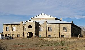
The former El Moro Public School (now privately held).
|
|

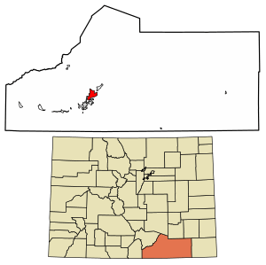
Location of the El Moro CDP in Las Animas County, Colorado.
|
|
| Country | |
| State | |
| County | Las Animas County |
| Government | |
| • Type | unincorporated community |
| Area | |
| • Total | 11.116 sq mi (28.791 km2) |
| • Land | 11.091 sq mi (28.725 km2) |
| • Water | 0.025 sq mi (0.066 km2) |
| Elevation | 5,880 ft (1,790 m) |
| Population
(2020)
|
|
| • Total | 216 |
| • Density | 19.43/sq mi (7.502/km2) |
| Time zone | UTC-7 (MST) |
| • Summer (DST) | UTC-6 (MDT) |
| ZIP Code |
Trinidad 81082
|
| Area code(s) | 719 |
| GNIS feature ID | 2583233 |
El Moro is a small community in Las Animas County, Colorado, United States. It is called an unincorporated community because it doesn't have its own local government. It is also a census-designated place (CDP), which means the United States Census Bureau counts its population for official records.
In 2020, about 216 people lived in El Moro. The local post office in Trinidad serves the area.
History of El Moro
The name El Moro comes from the Spanish word for "the Moor". The community got its own post office in 1876. This post office helped people send and receive mail until 1933.
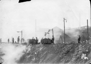
A big company called Colorado Fuel & Iron (CF&I) started operating in El Moro in 1892. They ran a large coal mine there. Over the years, more than 8 million tons of coal were sent from El Moro. This coal was moved using CF&I's special narrow gauge railway. This railway connected to the Colorado & Southern line, helping transport the coal to other places.
Geography and Location
El Moro is located in the western part of Las Animas County. It is right next to the city of Trinidad, which is the main town, or county seat, of Las Animas County.
Several important roads pass near El Moro. U.S. Route 160 runs along its southeastern edge. This road leads southwest about 3.5 miles (5.6 km) to the center of Trinidad. It also goes east to Springfield. U.S. Route 350 starts near El Moro and heads northeast to La Junta. The city of Pueblo is about 81 miles (130 km) north, reachable by Interstate 25, which is just west of El Moro.
The Purgatoire River flows through the community. This river eventually flows northeast towards the Arkansas River. El Moro covers an area of about 28.791 square kilometers (11.116 sq mi). A small part of this area, about 0.066 square kilometers (0.025 sq mi), is water.
Population Data
The United States Census Bureau first officially counted El Moro as a census-designated place for the United States Census 2010. This means they started tracking its population separately.
| El Moro CDP, Colorado | ||
|---|---|---|
| Year | Pop. | ±% |
| 2010 | 221 | — |
| 2020 | 216 | −2.3% |
| Source: United States Census Bureau | ||
The population numbers show how many people lived in El Moro during these specific years. In 2010, there were 221 residents, and in 2020, the population was 216.
See also
 In Spanish: El Moro (Colorado) para niños
 | Percy Lavon Julian |
 | Katherine Johnson |
 | George Washington Carver |
 | Annie Easley |


