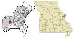
Ellisville, Missouri facts for kids
Quick facts for kids
Ellisville, Missouri
|
|
|---|---|

Location of Ellisville, Missouri
|
|
| Country | United States |
| State | Missouri |
| County | St. Louis |
| Area | |
| • Total | 4.37 sq mi (11.31 km2) |
| • Land | 4.37 sq mi (11.31 km2) |
| • Water | 0.00 sq mi (0.00 km2) |
| Elevation | 722 ft (220 m) |
| Population
(2020)
|
|
| • Total | 9,985 |
| • Density | 2,287.51/sq mi (883.15/km2) |
| Time zone | UTC-6 (Central (CST)) |
| • Summer (DST) | UTC-5 (CDT) |
| ZIP codes |
63011, 63021, 63038
|
| Area code(s) | 636 |
| FIPS code | 29-21898 |
| GNIS feature ID | 2394664 |
Ellisville is a city in St. Louis County, Missouri, in the United States. It is part of the larger Greater St. Louis area. Ellisville is a western suburb of St. Louis. In 2020, about 9,985 people lived there.
In 2009, Money magazine named Ellisville one of the "Best Places to Live in America." It was ranked #25 on their yearly list.
Contents
Discovering Ellisville's Past
Ellisville was first settled by Captain James Harvey Ferris from Kentucky. This happened before 1837. He built a house south of Manchester. The bricks for this house were made by enslaved people. Because of this, the house was also called the "Brick Place."
Captain Ferris later sold the house to Vespasian Ellis. Ellis was a newspaper editor in St. Louis. He worked on newspapers like the Old School Democrat. In 1842, Ellis became a United States consul to Venezuela. He sold his farm to William A. Hereford in 1842 or 1843.
How Ellisville Got Its Name
William A. Hereford was from Virginia. He is believed to have named the town Ellisville. He named it after his old post office in Ellisville, Virginia. Hereford opened the first post office in Ellisville, Missouri, on May 2, 1843. Some people think the Ellis House itself was used as the post office for a while.
Changes Through the Years
Hereford sold the property to Samuel Wilson. Wilson then sold it to Major Clarkson from Kentucky. Clarkson Road is named after him. Major Clarkson sold the land to Captain Benjamin F. Hutchinson. Captain Hutchinson was a steamboat captain. He owned several steamboats. He also raised horses and planted many fruit trees. This greatly improved the area. In 1868, Captain Hutchinson divided his farm into smaller lots.
Later, Adam Doering bought the brick house and much of the land. John Henry William Rasch bought the house around 1896. The original Ellisville House stood until 1969. It was then taken down.
Exploring Ellisville's Location
Ellisville covers about 4.39 square miles (11.37 square kilometers) of land. It is located about 13 miles west of the city limits of St. Louis.
Roads and Nearby Areas
Ellisville is about 5 miles south of Interstate 64. It is also 5 miles north of Interstate 44. Missouri Route 100 (Manchester Road) runs east-west through the city. Missouri Route 340 (Clarkson Road) runs north-south.
Ellisville shares borders with several other cities. To the north is Clarkson Valley. To the east and southeast is Ballwin. To the west is Wildwood. Some parts of St. Louis County that are not part of any city are to the south.
People of Ellisville
How Many People Live Here?
| Historical population | |||
|---|---|---|---|
| Census | Pop. | %± | |
| 1940 | 288 | — | |
| 1950 | 628 | 118.1% | |
| 1960 | 2,732 | 335.0% | |
| 1970 | 4,681 | 71.3% | |
| 1980 | 6,233 | 33.2% | |
| 1990 | 7,545 | 21.0% | |
| 2000 | 9,104 | 20.7% | |
| 2010 | 9,133 | 0.3% | |
| 2020 | 9,985 | 9.3% | |
| U.S. Decennial Census | |||
The 2020 United States census counted 9,985 people living in Ellisville. There were 3,887 households. The population density was about 2,285 people per square mile.
Most people in Ellisville are white (82.48%). There are also people who are African American (2.5%), Asian (7.31%), Native American (0.15%), or from other backgrounds. About 6.6% of the population is Hispanic or Latino.
About 21.9% of the people are under 18 years old. About 22.7% are 65 years or older. The average age in Ellisville is 44.4 years.
Getting Around Ellisville
Major Roads
Missouri Route 340 (Clarkson Road) goes through Ellisville from north to south. It turns into Kiefer Creek Road. Missouri Route 100 (Manchester Road) runs from east to west.
Public Transport
Metro provides public transportation in Ellisville. You can use bus routes to travel to other parts of Greater St. Louis.
Fun Places in Ellisville
The Ellisville Dog Park opened in October 2012. It is located in Bluebird Park. It's a great place for dogs to play!
Learning in Ellisville
The St. Louis County Library has a branch in Ellisville. It is called the Daniel Boone Branch and Asian Center.
Public Schools
Ellisville has several public schools. They are part of the Rockwood School District. These include Ellisville Elementary, Ridge Meadows Elementary, and Crestview Middle School.
Private Schools
There are also private schools in Ellisville. These include St. Clare of Assisi and St. John Lutheran School.
See also
 In Spanish: Ellisville (Misuri) para niños
 | Roy Wilkins |
 | John Lewis |
 | Linda Carol Brown |

