Emmeram, Kansas facts for kids
Quick facts for kids
Emmeram, Kansas
|
|
|---|---|

|
|
| Country | United States |
| State | Kansas |
| County | Ellis |
| Platted | 1902 |
| Elevation | 2,001 ft (610 m) |
| Time zone | UTC-6 (CST) |
| • Summer (DST) | UTC-5 (CDT) |
| ZIP code |
67640
|
| Area code | 785 |
| FIPS code | 20-21050 |
| GNIS ID | 484724 |
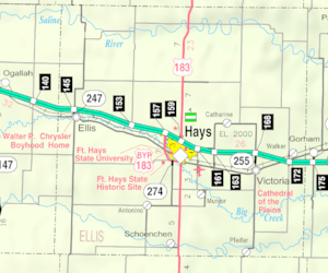
Emmeram is a small, unincorporated community in Ellis County, Kansas, United States. An "unincorporated community" is a place that doesn't have its own local government, like a city or town. Instead, it's usually governed by the county. Emmeram is located within Herzog Township.
History of Emmeram
In 1899, people from the nearby community of Herzog, who were part of the Catholic Church, decided to start a new church six miles north. They began building Sacred Heart Church, and it was finished in 1901.
The community was first called Norddorf. Later, it was renamed Emmeram after Emmeram Kausler, who was the church's pastor. The community grew and even had two schools. In 1902, plans were made for a town, but it was never fully built. A post office also operated in Emmeram for a short time, from 1903 to 1904.
Where is Emmeram?
Emmeram is located in the Smoky Hills region of the Great Plains. It is about half a mile northeast of Walker Creek. This creek is part of the Smoky Hill River watershed, which means its water flows into that river.
The community is roughly 5.5 miles (8.9 km) north of Interstate 70. It is also about 11 miles (18 km) northeast of Hays. Hays is the main city and the "county seat" for Ellis County, where the county government offices are located.
Getting Around Emmeram
Emmeram is found where two unpaved county roads meet. One road is Emmeram Road, which goes east and west. The other is 350th Avenue, which runs north and south.
 | DeHart Hubbard |
 | Wilma Rudolph |
 | Jesse Owens |
 | Jackie Joyner-Kersee |
 | Major Taylor |


