Entiat Mountains facts for kids
Quick facts for kids Entiat Mountains |
|
|---|---|

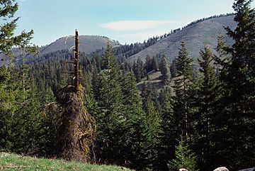
Chumstick Mountain Summit from primitive access road
|
|
| Highest point | |
| Peak | Mount Fernow |
| Elevation | 9,249 ft (2,819 m) |
| Dimensions | |
| Length | 53 mi (85 km) north-south |
| Width | 32 mi (51 km) east-west |
| Area | 612 sq mi (1,590 km2) |
| Geography | |
| Country | United States |
| Range coordinates | 47°50′N 120°34′W / 47.833°N 120.567°W |
| Parent range | North Cascades (Cascade Range) |
The Entiat Mountains, also called the Entiat Range, is a group of mountains in the U.S. state of Washington. These mountains are found west of the Columbia River, north of the Wenatchee River, and south of the Entiat River. They are part of the North Cascades, which is a section of the larger Cascade Range. The Entiat Range is quite long from north to south but not very wide from east to west.
Contents
Discover the Entiat Mountains
The Entiat Mountains are a long and narrow mountain range. They stretch from the Columbia River in the south up towards the northern part of Washington. The Entiat River valley separates these mountains from the Chelan Mountains to the northeast. To the west and south, across the Wenatchee River and its smaller rivers like the Chiwawa River, you'll find the Wenatchee Mountains.
Most of the Entiat Mountains are located within the Wenatchee National Forest. This forest is a protected area where nature can thrive. The very northern end of the range is also part of the Glacier Peak Wilderness. This is a special area where human activity is limited to protect the natural environment.
Exploring the Tall Peaks
The highest point in the Entiat Mountains is Mount Fernow. It stands tall at 9,249 feet (2,819 meters). Many other important peaks are also found here. These include Seven Fingered Jack, Mount Maude, Copper Peak, Dumbell Mountain, Spectacle Buttes, Ice Box, and Buckskin Mountain. All these peaks are over 8,000 feet (2,438 meters) high. The three highest ones are even over 9,000 feet (2,743 meters).
These very tall peaks are all located in the northern part of the Entiat Range. The mountains in the southern part are not as high. Their tallest peaks are under 7,000 feet (2,134 meters). Some notable southern peaks include Cougar Mountain, Tyee Mountain, Sugarloaf Peak, Chumstick Mountain, and Burch Mountain.
Where Did the Name Come From?
The name "Entiat" comes from the Entiat people. This is a Native American tribe that lived in the area. Many of the names for mountains and other places in the range were given by a person named Albert Hale Sylvester. He was important in mapping and exploring this region.
Wildfires in the Mountains
In July 2014, some large wildfires happened in the Entiat Mountains. These fires included the Mills Canyon Fire and the Kelly Mountain Fire. Wildfires are a natural part of forest ecosystems, but they can also cause damage to the environment and nearby communities.
 | William Lucy |
 | Charles Hayes |
 | Cleveland Robinson |


