Copper Peak (Washington) facts for kids
Quick facts for kids Copper Peak |
|
|---|---|

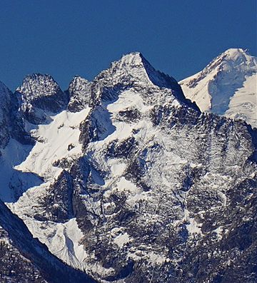
Copper Peak, east aspect
(Glacier Peak upper right) |
|
| Highest point | |
| Elevation | 8,964 ft (2,732 m) |
| Prominence | 484 ft (148 m) |
| Parent peak | Mount Fernow (9249 ft) |
| Geography | |
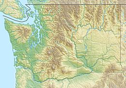
| Location | Glacier Peak Wilderness Chelan County Washington, U.S. |
| Parent range | Entiat Mountains North Cascades |
| Topo map | USGS Holden |
| Type of rock | Gneissic |
| Climbing | |
| First ascent | 1937 |
| Easiest route | class 4-5 |
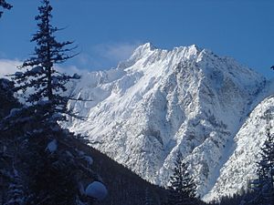
Copper Peak is a tall mountain in Washington state. It stands at 8,964 feet (2,732 meters) high. This peak is part of the Entiat Mountains. These mountains are a smaller range within the larger North Cascades.
Copper Peak is located in Chelan County. It is about 80 miles northeast of Seattle. The mountain is found within the Glacier Peak Wilderness. This area is managed by the Wenatchee National Forest. Copper Peak is one of Washington's highest mountains. It ranks 22nd among the state's top 100 peaks.
The closest higher mountain is Mount Fernow. It is less than a mile (0.88 miles or 1.42 kilometers) to the south. Water from Copper Peak flows into nearby Lake Chelan. This includes melted snow and ice from a glacier on its southeast side. The first people to climb Copper Peak were Franklin Bennet, Edgar Courtwright, and Toivo Hagman. They reached the top in August 1937. The mountain gets its name from an old copper mine. This mine used to be at the base of the peak.
Weather Around Copper Peak
The area around Copper Peak is a bit drier. This is because it lies east of the Cascade Range. Summers here can be warm. Sometimes, there are thunderstorms.
Most weather systems come from the Pacific Ocean. They move northeast towards the Cascade Mountains. When these systems reach the North Cascades, the tall peaks force the air upwards. This process is called Orographic lift. As the air rises, it cools down. This causes it to drop its moisture. This moisture falls as rain or snow onto the Cascades.
Because of this, the North Cascades gets a lot of rain and snow. This is especially true in winter. Copper Peak is very tall. So, it can have snow on it in late spring and early fall. Winters on the peak can be extremely cold.
How Copper Peak Was Formed
The North Cascades have very rugged land. You can see jagged peaks, long ridges, and deep valleys. These valleys were carved out by glaciers. Many years ago, big geological events happened. These events created the varied land and huge changes in height. These changes also led to different climates. Different climates mean different types of plants grow in these areas.
The Cascade Mountains started forming millions of years ago. This was during the late Eocene Epoch. The North American Plate was moving over the Pacific Plate. This caused many volcanic eruptions. Also, small pieces of the Earth's crust called terranes came together. These pieces formed the North Cascades about 50 million years ago.
During the Pleistocene period, glaciers moved across the land. This was over two million years ago. These glaciers moved forward and then retreated many times. As they moved, they scraped the landscape. They left behind piles of rock. The river valleys in this area have a "U" shape. This shape was created by these recent glaciers. The rising of the land and cracks in the Earth's crust. These, along with glaciation, have shaped the tall peaks and deep valleys of the North Cascades.
 | Leon Lynch |
 | Milton P. Webster |
 | Ferdinand Smith |


